Brazil is a giant country full of diverse cultures, geography, and wildlife. It’s one of the largest countries in the world as well as one of the most populous. The country is divided into 26 states and one federal district, and each has its own unique identity. We’ll take a look at each of these states in this post and examine things like size, population, capital cities, and things to see.
Brazil States Maps
Below is a map of Brazil’s 26 states and one federal district. It’s color-coded to highlight the borders between each, which are outlined in white.
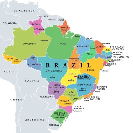
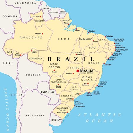
Brazil States (Federative Units)
Acre
2021 Population Estimate: 906,880
Total Area: 164,123 km2 (63,368 mi2)
Capital City: Rio Branco
The state of Acre contains the westernmost point in Brazil and shares a long border with the state of Amazonas as well as a short border with Rondônia. The state also shares foreign borders with Peru and Bolivia. It’s part of Brazil’s North Region.
Compared to other Brazilian states, Acre has a relatively small population and contribution to the national economy. Less than 0.5% of the country’s population lives in this state, and it accounts for just 0.2% of the country’s GDP. Primary economic activities in the state are in the service and industrial sectors.
The capital and largest city in Acre is Rio Branco, which is where nearly half of the state’s population lives. The city is the westernmost major settlement in the country and was founded as a county in 1913, becoming the capital of the state in 1962.
Alagoas
2021 Population Estimate: 3,365,350
Total Area: 27,779 km2 (10,726 mi2)
Capital City: Maceió
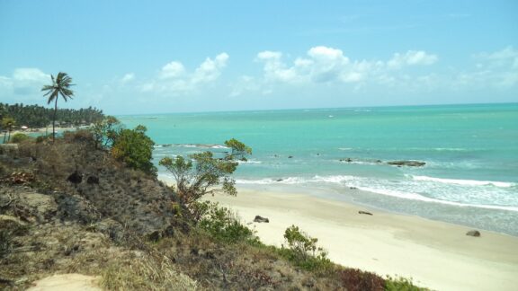
Alagoas is located in the eastern portion of Brazil’s Northeastern, bordering the Atlantic Ocean. It also borders the states of Pernambuco, Bahia, and Sergipe. It’s the second smallest Brazilian state, smaller only than neighboring Sergipe.
Economically, the state is known for being the country’s biggest exporter of coconuts and sugarcane, and cattle raising plays a central role in its economy. Alagoas is a fairly poor state, and it has the lowest Human Development Index (HDI) score of any in the country.
The main sights in Maceió and in Alagoas are white sand beaches and coconut plantations, and the capital is also home to several historical buildings like the Cathedral of Our Lady of Pleasures, the Peixoto Palace, and the Historical Institute Museum.
Amapá
2021 Population Estimate: 877,610
Total Area: 142,829 km2 (55,147 mi2)
Capital City: Macapá
Amapá is the second least populated state in Brazil and extends the second furthest north of any of the country’s states. It shares a foreign border with French Guiana and the state of Pará as well as the Atlantic Ocean.
The capital and largest city in Amapá is Macapá, which has a population of just over 500,000 people and is located on the northern channel of the Amazon River. The city is only accessible by road from other towns in Amapá and a road that comes from French Guiana in addition to a ferry that travels to the city from Belem, Brazil.
There are some interesting buildings and cultural sights in Amapá, such as the Fortaleza de São José de Macapá, a historic fort in the capital, and the Marco Zero monument, which marks the line of the equator and follows the path of the sun. The state is also home to Tumucumaque Mountains National Park, which is the largest tropical forest park in the world.
Amazonas
2021 Population Estimate: 4,270,000
Total Area: 1,559,159 km2 (601,995 mi2)
Capital City: Manaus
Amazonas is the largest state in Brazil, and it’s best known for being almost completely covered by the Amazon Rainforest — the largest and most biodiverse rainforest in the world. Since so much of the state is tropical jungle, travel between cities is often not possible by car. Instead, cities are located along waterways and may be accessed by boat or plane.
The capital of Amazonas is Manaus, which is also the largest city in the state. Manaus has a 2022 population estimate of 2.3 million, which makes it the seventh-largest city in Brazil. It’s located along the Amazon River in the eastern half of the state. Its location in the middle of the Amazon Rainforest makes it a popular tourist destination.
Things to see in Amazonas are the Amazonas Opera House in Manaus, tours through the rainforest, and a variety of natural parks.
Bahia
2021 Population Estimate: 14,985,280
Total Area: 564,733 km2 (218,045 mi2)
Capital City: Salvador
Bahia is a state in eastern Brazil that borders the Atlantic Ocean and eight other states. It is Brazil’s fourth most populated state and its economy is primarily based on agricultural and industrial activities. The state is in one of the first areas to be reached by Portuguese colonizers around 1500, and its capital is one of the oldest in the Americas.
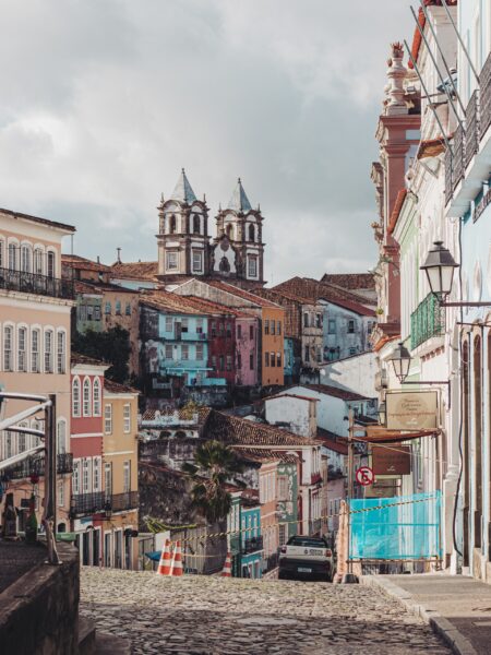
The capital and largest city of Bahia is Salvador, which was founded in 1549. It’s famous for being the first colonial capital of Brazil, and it is full of historical buildings. The colonial architecture of the city was declared a UNESCO World Heritage Site in 1985.
Carnival in Salvador is the biggest festival in Brazil and one of the biggest in the world, which makes it a popular attraction for visitors.
Ceará
2021 Population Estimate: 9,240,580
Total Area: 148,921 km2 (57,499 mi2)
Capital City: Fortaleza
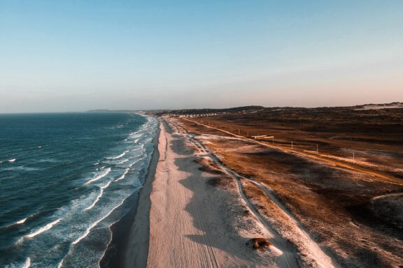
Ceará is located along the northern portion of Brazil’s eastern coast. It occupies about 600 kilometers (370 miles) of coastline which is mostly sand and is home to some of the country’s best beaches. Cumbuco is one such beach that is considered one of the best in the world for kitesurfing.
Fortaleza is the capital of Ceará and the fifth largest city in Brazil. It’s connected to Central and North America by its international airport, which makes it a popular tourist destination. It’s also where the BR-116, the country’s most important highway system, begins.
Distrito Federal (Federal District)
2021 Population Estimate: 3,094,330
Total Area: 5,780 km2 (2,232 mi2)
Capital City: Brasília
The Distrito Federal is special on this list because it’s the only federative unit that isn’t a state, and it contains the capital of Brazil, Brasília. Because of its special status, it’s the smallest federal unit in Brazil and has no municipalities.
Brasília became the capital of Brazil in 1960, and that’s also the year that the Distrito Federal was established. Brasília is notable for being a planned city, as it was constructed with the purpose of becoming the capital city of the country. The city has been declared a UNESCO World Heritage Site as an example of urban planning.
Another site in this region is Lake Paranoá, a very large artificial lake constructed to increase the capital city’s access to water.
Espírito Santo
2021 Population Estimate: 4,108,510
Total Area: 46,095 km2 (17,797 mi2)
Capital City: Vitória
The name of this state translates to “Holy Spirit” in English and hints at the country’s strong ties to Catholicism. Espírito Santo is located along the Atlantic coast and borders the states of Bahia, Minas Gerais, and Rio de Janeiro.
Because of its extensive coastline and beautiful beaches, many tourists visit this state. Some of Brazil’s main ports are also located along this coastline. The economy of Espírito Santo was supported by sugarcane and coffee production for many years, and tourism and port activity are primary economic activities in Vitória, the capital city.
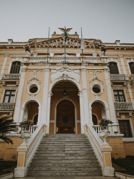
Some sights in Espírito Santo are the Pontões Capixabas Natural Monument and the Anchieta Palace in Vitória.
Goiás
2021 Population Estimate: 7,206,590
Total Area: 340,112 km2 (131,318 mi2)
Capital City: Goiânia
Goiás is a state in central Brazil without any coastline. It is bordered by five states and the Distrito Federal, and it has the 11th highest population in the country.
The state’s geography is characterized by a large number of plateaus and rivers that dry up during the dry season. There are a number of national parks in the state, including incredible hydrothermal resorts in the city of Caldas Novas.
The capital and largest city of Goiás is Goiânia, which is a planned city that was founded in 1933. The city is known for its high number of green spaces and for being the cradle of the sertanejo music genre.
Maranhão
2021 Population Estimate: 7,153,260
Total Area: 331,937 km2 (128,162 mi2)
Capital City: São Luís
Maranhão is a state in the Northeast Region of Brazil that borders the Atlantic Ocean as well as the states of Piauí, Tocantins, and Pará. The state has a population of just over 7 million, and the capital is São Luís, which is also the state’s largest city.
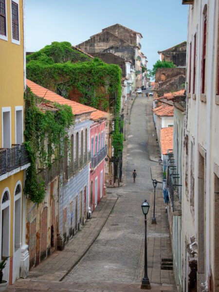
São Luís is located on São Luís Island and is the only Brazilian state capital to have been founded by France. The historic center of the city still uses the original street plan design, and it was designated as a UNESCO World Heritage Site in 1997.
Maranhão is one of the wealthiest states in Brazil, and its primary exports are aluminum, iron, and soybean.
Mato Grosso
2021 Population Estimate: 3,567,230
Total Area: 903,366 km2 (348,792 mi2)
Capital City: Cuiabá
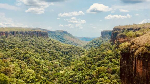
The third largest state in Brazil is Mato Grosso, which is located in the country’s Center-West Region and borders Bolivia as well as six domestic states. The name of the state translates to “Thick Bush” in English, and the state includes large portions of the Amazon Rainforest and Pantanal, where the world’s largest wetland is located.
The capital of this state is Cuiabá, which is located near the geographical center of the country. It’s one of the fastest growing cities in Brazil and is a trading center for the larger cattle-raising and agricultural area it is a part of.
Natural areas and parks are the major highlights for visitors to this state, including Chapada dos Guimarães, which features the largest sandstone cavern in Brazil.
Mato Grosso do Sul
2021 Population Estimate: 2,839,190
Total Area: 357,146 km2 (137,895 mi2)
Capital City: 137,895
Mato Grosso do Sul is located just south of Matto Grosso and borders Paraguay to the southwest and Bolivia to the west. The state has a warm, humid climate and is known for its vast natural areas. Its main economic activities are related to cattle-raising and agriculture.
The capital of Matto Grosso do Sul is Campo Grande, which means “Great Field” in English. It’s the largest city in Matto Grosso do Sul and was founded in 1899. It became the capital of the state when Matto Gross was split in two in 1977.
Things to see in Matto Grosso do Sul are mostly centered around the natural attractions in the state. Bonito is a municipality with impressively clear waters that are great for diving, and South Pantanal is popular for fishing and birdwatching.
Minas Gerais
2021 Population Estimate: 21,411,920
Total Area: 586,522 km2 (226,457 mi2)
Capital City: Belo Horizonte
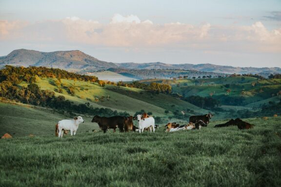
Minas Gerais has the second highest population of any state in Brazil, and it’s the fourth largest by area. The capital and largest city of Minas Gerais is Belo Horizonte, whose metropolitan area is the third most populous in Brazil after those in São Paulo and Rio de Janeiro.
Roughly 10% of Brazil’s population lives in Minas Gerais, and nine Brazilian presidents have been born here, which is more than any other state. The state is also known for being the country’s leading coffee and milk producer as well as the beautiful architecture in its historical cities.
Pará
2021 Population Estimate: 8,777,120
Total Area: 1,247,955 km2 (481,838 mi2)
Capital City: Belém
Pará is located in the central part of northern Brazil and borders the Atlantic coast where the Amazon River flows into the sea. The state borders the foreign countries Suriname and Guyana as well as six other domestic states.
The capital of Pará is Belém, located in the northern part of the state. Its location along the Amazon and near the Atlantic makes it a gateway to the river, and it has a busy port and airport that serves some international flights.
Notable buildings in the state’s capital include a museum, the city’s oldest church, and a classical theater. National parks are another big attraction in the state, and thousands of tourists arrive in Belém each year for the Círio de Nazaré religious celebration.
Paraíba
2021 Population Estimate: 4,059,910
Total Area: 56,470 km2 (21,803 mi2)
Capital City: João Pessoa
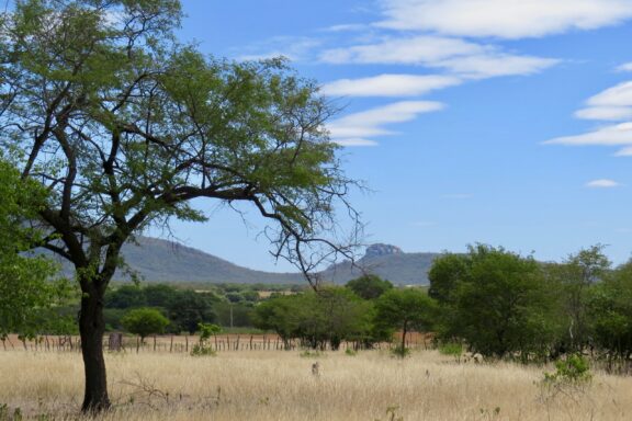
Paraíba is a small state in the Northeastern Region of Brazil, and its capital is João Pessoa. It has a small coastline on the Atlantic and includes the easternmost point in the Americas at Ponta do Seixas. The state is named after the Paraíba River.
Known for its agreeable climate, attractive beaches, beautiful topography, and rich culture, Paraíba is popular among tourists. Several well-known Brazilian writers and poets are from this state.
Paraná
2021 Population Estimate: 11,597,480
Total Area: 199,308 km2 (76,953 mi2)
Capital City: Curitiba
The third southernmost state in Brazil, Paraná borders the Atlantic Ocean, Paraguay, Argentina, and the states of Mato Grosso do Sul, São Paulo, and Santa Catarina. Its capital is Curitiba and it contains 399 municipalities in total.
Along the state’s border with Argentina is the National Park of Iguaçu, which features iconic waterfalls and is a UNESCO World Heritage Site. The Itaipu Hydroelectric Dam, the world’s largest dam, is located on the Paraná River.
Pernambuco
2021 Population Estimate: 9,674,790
Total Area: 98,148 km2 (37,895 mi2)
Capital City: Recife
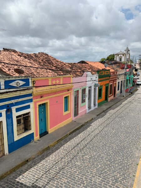
Pernambuco is the seventh most populated state in Brazil with a population of just under 10 million. It’s located along Brazil’s Atlantic coast and its capital city is Recife, which is the largest in the state and an important economic hub in Brazil.
Recife’s international airport and two international seaports make it a major center for business in Brazil. Its beaches and Carnival festival also make it popular among tourists. Also part of Pernambuco is Fernando de Noronha, a group of 21 islands off of the coast of Brazil.
Piauí
2021 Population Estimate: 3,289,290
Total Area: 251,578 km2 (97,135 mi2)
Capital City: Teresina
The state of Piauí is located in the Northeast Region of Brazil, and it’s got the shortest coastline of any state in the country. The capital and largest city in the state is Teresina, which is the only state capital in the region that’s located inland instead of on the coast.
Serra da Capivara is a national park in the southern reaches of the state that contains a number of prehistoric paintings and is a UNESCO World Heritage Site. There are several cultural attractions in Teresina, including the Casa da Cultura de Teresina, which exhibits cultural elements of the city’s history, and the city’s theater.
Rio de Janeiro
2021 Population Estimate: 17,463,350
Total Area: 43,780 km2 (16,904 mi2)
Capital City: Rio de Janeiro
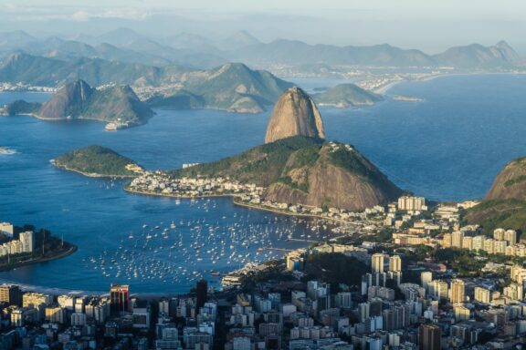
Rio de Janeiro is located in the Southeast Region of Brazil, and its capital city of the same name is the second most populous city in the country. The state has the second largest economy in the country after São Paulo, of which industrial activity is the main economic provider.
The capital city is one of the most iconic in Brazil and has famous landmarks like the Christ the Redeemer statue and the Copacabana and Ipanema beaches. Carnival in the city is a massive event that sees up to two million people on the street each day.
Rio Grande do Norte
2021 Population Estimate: 3,560,900
Total Area: 52,811 km2 (20,390 mi2)
Capital City: Natal
Rio Grande do Norte is a small state in northeastern Brazil that borders the Atlantic Ocean as well as the states of Paraíba and Ceará. The state has hundreds of kilometers of sandy beaches and also includes the Rocas Atoll, which is the only atoll in the Atlantic Ocean.
The capital and largest city of Rio Grande do Norte is Natal, which is known for being a tourist destination and for exporting fruits. It’s the closest Brazilian city to Africa and Europe. Some interesting things to see in this state are the world’s largest cashew tree, the Cashew of Pirangi, and the dunes of Genipabu.
Rio Grande do Sul
2021 Population Estimate: 11,466,630
Total Area: 281,730 km2 (108,777 mi2)
Capital City: Porto Alegre
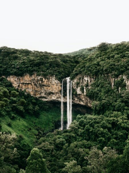
Rio Grande do Sul is the fifth most populous state in Brazil and is the southernmost state in the country. It borders Argentina to the west, Uruguay to the south, the Atlantic Ocean to the east, and the state of Santa Catarina to the north.
The capital of this state is Porto Alegre which means “Joyful Harbor” in English. Some of the attractions for tourists in the capital city are Piratini Palace, which is the state’s seat of government, and diverse nightlife.
Rondônia
2021 Population Estimate: 1,815,280
Total Area: 237,591 km2 (91,734 mi2)
Capital City: Porto Velho
Rondônia is located in Brazil’s Center-West Region and is one of the least populated states in the country. Its capital and largest city is Porto Velho, located on the state’s border with Amazonas. The city is an important trading center for the mineral cassiterite. Although the capital’s population is relatively small, it is the country’s largest state capital by area.
There are over 20 indigenous languages spoken in Rondônia by many indigenous communities, some of whose territories are under threat from logging activities.
Roraima
2021 Population Estimate: 652,710
Total Area: 224,301 km2 (86,603 mi2)
Capital City: Boa Vista
Roraima is Brazil’s most isolated state as well as its northernmost state. It’s also the country’s least populated state. The state shares domestic borders with the states of Amazonas and Pará and foreign borders with Venezuela and Guyana.
The capital of Roraima is Boa Vista, which lies on the banks of the Branco River and is the only Brazilian capital to be located entirely north of the equator. Pedra Pintada is the most important archeological site in the state, a large rock formation that contains artifacts from civilizations that lived up to four thousand years ago.
Santa Catarina
2021 Population Estimate: 7,338,470
Total Area: 95,736 km2 (36,964 mi2)
Capital City: Florianópolis
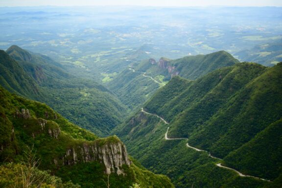
The second southernmost and seventh smallest state in Brazil is Santa Catarina. It’s located in the country’s South Region and borders the states of Paraná, Rio Grande do Sul, Argentina, and the Atlantic Ocean.
The capital city of Santa Catarina is Florianópolis, but the most populous city in Joinville. Florianópolis is located on Santa Catarina Island, and Joinville is located further north in the state.
São Paulo
2021 Population Estimate: 46,649,130
Total Area: 248,223 km2 (95,839 mi2)
Capital City: São Paulo
São Paulo is Brazil’s most populous state and wealthiest state. It’s located in the Southeast region of the country, and its capital and largest city has the same name. The capital is known for its economic and political power as well as its many monuments, parks, and museums.
The state has the second highest HDI score in the country and the second highest GDP per capita. Indigenous people had inhabited the area of the state for thousands of years before the arrival of Europeans, and the present-day population is very diverse.
Sergipe
2021 Population Estimate: 2,338,470
Total Area: 21,915 km2 (8,461 mi2)
Capital City: Aracaju
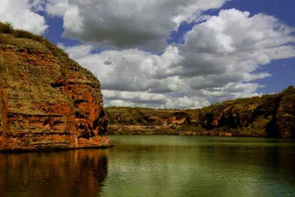
Sergipe is the smallest state in Brazil in terms of population and is located along the Atlantic coast between the states of Alagoa and Bahia. The state consists mostly of savannah, and its coast is a combination of mangroves and sandy beaches.
The capital and largest city in Sergipe is Aracaju, where about 33% of the state’s population lives. It’s considered one of the safest capital cities in the Northeast Region, and its relatively low cost of living has made it an increasingly popular location for low-cost tourism.
Tocantins
2021 Population Estimate: 1,607,360
Total Area: 277,721 km2 (107,229 mi2)
Capital City: Palmas
Tocantins is the newest state in Brazil, located in the North Region of the country. It has no international borders or coastline, and it borders six other Brazilian states. The capital city of Tocantins is Palmas, which is also the largest city in the state.
The capital was founded in 1990 and developed in a formerly agricultural area with the intention of bringing jobs to people in a previously undeveloped part of the country. Many people visit the village of Taquaruçu to visit the ecotourism resort and see the impressive surrounding waterfalls.
Image Sources and Copyright Information
- Colorful Map of Brazilian States: © Peter Hermes Furian/Shutterstock
- Map of Brazil with States and Capitals: © Peter Hermes Furian/Shutterstock