Of all the regions in the United States, the Southwestern States could be one of the hardest to define.
While there are various descriptions of the actual area that counts as the US Southwest, there are some key features of the region that are easy to agree on: an arid climate, southwestern cuisine, a unique architectural style, and cowboy culture, to name a few.
In this post, we’ll take a look at each of the five states that make up the American Southwest.
Southwest States Map

States in the Southwestern United States
- Nevada
- Utah
- Colorado
- Arizona
- New Mexico
Nevada
- Total Area: 286,382 km2 (110,577 mi2)
- 2022 Population Estimate: 3,201,212
Nevada is a landlocked state in the Southwestern US that is bordered by five others. Its most populous and famous city is Las Vegas, which is also the largest city in the Southwestern region and is home to many luxury resorts and casinos. The capital of Nevada is Carson City.
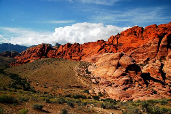
While the neon lights of the Las Vegas Strip may not be what most people associate with the American Southwest, Nevada’s deserts certainly fit the picture. There are several that can be found in the state, but the two most prominent are the Great Basin Desert and the Mojave Desert.
The Great Basin Desert covers most of Nevada and is characterized by wide valleys, the surrounding Sierra Nevada Mountain Range, and a temperate climate with hot, dry summers and snowy winters.
The Mojave Desert is named after the Mojave people, who are indigenous to the area and have inhabited land in the Southwest long before European settlers arrived. The desert is the smallest and driest on the North American continent and contains several national parks and beautiful geological formations, making it a popular tourist destination.
Utah

- Total Area: 219,887 km2 (84,899 mi2)
- 2022 Population Estimate: 3,426,431
Another landlocked state in the Southwestern United States, Utah is also part of the Mountain West subregion of the country. The Ancestral Puebloans, Navajo, and Ute peoples are some of the indigenous groups that have inhabited this region for thousands of years, and the name of the state is a reference to the Ute Tribe.
In some descriptions of the Southwestern US, Utah isn’t included. In others, the southern portion of the state makes it into the Southwest category, and that’s why we’ve included it. The Mojave Desert that takes up so much of Nevada stretches into southwestern Utah and is the lowest elevation and hottest region in the state.
The southern and southeastern sections of Utah are home to visually striking sandstone formations that attract many tourists each year. There are also several national parks in this area: Arches, Bryce Canyon, Zion, and Canyon lands are some of the most famous.
One reason the terrain is so striking in the southern region of Utah is the Colorado River, which has been shaping the sandstone along with wind and rain for millions of years.
The most populous city in Utah, and its capital, is Salt Lake City. It has a population of about 200,000 people and is located in the northern part of the state. It is widely known for being the religious center for Latter-Day Saints (Mormons).
Colorado

- Total Area: 269,837 km2 (104,094 mi2)
- 2022 Population Estimate: 5,855,078
Colorado is a state in the Southwestern United States that constitutes the For Corners region along with Utah, Arizona, and New Mexico. The southern parts of this state are those most associated with the Southwestern US, and the Colorado Plateau is a key feature of the region. Like Utah, it is also part of the Mountain West region.
The capital city of Colorado is Denver, which is also the largest city in the state and is located just northeast of central Colorado. About half of Colorado’s topography is flat and rolling, but the state has very diverse terrain. There are also alpine mountains, impressive deserts, and deep canyons.
Although the majority of the Colorado Plateau lies outside of Colorado, its northeastern corner can be found in the state and is one of the reasons we’re counting Colorado as a Southwestern state. There are eight national parks within the borders of the Colorado Plateau, which consists mostly of high desert and scattered forests.
Nicknamed the “Centennial State,” Colorado became a state in1876, one century after the constitution was signed. Due in large part to the Colorado Silver Boom, mining was a main supporter of Colorado’s economy during the 19th century, but the industry collapsed at the end of the century. Colorado slowly recovered, and mining along with ranching and farming are important parts of the state’s economy today.
Arizona

- Total Area: 295,234 km2 (113,990 mi2)
- 2022 Population Estimate: 7,408,017
Bordering Mexico and five other US states, Arizona is one of two states that fit every definition of the Southwestern US, the other being New Mexico. Along with the other states in the Southwestern region, Arizona is also part of the Western US. It’s known for having intensely hot summers and freezing winters, especially in the south.
One of the most famous geographic features on the North American continent is located in Arizona: the Grand Canyon. The Grand Canyon is a gorge of the Colorado River in Grand Canyon National Park in northwestern Arizona and was designated as a UNESCO World Heritage Site in 1979. Almost 6 million people are estimated to visit the canyon each year.
New Mexico

- Total Area: 314,918 km2 (121,591 mi2)
- 2022 Population Estimate: 2,113,550
Along with Arizona, New Mexico is one of the states that is always included in descriptions of the American Southwest. It is one of the Four Corner states and borders Mexico as well as five other states.
The capital city of New Mexico is Santa Fe, which is the oldest capital city in the country. Albuquerque is the largest city in the state. The highest percentage of Latino and Hispanic Americans live in New Mexico, and it has the second-highest percentage of Native American residents, after Alaska.
While New Mexico may conjure up images of vast deserts and rolling tumbleweeds in most, the state actually has one of the most diverse geographies in the country. In addition to colorful deserts, there are tall, snow-capped mountains, green grasslands, and mesas.
Southwest USA States FAQs
What are the five Southwestern states?
The five Southwestern states are Arizona, New Mexico, Utah, Nevada, and Colorado. Not all definitions of the region include all portions of these states, but all include Arizona and New Mexico.
How many states are in the Southwest?
There are two states that are considered to be entirely in the Southwestern United States: Arizona and New Mexico. The adjacent areas of Utah, Nevada, and Colorado are often included in the description, which means there are five states in the Southwest.
What are the natural resources in the Southwest region?
Natural resources in the southwest region include silver, uranium, copper, iron, coal, oil, and livestock. Oil and natural gas are the most valuable resources in the Southwest, and the region raises more beef cattle than most other states.
What is the climate like in the Southwest?
The Southwest is characterized by an arid, warm climate. It is the hottest and driest region of the United States and sees low amounts of rainfall annually.


- Cedar Breaks National Monument Canyon View — © EQRoy/Shutterstock
- Sand Dunes and Mountain Backdrop — © Kris Wiktor/Shutterstock
- Dusk at Hunts Mesa Overlooking Monument Valley, Arizona — © Zhukova Valentyna/Shutterstock
- Sunset Skyline of Albuquerque, New Mexico — © Paul Brady/Shutterstock