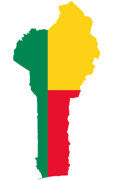
The flag of Benin is a vibrant emblem of the nation, encapsulating its independence, diversity, and vision.
Adopted shortly before gaining autonomy, it represents the country’s rich cultural tapestry and commitment to progress. It is a visual testimony to Benin’s resilience and unity, fluttering as a symbol of national pride and identity.
Benin Flag
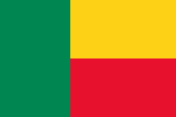
The flag of Benin features a bold geometric design with a vertical green stripe at the hoist, complemented by horizontal yellow and red bands on the fly side.
Its simplicity in form is matched by a deep symbolic resonance, marking Benin’s identity on the global stage. The flag symbolizes the nation’s sovereignty and the vibrant culture of its people.1
Benin Flag: Color Palette
Benin Flag Emoji: 🇧🇯
The color palette of the Benin flag is a carefully chosen trio of hues, each selected for its powerful symbolism and ability to stand out. These colors combine to form a visually striking and meaningful display that resonates with the country’s identity.
The forthcoming segment will delve into the significance of each color, unraveling the stories they collectively bring to life on the flag.
Meaning of Each Color

Green
The verdant band on the flag symbolizes the nation’s bright future and democratic hopes, reflecting Benin’s lush landscapes and agricultural abundance.
This shade of green is also a tribute to the resilience and enduring spirit of the Beninese people, whose connection to their land is as deep as their cultural roots.
Yellow
The golden stripe represents the country’s wealth, both in its cultural legacy and its natural endowments, paying homage to the northern savannahs and the prosperity brought by resources like palm oil.
Beyond material wealth, the yellow also radiates the warmth of the Beninese spirit, illuminating their hospitality and the rich tapestry of their communal traditions.
Red
The crimson band symbolizes the courage and lasting resolve of Benin’s forebears, mirroring the nation’s path to sovereignty and the cultural importance of robustness and vigor.
This red also embodies life’s blood and the fierce determination of a nation that has overcome adversity to forge a path of accord and progress.
Benin Coat of Arms
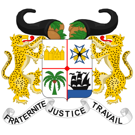
The Coat of Arms of Benin encapsulates the nation’s abundant resources, symbolized by corn-laden cornucopias, and its rich history with a shield displaying significant emblems like the ancient Somba castle and the guiding Star of Benin.
A fruitful palm tree underlines Benin’s agricultural reliance, while a ship traverses blue waves, symbolizing influential international interactions. Guarded by leopards, the emblem stands for vigilance and national values, underscored by a motto that pledges to brotherhood, justice, and relentless effort.
This emblem thus represents Benin’s reverence for its past and unified strides toward a prosperous future.
Historical Evolution and the Meaning Behind Changes
The flag of Benin has a history of evolution that reflects the nation’s changing political landscape and cultural self-realization. Initially under French colonial rule, the territory now Benin flew the French Tricolor. It wasn’t until 1959, just before gaining independence in 1960, that Benin, then known as Dahomey, adopted its distinct flag.
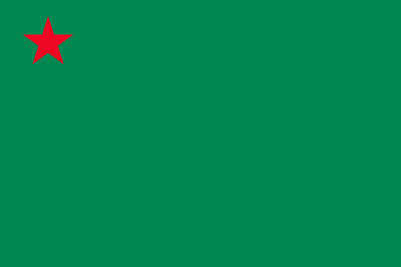
The original flag displayed a green field with a red star in the canton, symbolizing the socialist revolution and pan-Africanism. However, in 1975, when the country was renamed the People’s Republic of Benin, the flag was changed.
In 1990, with the end of Marxist-Leninist rule, Benin’s flag underwent its most recent and final alteration, returning to a design first used upon gaining independence. This current design eschews overt political symbols and emphasizes a connection to the broader African context.
The changes in the flag mirror the shifts in governance and policy in Benin, transitioning from colonial possession to an independent nation grappling with different ideologies and finally settling on a symbol of integration and heritage.
Overall Symbolic Meaning of the Flag

The flag of Benin symbolizes the nation’s stability, harmony, and cultural pride, encapsulating its past and aspirations within its vibrant design. The emblematic stripes reflect the country’s progress and the shared ambitions of its people.
The flag is a reminder of their sovereignty and a banner under which all Beninese unite, signifying collective identity and hope for a thriving future.
Similar Flags to the flag of Benin
The flag of Benin shares its design features with several other national flags, most notably due to the pan-African color scheme that is prominent in many African countries’ flags. Here are some examples:
Guinea
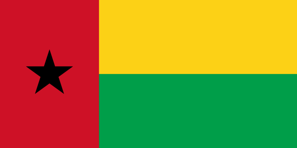
Guinea’s flag consists of three vertical stripes of red, yellow, and green. These colors are also used in Benin’s flag, reflecting the shared values of African solidarity and independence, with red symbolizing the blood of martyrs, yellow the sun and riches, and green the vegetation of the land.
Ghana
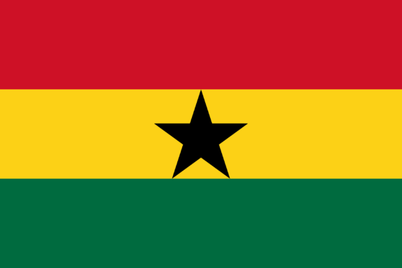
The flag of Ghana is composed of red, yellow, and green horizontal stripes with a black star in the center. The color scheme is similar to Benin’s, with both flags drawing on the same pan-African colors to convey a sense of unity and African identity.
Mali
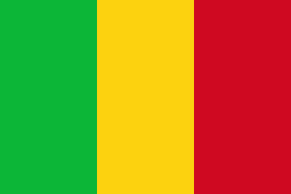
The flag of Mali is similar to Benin’s in its color scheme, with a tricolor pattern of green, yellow, and red vertical stripes. This arrangement symbolizes the shared aspirations for independence, prosperity, and unity.
Although the flags share no direct historical or political connection, their similar use of the pan-African colors denotes a common heritage and collective identity that transcends national borders.
Conclusion
Benin’s flag symbolizes national identity and pride, reflecting the country’s resilience and unity. It is distinct among the world’s flags, representing the citizens’ shared history and aspirations.
This emblem serves as a testament to Benin’s enduring spirit and the collective journey of its people towards a bright and sovereign future.


- Flag of Benin Against Blue Sky — © railway fx/Shutterstock
- Benin Flag on Map Location — © hyotographics@Shutterstock