Known as the Aloha State, Hawaii is something of a tropical paradise located in the heart of the Pacific Ocean. The 137 islands that make up the Hawaiian archipelago have earned worldwide renown for their stunning natural beauty, diverse ecosystems, and vibrant culture.
Hawaii was the 50th state to join the United States, with statehood granted in 1959. The state’s unique culture is a blend of Native Hawaiian traditions and influences from Asia and the US. It’s one of the top vacation destinations for Americans and tourists from around the world.
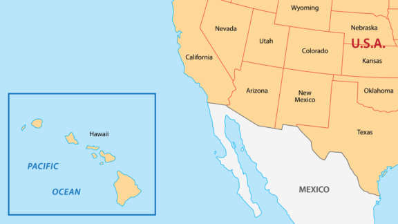
Hawaii (HI) on the North America Map
There are five counties in Hawaii, and they are the only administrative divisions used within the state.
Where other states have city-level governments and local school boards, Hawaii’s counties constitute the smallest legal government bodies in the state, and educational responsibilities are carried out by the Hawaii State Department of Education.
In this post, we’ll look at a Hawaii Counties Map in order to learn more about the five Hawaiian counties: Hawaii, Honolulu, Kalawao, Kauai, and Maui.
Map of Hawaii Counties
Below is a map of the 5 counties of Hawaii (you can click on the map to enlarge it and see the major city in each county).

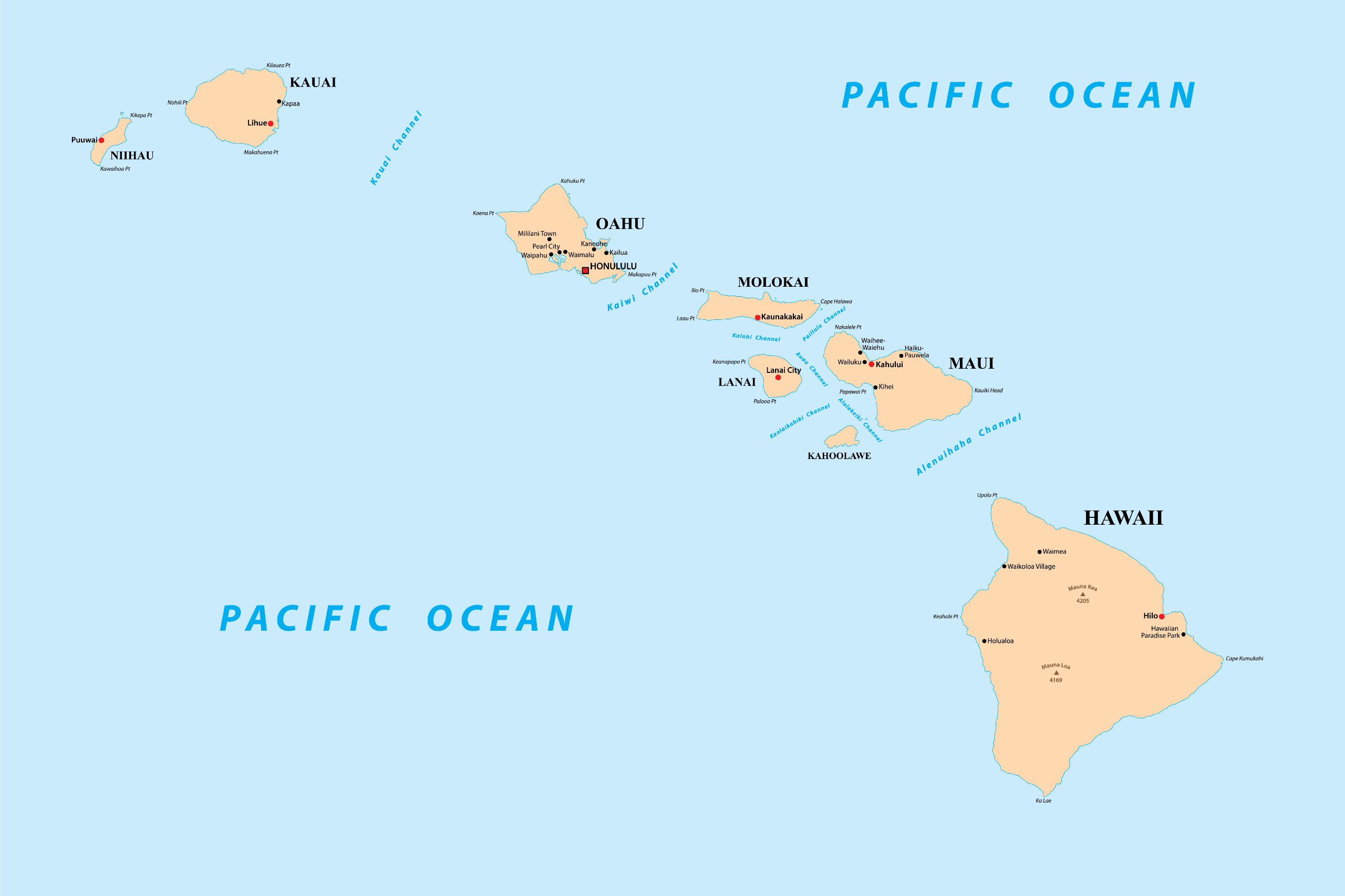
Interactive Map of Hawaii Counties
Click on any of the counties on the map to see its population, economic data, time zone, and zip code (the data will appear below the map). Data is sourced from the US Census 2021.
List of the Counties of Hawaii:
| County | Population | Per sq. km | Largest City |
|---|---|---|---|
| Hawaii County | 200,468 | 19.21 | Hilo |
| Honolulu County | 1,015,167 | 652.58 | Honolulu |
| Kalawao County | 48 | 1.55 | |
| Kauai County | 73,247 | 45.62 | Kapaa |
| Maui County | 164,568 | 54.7 | Kahului |
Hawaii County

Commonly referred to as the Big Island, Hawaii County is coterminous with the island of the same name. This is the largest county in the state, covering an area greater than all of the other islands combined. The island is located in the southernmost part of the archipelago and is renowned for its diverse landscape.
From the snow-capped peaks of Mauna Kea to the molten lava flows of Kilauea, the island is a living exhibit of geological wonders. It’s no wonder many of the best guided tours in Hawaii can be found in this county. Although you won’t find it on our list of highest mountains in the world, the island’s Mauna Kea can claim it is the tallest in the world measured from sea floor to peak.
The Big Island is unique in many respects, but perhaps most notably for its diverse climate zones, which range from tropical rainforests in the east to arid deserts in the west. This diversity enables a variety of agricultural ventures, such as the production of Kona coffee, one of the most prized coffee varieties in the world.
Hawaii County has a growing economy primarily driven by tourism, agriculture, and renewable energy. Its tourism sector is less commercialized compared to places like Honolulu, offering a more tranquil experience that caters to nature lovers and adventure seekers.
Popular attractions include Hawaii Volcanoes National Park, where visitors can witness active volcanoes, and Mauna Kea, a dormant volcano and home to some of the world’s most advanced astronomical observatories.
Honolulu County

Named after the state’s capital and most populous city, Honolulu County encompasses the entire island of Oahu in addition to several smaller, outlying islands.
If Hawaii County is known for its natural beauty, Honolulu County is known for its urban attractions. Shopping districts like Waikiki, historical landmarks such as Pearl Harbor, and a variety of culinary and cultural offerings make this county special.
Nicknamed “The Gathering Place,” the island of Oahu exemplifies both ancient and modern aspects of Hawaiian culture. The island’s history is reflected in sites like the Iolani Palace, which is the only royal palace in the United States, and the island’s Polynesian Cultural Center offers a comprehensive look into the diverse cultures of Polynesia.
While Honolulu County may seem overwhelmingly urban, it’s also home to a variety of natural escapes. The stunning Hanauma Bay offers some of the best snorkeling experiences, and the trails leading up to the Diamond Head Crater provide panoramic views of the city and the ocean. Manoa Falls and the Ko’olau Mountains are other must-see natural attractions that offer a break from the city.
Something that makes Honolulu County unique in Hawaii is that the county is consolidated with the city of the same name, creating a city-county entity. It’s also where about 70% of the state’s population lives, and it has the highest percentage of Asian or Asian American residents of any county in the country.
Kalawao County

There are a number of factors that make Kalawao County in Hawaii unlike any other. For starters, it’s the smallest county in the US by size and the second-smallest by population. Historically, the county was used exclusively as a leper colony, and it still doesn’t have a traditional county government structure today.
Kalawao County is located on the Kalaupapa Peninsula on the eastern side of Molokai Island, but it is administratively part of Maui County and is under the jurisdiction of the Hawaii State Department of Health.
The Kalaupapa National Historical Park within Kalawao County serves as a poignant reminder of Hawaii’s complex past. This area was where individuals diagnosed with Hansen’s disease (also known as leprosy) were once sent into forced isolation, a practice that began in the late 19th century and continued for about a hundred years.
Because of its specialized focus, Kalawao County has no elected county government, nor does it have schools or many of the other public services typically provided by a county. Due to its geographic isolation, the area is accessible only by a mule trail, small aircraft, or by sea.
Kalawao County provides a different lens through which to view Hawaii, one that melds natural beauty with historical and ethical complexity.
Kauai County

Kauai County includes the islands of Kauai, Niihau, Lehua, and Kaʻula. Kauai and Niihau are the largest of these, and they’re renowned for lush landscapes that include tropical rainforests, cascading waterfalls, and jagged mountain cliffs. These features have earned Kauai the nickname, “Garden Island.”
One of the most famous natural attractions on Kauai is the Na Pali Coast — its towering cliffs and secluded beaches are accessible only by boat or strenuous hike, but they’re worth the journey. Another option for breathtaking views and hiking opportunities is Waimea Canyon, sometimes called the “Grand Canyon of the Pacific.”
Thanks to its significantly smaller population, Kauai County provides a more relaxed experience than its bustling counterparts like Honolulu or Hawaii County. Kauai is a favorite destination for outdoor enthusiasts interested in activities such as hiking, kayaking, snorkeling, and surfing. Strict building regulations help the county retain its natural beauty and charm.
Kauai County’s island of Niihau, known as the “Forbidden Island,” is privately owned and one of Hawaii’s most mysterious islands. Access to the island is highly restricted and is generally limited to family and friends of the owners as well as the US Navy and government officials.
Maui County

Maui County comprises the islands of Maui, Lanai, Molokai (excluding Kalawao County), Kahoolawe, and Molokini. Maui is the second-largest island in Hawaii and is known as the “Valley Isle.” It’s famous for its diverse landscapes that range from the sunny beaches of Wailea to the summit of Haleakala, a dormant volcano that provides exceptional sunrise views.
An excellent way to experience the island’s impressive geography is to drive the scenic Road to Hana, which guides visitors through much of what Maui has to offer: forests, waterfalls, coastal cliffs, and more.
Lanai is the second-largest island in Maui County and is often called the “Pineapple Isle” for its legacy of pineapple production, celebrating the annual Lanai Pineapple Festival. Molokai Island is called the “Friendly Isle” and has a largely rural landscape with a strong sense of community.
Tourism is the strongest contributor to the economy in Maui County, and the government has put significant effort into managing the industry through regulations and initiatives that focus on encouraging responsible tourism as well as preserving the island’s environmental and cultural assets.
Tragically, the island of Maui experienced a number of destructive and deadly fires in 2023. The fire in Lahaina, a census-designated place on the northeastern coast of Maui, was especially affected.
Maui County is a microcosm of what makes Hawaii special: stunning natural scenery, rich cultural heritage, and a sense of community that ties it all together. It’s possible to watch humpback whales off the coast of Maui, explore the petroglyphs on Lanai, and embrace the tranquility of Molokai, all within Maui County.
More About Hawaii Counties: FAQs
Is Honolulu a city or a county?
Both! Honolulu is the only consolidated city-county in Hawaii.
How are county governments in Hawaii structured?
Each county in Hawaii, with the exception of Kalawao County, has its own mayor and council, which are responsible for legislative activities. They oversee various departments like public works, public safety, and health services.
Kalawao County is administered by Maui County and falls under the jurisdiction of the Hawaii State Department of Health.
Do Hawaii counties have their own police and fire departments?
Yes, all but Kalawao County has its own police and fire departments. These departments operate independently within their respective counties and are funded and managed by the county governments.
What Hawaiian county is Waikiki in?
Waikiki is located in Honolulu County and is a popular shopping and beach destination in the state.

- Hawaii Counties Map — © Sunflowerr/Shutterstock.com
- Lava Flows Entering the Ocean at Twilight — © Yvonne Baur/Shutterstock
- Breathtaking View of Waikiki Beach and Diamond Head Crater, Honolulu — © okimo/Shutterstock
- Panoramic View of Kalawao County’s Sheer Sea Cliffs and Kalaupapa Leper Sanctuary in Hawaii — © Reimar/Shutterstock
- Aerial View of the Majestic Na Pali Coast in Kauai, Hawaii — © Mohamed Selim/Shutterstock
- Aerial View of the Vibrant Coastline and Clear Waters of Lanai, Hawaii — © Frederick Millett/Shutterstock