There are 14 El Salvador departments, and these are divided into a total of 262 municipalities. In this article, we’ll explore some general facts about each of these parts of El Salvador, such as population and total area. The last official census was conducted in 2007, but there is population data from a 2013 survey, which is used in this article.
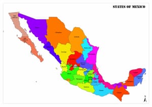
Departments of El Salvador Map
As can be seen in the above El Salvador Departments Map, there are only two departments that don’t share a border with a foreign nation. Most departments also border at least three others.
Departments of El Salvador
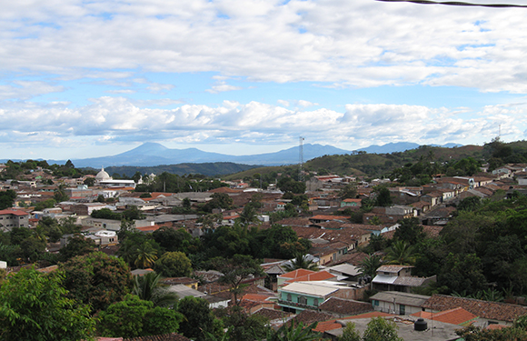
Ahuachapán
- Population: 333,406
- Total Land Area: 1,240 square kilometers (479 square miles)
- Capital: Ahuachapán
This district is in western El Salvador, bordering Guatemala as well as the Pacific Ocean and two other departments in El Salvador. The Rio Paz river is the primary river in the department and delineates the border of El Salvador with Guatemala. The capital of this district is also named Ahuachapán and is the country’s westernmost city. Coffee is produced in this region, and Ahuachapán is the center of agriculture in the area.
Some notable aspects of Ahuachapán are that is it the location of a geothermal plant and a hydroelectric station used to supply electricity and that it is the birthplace of El Salvador’s most famous poet, Alfredo Espino.
Cabañas
- Population: 164,945
- Total Land Area: 1,104 square kilometers (426 square miles)
- Capital: Sensuntepeque
Cabañas was classified as a department in 1873 and covers one of the coolest regions of El Salvador. It borders Honduras to the northeast as well as four other departments within El Salvador. The name Cabañas comes from General José Trinidad Cabañas, who served as a Minister of El Salvador for some time.
The capital of Cabañas is Sensuntepeque, whose name means “400 hills” in the local Pipil language and alludes to the hilly topography of the region. The location of the town was first inhabited by the Lenca people before it became a village of the Pipil people in 1550. It gained independence from Spanish rule in 1821.
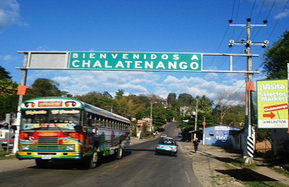
Chalatenango
- Population: 204,808
- Total Land Area: 2,017
- Capital: Chalatenango
The Chalatenango District of El Salvador borders Honduras and five other domestic departments.This department was officially recognized in 1855 and has 33 municipalities. Agriculture is a main economic activity in Chalatenango, with grains, agave, coffee, fruits, and vegetables being some of the primary crops. It also contains the highest point in El Salvador, El Pital.
Chalatenango is also the name of the department’s capital. The town is home to two professional football teams that share the José Gregorio Martínez Stadium. Jaripeo is another popular sport in the town, which is a type of bull riding.
Cuscatlán
- Population: 252,528
- Total Land Area: 756 square kilometers (292 square miles)
- Capital: Cojutepeque
Cuscatlán is one of two departments in El Salvador that do not make up part of the county’s external border; it’s located in the center of the country and is surrounded by five other departments. This is El Salvador’s smallest department, and its name means “land of precious jewels” in the Pipil language.
The capital of Cuscatlán is Cojutepeque, known also as “City of the Mists” for its humid climate. One of the main tourist draws in the city is the hill of Cerro de Las Pavas, on top of which one can get views of Lake Ilopango, the San Vicente Volcano, and the Valley of Jiboa. The chorizo sausages of this city are also famous throughout El Salvador.
La Libertad
- Population: 747,662
- Total Land Area: 1,653 square kilometers (638 square miles)
- Capital: Santa Tecla
La Libertad is a department in El Salvador that borders the Pacific Ocean in addition to five other departments. It became a department in 1865, and is composed of 22 different municipalities. La Libertad is famous for its seafood, something that can be enjoyed at an annual gastronomy festival that takes place at the port of La Libertad.
The capital of La Libertad is Santa Tecla, although it was named “Nueva San Salvador” for many years before its name change in 2003. There are several historical buildings in Santa Tecla, some of which are the Santa Tecla Museum, the Santa Tecla Municipal Palace, and the El Carmen Cathedral.
La Paz
- Population: 328,221
- Total Land Area: 1,224 square kilometers (473 square miles)
- Capital: Zacatecoluca
La Paz is located in southern El Salvador and is bordered by four other departments as well as the Pacific Ocean. It is one of the oldest departments in El Salvador and was founded in 1852. It’s known for containing some caves with rock writings in its territory as well as an area that has adopted and maintained several ancestral dances and traditions.
The capital of La Paz is Zacatecoluca, located at the base of the San Vicente Volcano. It is an agricultural trade center for the surrounding area and is home to professional football team Platense.
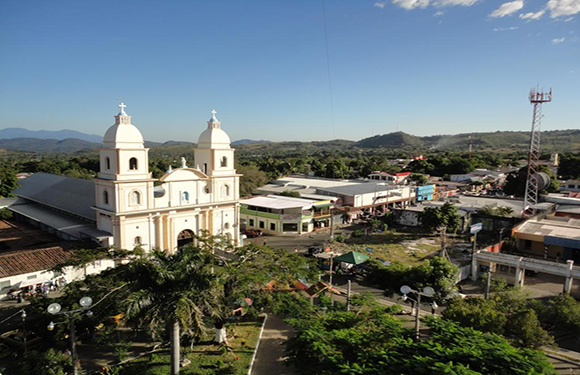
La Unión
- Population: 263,271
- Total Land Area: 2,074 square kilometers (801 square miles)
- Capital: La Unión
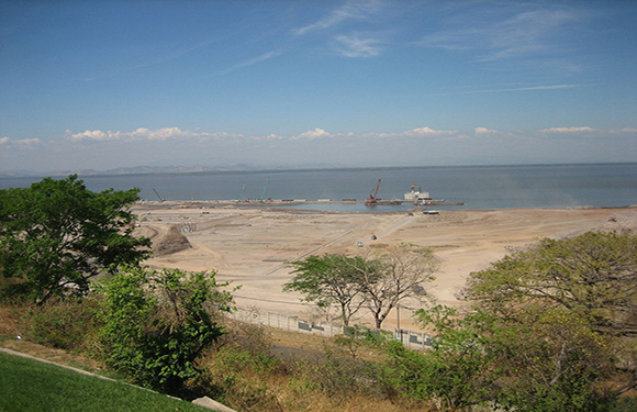
The department of La Unión is located in the far eastern region of El Salvador and officially became a department in 1865. It borders two other departments as well as the Pacific Ocean and Honduras. The Conchagua Temple and other archeological ruins are top tourist attractions in this department.
La Unión is also the name of this department’s capital, a city with roughly 34,000 people. Construction on a new seaport was completed in La Unión in 2012, which has helped grow the local economy.
Morazán
- Population: 199,519
- Total Land Area: 1,447 square kilometers (559 square kilometers)
- Capital: San Francisco Gotera
El Salvador’s Morazán Department was founded in 1875, although it was named Gotera until 1877. It is located in the northeast of the country and borders Honduras as well as two other departments in El Salvador.
The capital city of this department is San Francisco Gotera, which gets its name from the saint and the word “gotera” which means “hill of snakes.” This refers to Coroban hill, where the remains of its original population can still be found.
San Miguel
- Population: 478,792
- Total Land Area: 2,077 square kilometers (802 square miles)
- Capital: San Miguel
San Miguel is the only department in El Salvador to border both Honduras and the Pacific Ocean. It also shares borders with five other domestic departments. San Miguel was made a department in 1824, just three years after El Salvador gained independence.
San Miguel is also the name of the department’s capital, and it is the third most populous city in El Salvador. As well as being an important economic hub of the country, the city of San Miguel has a number of educational institutions, including some of the oldest in the country.
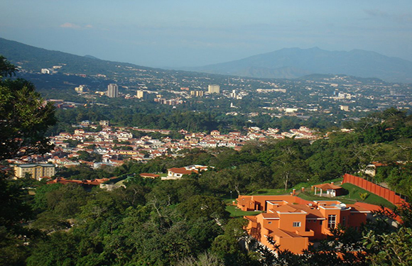
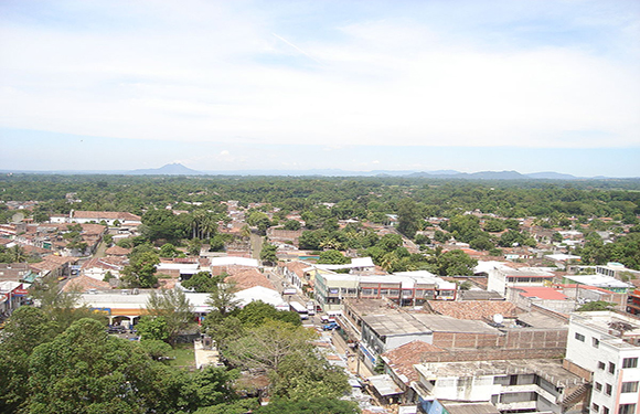
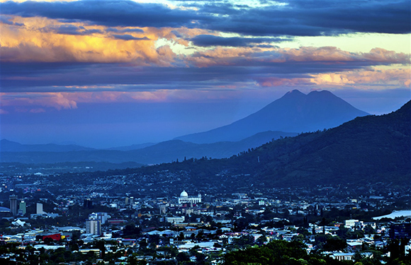
San Salvador
- Population: 1,740,847
- Total Land Area: 886 square kilometers (342 square miles)
- Capital: San Salvador
The San Salvador department in west central El Salvador. The capital is also called San Salvador, and it is the capital of El Salvador as well. This is the second smallest department in El Salvador by size, but it is by far the most populous. It became a department in 1824 and is now an important economic and administrative center of the country.
The capital of the department is also called San Salvador, which means “Holy Savior” in Spanish. The historic downtown area of San Salvador attracts many tourists, although most of the colonial Spanish buildings have been destroyed by natural disasters. This area of the city dates back to the 16th century.
San Vicente
- Population: 174,561
- Total Land Area: 1,184 square kilometers (457 square miles)
- Capital: San Vicente
San Vicente is a department in central El Salvador with a narrow coastline on the Pacific Ocean that borders five other departments in the country. The capital is also named San Vicente.
The municipality of San Vicente was founded by 50 Spanish families in 1635. It is located in a volcanic region with many hot springs nearby.
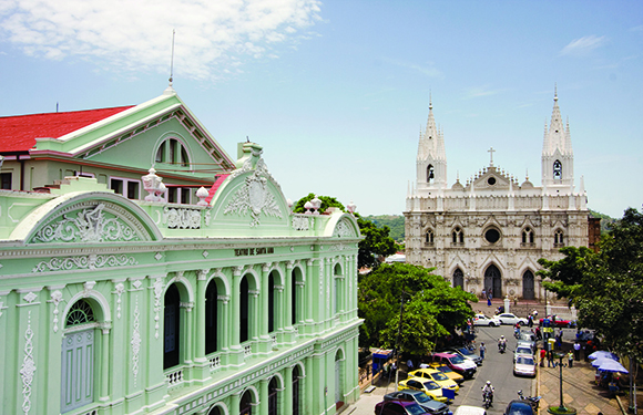
Santa Ana
- Population: 572,081
- Total Land Area: 2,023 square kilometers (781 square miles)
- Capital: Santa Ana
Santa Ana is a department in the northwest corner of El Salvador, bordering Guatemala and four other domestic departments. This department is where El Salvador’s Santa Ana Volcano, the highest in the country, is located.
The capital has the same name as the department, and it is the second largest city in El Salvador. The city is a tourist destination for those interested in learning about Salvadoran culture and history. There is also an important coffee bean processing center located near the city.
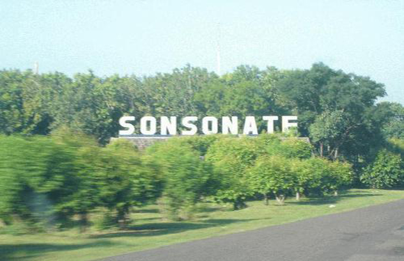
Sonsonate
- Population: 463,732
- Total Land Area: 1,225 square kilometers (434 square miles)
- Capital: Sonsonante
Sonsonante is the name of this department and its capital in southwestern El Salvador. It was created in 1824 and borders three other departments and the Pacific Ocean. The department is considered the heart of the Pipil culture in the country.
The main economic activities in the city of Sonsonante are tobacco farming, ranching, and tourism. Tourists come to the area to see volcanoes and explore coral reefs.
Usulután
- Population: 366,040
- Total Land Area: 2,130 square kilometers (822 square miles)
- Capital: Usulatán
Usulatán is El Salvador’s largest department. Created in 1865, it borders two other departments and has a wide section of Pacific Ocean coastline. Some of the beaches here are considered among the best in the country.
The capital of Usulatán goes by the same name and is the fifth-largest city in the country. It has a humid climate because of its proximity to the ocean and is highly suitable for agriculture.