A powerful magnitude 7.5 earthquake struck the South Pacific Ocean on March 24, 2026, centered approximately 153 km (95 miles) west of Neiafu, Tonga — making it the strongest earthquake recorded anywhere in the world so far in 2026. The deep tremor triggered tsunami sirens across the island nation, though no destructive waves materialized thanks to the quake’s exceptional depth of 238 km (148 miles) below the ocean floor.
Interactive Earthquake Map
Explore the epicenter location, aftershock positions, and the Tonga Trench subduction zone on the interactive map below. Click markers for details on each seismic event.
What Happened
The earthquake struck at 04:37 UTC on March 24 (5:37 PM local Tonga time), jolting residents across the archipelago. The USGS recorded the event at a depth of 238 km — classifying it as an intermediate-depth earthquake occurring within the subducted Pacific Plate rather than at the shallow plate interface.
The event was part of a broader seismic cluster, with 1,206 earthquakes recorded worldwide on March 24 alone. Additional aftershocks of M5.7 and M5.2 followed in the same Vava’u/Tonga region, confirming ongoing tectonic stress in the area.
Shaking was felt across multiple island groups, with the strongest intensity (MMI VI — “Strong”) reported in the Vava’u group nearest the epicenter. A guest at the Tanoa International Dateline Hotel in the capital Nuku’alofa reported: “The whole building shook. No further damage. Everything was ok.”
Key Facts
- Magnitude: 7.5 (USGS revised; initially reported as 7.6)
- Depth: 238 km (148 miles) — intermediate-depth
- Epicenter: 18.70°S, 175.43°W — 153 km west of Neiafu, Tonga
- Local Time: 5:37 PM, Tuesday, March 24, 2026 (Tonga Time, GMT+13)
- Nearest Town: Neiafu, Vava’u (population ~6,000) — 95 miles from epicenter
- Nearest Volcano: Home Reef (77 km / 48 miles)
- Aftershocks: M5.7 and M5.2 in the same region
- People Exposed: ~20,000 (GDACS estimate)
- Damage: No casualties or major damage reported
- Tsunami: Local warning issued and lifted after 2 hours; no waves detected
The Tsunami Question: Why Warnings Diverged
The earthquake triggered a fascinating split in disaster response. Tonga’s National Disaster Risk Management Office immediately issued a tsunami warning, activating sirens and urging coastal residents to move to higher ground. Meanwhile, the Pacific Tsunami Warning Center (PTWC) in Hawaii assessed the event and chose not to issue a warning.
The reason? Earthquakes at 230+ km depth cannot directly trigger tsunamis — the seismic slip occurs far too deep within the Earth’s mantle to cause significant seafloor displacement. The PTWC stated the quake was “located too deep inside the earth” to pose a tsunami threat.
However, Tonga’s local authorities were arguably right to err on the side of caution. Earthquake depth is a derived parameter with significant uncertainty, and a mistaken “safe” call on a shallow quake could prove catastrophic. In a nation where a 2022 tsunami triggered by the Hunga Tonga volcanic eruption killed three people, the precautionary approach is both understandable and commendable.
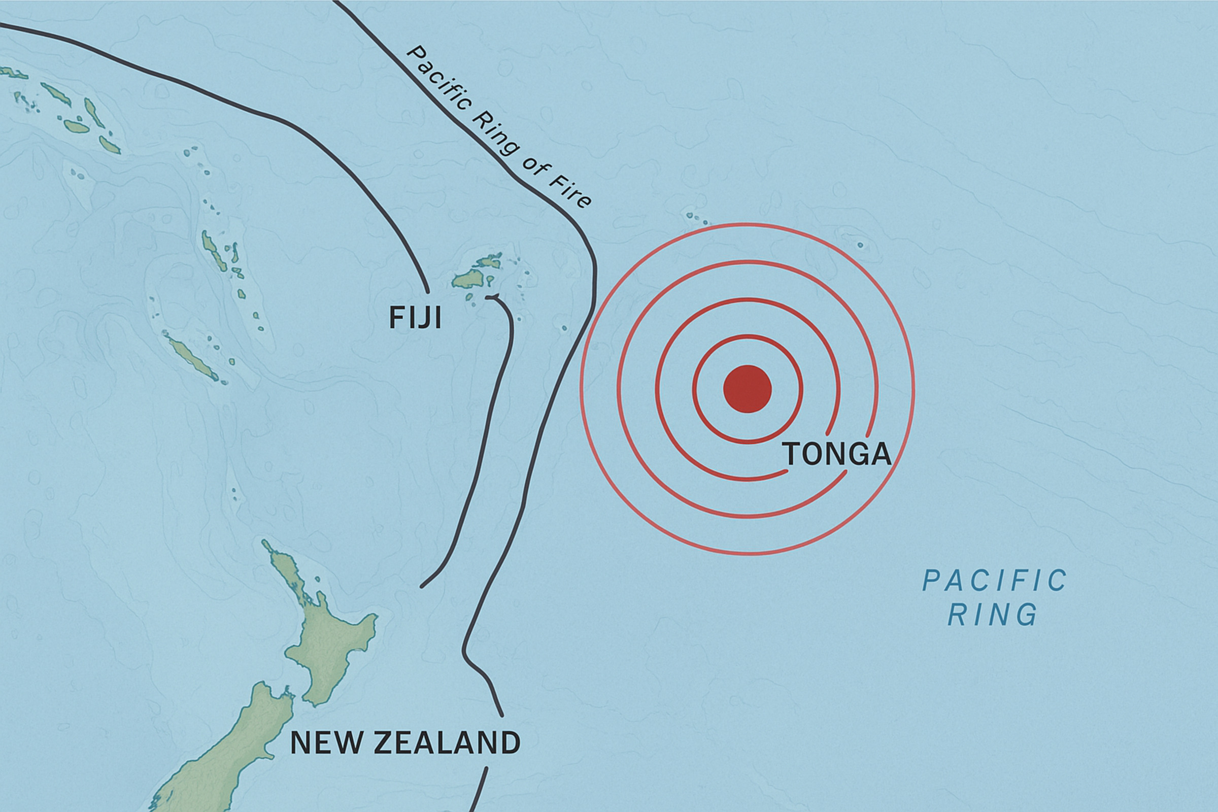
Why Tonga: The Kermadec-Tonga Subduction Zone
Tonga sits squarely on the Pacific Ring of Fire — the horseshoe-shaped belt of seismic faults encircling the Pacific Ocean where approximately 90% of the world’s earthquakes occur. More specifically, the archipelago lies along the Kermadec-Tonga Subduction Zone, where the Pacific Plate dives beneath the Australian Plate at one of the fastest convergence rates on Earth.
The Tonga Trench, running roughly north-south to the east of the islands, plunges to depths exceeding 10,800 meters (35,400 feet) — making it one of the deepest oceanic trenches in the world. This relentless plate collision generates frequent intermediate and deep-focus earthquakes as the descending slab deforms under extreme pressure and temperature.
Since 1950, six previous earthquakes of magnitude 7 or larger have occurred within 250 km of this event’s epicenter. The most recent was a magnitude 7.0 in March 2025. The largest was a magnitude 8.0 on May 3, 2006, which caused minor damage in the region.
Tonga at a Glance
- Location: Polynesia, South Pacific Ocean — 1,800 km northeast of New Zealand
- Archipelago: 171 islands (36 inhabited)
- Population: ~100,000 (most on main island Tongatapu)
- Capital: Nuku’alofa (Tongatapu)
- Earthquake Epicenter Region: Near Vava’u island group, the second-largest urban center
- Tectonic Setting: Pacific-Australian plate boundary, Kermadec-Tonga subduction zone
What’s Next
While the immediate threat has passed, seismologists continue to monitor the region for further aftershock activity. The South Pacific remains the most seismically active zone globally in March 2026, with ongoing earthquake clusters across Alaska, Indonesia, Japan, and the Mid-Indian Ridge.
The event serves as a stark reminder that Tonga and its Pacific neighbors live in perpetual proximity to some of Earth’s most powerful geological forces. The 2022 Hunga Tonga eruption and tsunami demonstrated how quickly conditions can escalate — making continued investment in early warning systems and disaster preparedness essential for the region’s resilience.


Sources
- USGS — United States Geological Survey Earthquake Hazards Program
- Reuters — No tsunami threat after deep 7.6 magnitude earthquake near Tonga
- AccuWeather — Strongest earthquake of 2026 strikes near Tonga in Pacific Ocean
- VolcanoDiscovery — Major M7.5 earthquake near Tonga
- Earthquake Insights — M7.5 earthquake near Tonga is the largest of 2026
- ReliefWeb / UN OCHA — ECHO Daily Flash: Tonga Earthquake, 24 March 2026
- FOX Weather — Deep magnitude 7.5 earthquake shakes Tonga