Every June 8, the United Nations marks World Oceans Day — a reminder that one connected ocean covers about 71% of our planet and shapes life across all of it. We carve that ocean into five named basins and draw borders across its surface, but which countries actually touch the most of it? This guide maps the world’s oceans and seas — how many there are, where they meet, and (scroll down for the data) which nations command the longest coastlines and the largest slices of ocean territory.
Key Takeaways
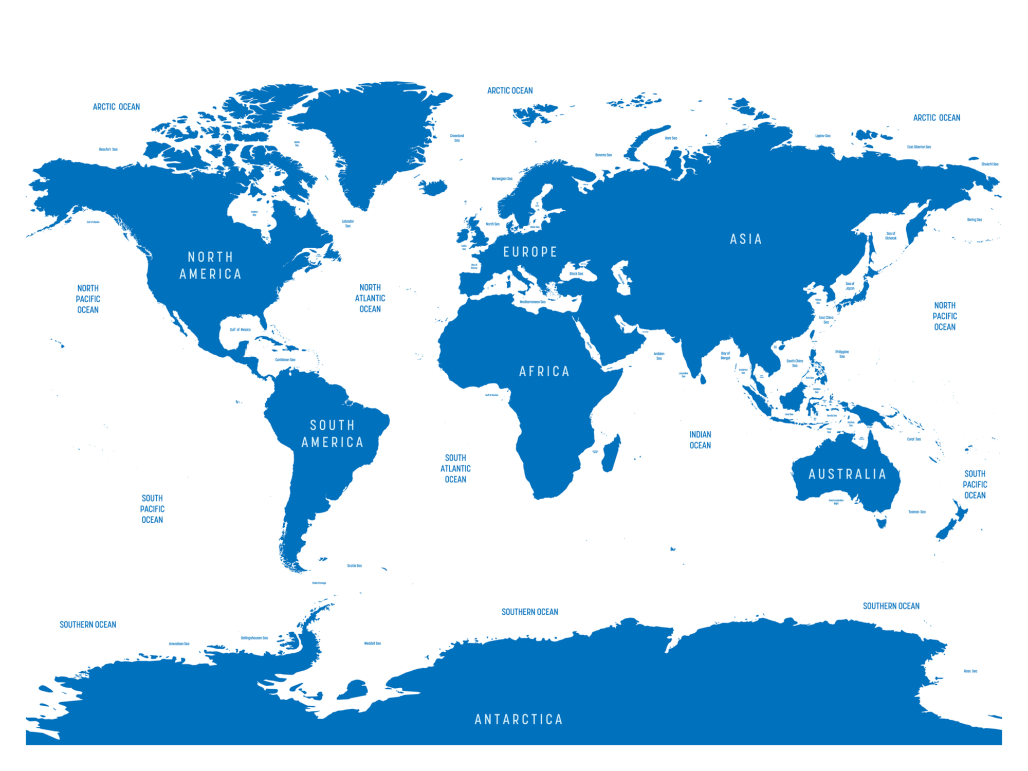
- One global ocean, five named basins. The Pacific, Atlantic, Indian, Arctic and Southern oceans are really one connected body of saltwater that covers about 71% of Earth’s surface.
- Canada has the world’s longest coastline. At 202,080 km it dwarfs every other nation — longer than Norway (83,281 km) and Indonesia (54,716 km) put together.
- Islands and fjords inflate the rankings. Norway’s 83,281 km counts roughly 239,000 islands and deep fjords; its mainland-only coast is closer to 25,000 km — the ‘coastline paradox’ at work.
- Coastline length is not ocean territory. France’s coast is just 4,853 km, yet its scattered overseas islands give it one of the planet’s largest exclusive economic zones — over 10 million km², rivalling the United States.
- More than 40 countries touch no ocean at all. Landlocked nations from Mongolia and Bolivia to the heart of Africa have zero coastline and depend on neighbours for sea access.
1, 4, or 5 Oceans?
How many oceans are there in the world?
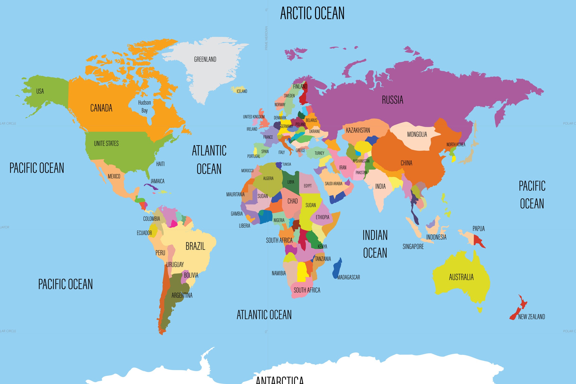
While some countries claim that there are four oceans in the world, most agree that there are five:
- Pacific Ocean
- Atlantic Ocean
- Indian Ocean
- Arctic Ocean
- Southern (Antarctic) Ocean
But it isn’t obvious just by looking at a map where one ocean ends and another begins. The truth is that they’re all one connected body of water, and this body of water is sometimes referred to as the global ocean. 71% of the Earth is covered in water, and the different oceans that make up so much of the planet are all unique.
It is only recently that most of the world agreed to recognize five world oceans. The five oceans we now commonly speak of do have official boundaries that have been set by the International Hydrographic Organization. These boundaries are mostly static and based on continental boundaries as well as latitude and longitude lines, but the currents, wildlife, and weather patterns in the world’s oceans are constantly changing.
Pacific Ocean
The Pacific is the world’s largest and deepest ocean. Named by Portuguese explorer Ferdinand Magellan in 1502, it borders the continents of Asia and Australia to the west and the Americas to the east. The explorer decided on the name, which means peaceful, after sailing through a calm patch of the ocean, but this isn’t the most accurate description — the Pacific Ocean is home to violent hurricanes, the Mariana Trench, and many earthquakes. There are sometimes references to the North and South Pacific Oceans.
Atlantic Ocean
The name of this ocean comes from Greek mythology and means “Sea of Atlas.” It covers one fifth of the Earth’s surface and separates the American continents from Europe and Africa. The shape of this ocean makes it unique from the others — it is much longer than it is wide, and it takes on an “S” shape. It is sometimes divided into the North and South Atlantic Oceans.
Indian Ocean
This ocean sits beneath the Asian continent, in between Africa to the west and Australia to the east. The southern limit of the Indian Ocean isn’t widely agreed upon; some authorities state that the ocean extends to the coast of Antarctica, while others define its southern border as latitude 60°S. There is a wide variety of coastal environments to be found around this ocean, among which is the world’s most tectonically active in southern Pakistan.
Arctic Ocean
The world’s smallest ocean, the Arctic Ocean is centered around the North Pole and is home to freezing waters and hostile weather patterns. This is also the ocean that may be most likely to experience severe changes due to climate change because of the large amounts of ice cover found in the area. This ocean is considered to be less scientifically understood than the others because of its remote location and inhospitable climate.
The above map of the world oceans lists only four different oceans. This is how most maps described the world’s bodies of water until the year 1999. The Southern Ocean is not labeled.
The Southern Ocean
In 1999, the National Geography Society officially recognized the Southern Ocean, though it is not yet recognized by all countries. There are several characteristics that make this ocean unique from the other four. One of these is that it is the only ocean whose borders are defined by currents rather than continents. Another is that it is the only ocean that completely surrounds one continent. The borders of this ocean are described by the latitude 60°S.
In addition to being the most recently named ocean, the Southern Ocean is the youngest on the planet in terms of geology. It was formed roughly 30 million years ago when the continents of South America and Antarctica drifted apart. This separation created the Drake Passage and allowed for the Antarctic Circumpolar Current (ACC) to flow around Antarctica in a clockwise motion.
The above map shows the most widely accepted modern representation of the world’s oceans, including the Southern Ocean surrounding Antarctica.
History of Oceans
The oceans of the world formed billions of years ago. The majority of scientists think that water formed on the planet as it cooled, allowing gasses to condense into liquid which filled the Earth’s basins with water. This process likely took centuries, meaning hundreds of years of rain while the global ocean formed.
New theories about the history of the Earth propose the idea that the planet was once actually completely covered with water. This is a relatively new theory, and it’s bringing up new questions about theories regarding the origins of life on the planet.
What are the Seven Seas?
This phrase can be found in literature from several different societies and dates back to thousands of years ago. At various times throughout history it was descriptive of specific bodies of water in different regions of the planet, but the origin of the phrase is not known.
The seven seas are now sometimes defined as the seven oceanic bodies that come from separating two of the world’s oceans into a northern and southern part. However, it’s more common for the phrase to be used as a figurative term to refer to all of the seas in the world.
The modern seven seas:
- Arctic Ocean
- Indian Ocean
- Southern Oceans
- North Atlantic
- South Atlantic
- North Pacific
- South Pacific
The seven seas according to Greek literature:
- Aegean Sea
- Adriatic Sea
- Mediterranean Sea
- Black Sea
- Red Sea
- Caspian Sea
- Persian Gulf
The seven seas according to Medieval European literature:
- North Sea
- Baltic Sea
- Atlantic
- Mediterranean Sea
- Black Sea
- Red Sea
- Arabian Sea
Which Countries Have the Most Coastline?
The world’s coastlines stretch for roughly 356,000 km in total — enough to wrap around the Equator almost nine times. But that shoreline is spread wildly unevenly. A handful of vast, island-strewn nations hold most of it, while dozens of countries have none. The map below shades every country by the length of its coastline, using figures from the CIA World Factbook.
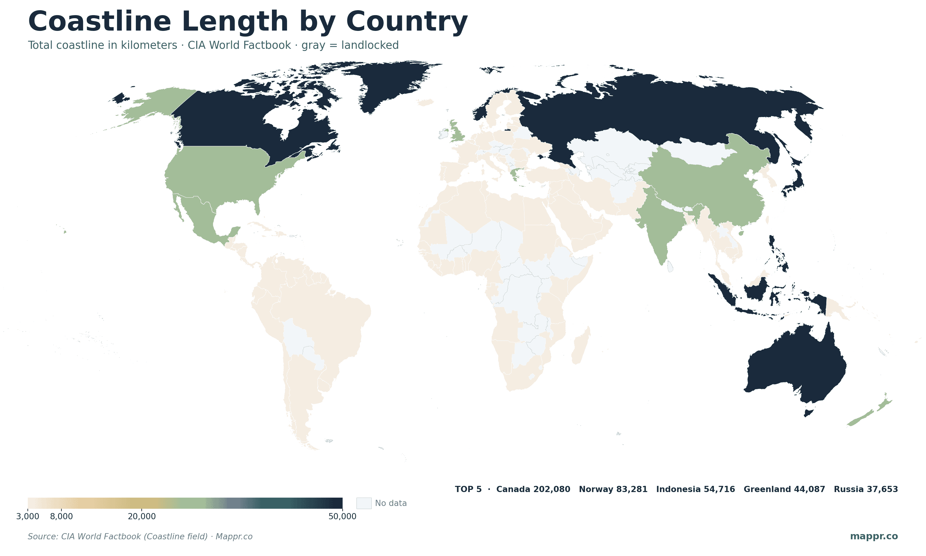
Canada runs away with first place. Its 202,080 km of coastline — fringing the Atlantic, Pacific and the maze of the Arctic Archipelago — is more than twice that of any other country. Behind it come the great archipelago and high-latitude nations: Norway (83,281 km), Indonesia (54,716 km), Russia (37,653 km) and the Philippines (36,289 km). Greenland, a self-governing part of Denmark, would slot in around fourth with 44,087 km if counted on its own.
Why so lopsided? Coastline length is really a measure of how broken-up and convoluted a shore is. Thousands of islands, fjords and inlets multiply a country’s edge. Norway is the classic example: its headline figure folds in some 239,000 islands and its famously deep fjords, so its mainland-only coast is closer to 25,000 km. Measure the same coast at a finer scale and it gets longer still — a quirk geographers call the coastline paradox. Smooth-shored giants fare differently: the United States (19,924 km), China (14,500 km) and Brazil (7,491 km) all rank lower than their size might suggest, while compact, island-rich Greece (13,676 km) punches far above its weight.
Coastline isn’t the same as ocean territory
Having a long coast doesn’t automatically mean controlling a lot of ocean. Under the UN Convention on the Law of the Sea, every coastal state can claim an exclusive economic zone (EEZ) reaching 200 nautical miles out from its shores. By that measure the rankings reshuffle completely: the United States and France hold the two largest EEZs on Earth — each more than 10 million km² — not because of long mainland coasts, but because of far-flung island territories scattered across the Pacific, Atlantic and Indian oceans. France’s metropolitan coastline is a modest 4,853 km, yet its overseas islands make it a maritime superpower. Australia, Russia and the United Kingdom round out the top five by ocean area.
The countries with no coast at all
At the other extreme, more than 40 sovereign states are landlocked — shown in gray on the map. They range from a belt across Central Africa (Chad, Niger, Mali) and the heart of Eurasia (Mongolia, Kazakhstan, the ‘-stans’) to South America’s Bolivia and Paraguay and a cluster in central Europe. Two of them, Uzbekistan and Liechtenstein, are even double-landlocked, surrounded entirely by other landlocked countries. For these nations, access to the global ocean depends on treaties, rivers and the goodwill of their neighbours — a reminder of why the sea has always been so prized.
Coastline lengths are from the CIA World Factbook (Coastline field), which covers 198 countries; figures are measured at unstated map scales and are not strictly comparable between countries. Exclusive economic zone areas are from the Sea Around Us / Marine Regions database. Ocean coverage and the five-ocean framework follow the International Hydrographic Organization and National Geographic.


