The British Overseas Territories are a diverse collection of lands spanning the globe, each with its unique identity, culture, and history, yet united under the sovereignty of the United Kingdom.
From the icy expanses of the British Antarctic Territory to the tropical beauty of the Caribbean islands, these territories encompass a wide range of environments, peoples, and ways of life.
Below is a map of British territories around the world:
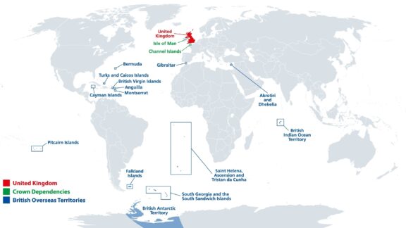
UK/British Territories: Caribbean Map
Below is a detailed map of the UK Overseas Territories in the Caribbean Islands:
List of all UK Territories
| Name | Location | Capital |
|---|---|---|
| British Antarctic Territory | Antarctica | Rothera (main base) |
| Cayman Islands | Caribbean | George Town |
| British Virgin Islands | Caribbean , North Atlantic Ocean | Road Town |
| Anguilla | Caribbean, North Atlantic Ocean | The Valley |
| Montserrat | Caribbean, North Atlantic Ocean | Plymouth |
| Sovereign Base Areas of Akrotiri and Dhekelia | Cyprus , Mediterranean Sea | Episkopi Cantonment |
| Gibraltar | Iberian Peninsula , Continental Europe | Gibraltar |
| British Indian Ocean Territory | Indian Ocean | Naval Support Facility Diego Garcia (base) |
| Turks and Caicos Islands | Lucayan Archipelago , North Atlantic Ocean | Cockburn Town |
| Bermuda | North Atlantic Ocean between the Azores , the Caribbean , Cape Sable Island in Canada , and Cape Hatteras (its nearest neighbour) in the United States | Hamilton |
| Pitcairn, Henderson, Ducie and Oeno Islands | Pacific Ocean | Adamstown |
| Falkland Islands | South Atlantic Ocean | Stanley |
| Saint Helena, Ascension and Tristan da Cunha | South Atlantic Ocean | Jamestown |
| South Georgia and the South Sandwich Islands | South Atlantic Ocean | King Edward Point |
Anguilla
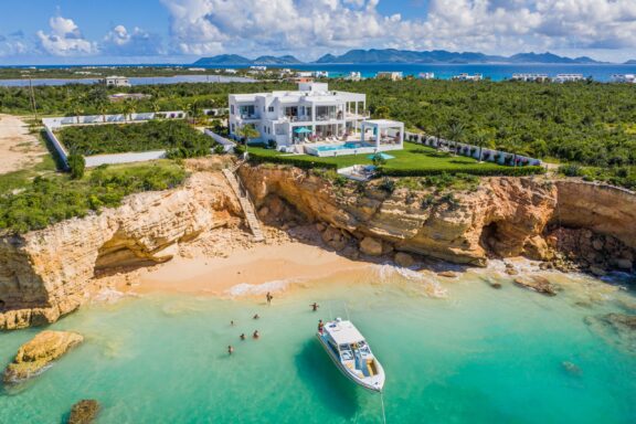
Anguilla is a small, narrow island in the Caribbean Sea, known for its white sandy beaches, crystal-clear waters, and a laid-back atmosphere that contrasts with some of its busier Caribbean neighbors.
It is a British Overseas Territory with a rich history dating back to settlement by the Arawak and Carib peoples thousands of years ago. It most recently became a separate entity in 1980 after a series of peaceful negotiations for autonomy from Saint Kitts and Nevis. Today, Anguilla’s economy thrives on luxury tourism, offshore banking, and fishing.
African, Spanish, French, and British heritage influences the island’s cultural landscape. Noteworthy is its annual Summer Festival, which celebrates Emancipation Day with boat racing, one of the island’s national sports.
Bermuda
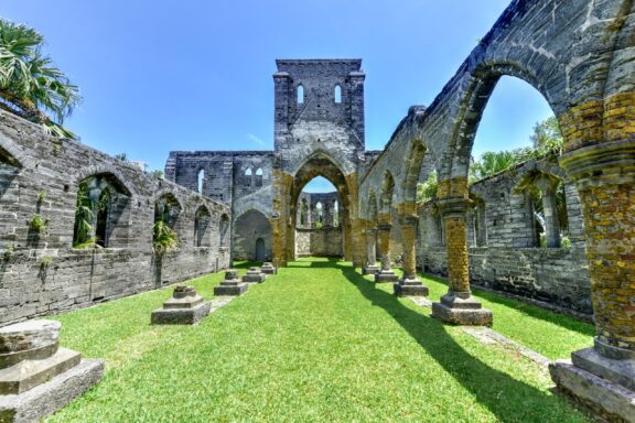
Bermuda is renowned for its unique blend of British and American culture, manifesting in its charming towns that exude a distinctly British vibe with a subtropical twist. Situated in the North Atlantic Ocean, this British Overseas Territory is famous for its association with the Bermuda Triangle mystery.
The archipelago consists of approximately 138 islands, with a rich history that dates back to its discovery in 1505 by Spanish explorer Juan de Bermúdez. Unlike any Caribbean island, Bermuda boasts pink-sand beaches like Horseshoe Bay, lush botanical gardens, and the historic town of St. George, a UNESCO World Heritage site known for its well-preserved colonial architecture.
Bermuda’s economy relies heavily on finance — particularly insurance and reinsurance — and tourism.
British Antarctic Territory
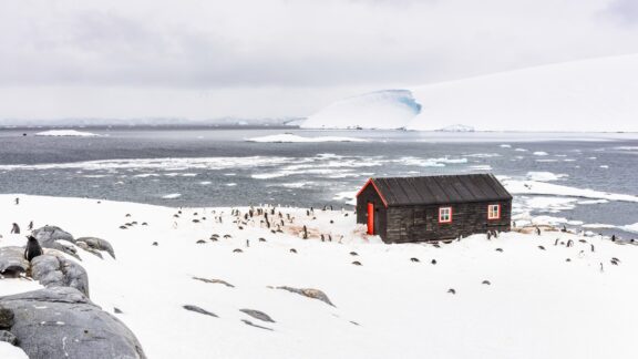
The British Antarctic Territory, a region of stark beauty and extreme conditions, covers a vast expanse of Antarctica’s icy landscape. Established as a territorial claim by Britain in 1962, it is one of the largest British Overseas Territories, covering around 1,709,400 square kilometers (660,003 square miles) of ice shelves and mountainous terrain.
This territory is valuable for scientific research, hosting numerous research stations where international teams of scientists study climate change, glaciology, and marine biology. The British Antarctic Survey, a leading environmental research center, conducts vital work here, contributing significantly to our understanding of global environmental issues.
The Antarctic Treaty, signed in 1959, ensures that the region is used solely for peaceful and scientific purposes, prohibiting military activity and mineral mining.
British Indian Ocean Territory
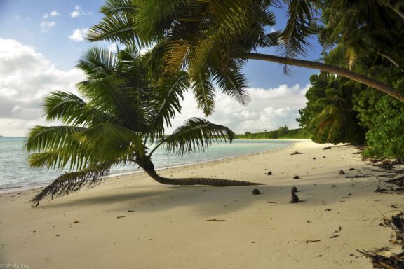
The British Indian Ocean Territory (BIOT) is an archipelago of 55 islands in the Indian Ocean, the most famous of which is Diego Garcia, home to a joint US-UK military base. Established in 1965, BIOT is strategically located midway between Africa and Indonesia, contributing to its importance for global security and telecommunications.
Despite its use for military purposes, BIOT’s natural environment is largely undisturbed, offering a unique opportunity for studying untouched ecosystems. The territory is known for its rich biodiversity, including pristine coral reefs that are among the world’s largest protected marine areas.
British Virgin Islands
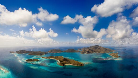
The British Virgin Islands (BVI), a cluster of over 50 islands in the Caribbean, are celebrated for their breathtaking beauty, from the azure waters of the Sir Francis Drake Channel to the rugged terrain of Tortola, the largest island.
Known for their robust offshore financial services sector, the BVI have become a global hub for company registrations, benefiting from a combination of tax neutrality and a well-established legal system.
Despite their economic focus on finance, the BVI are also a premier yachting destination, with sailing events such as the annual Spring Regatta drawing enthusiasts from around the world. The islands’ rich cultural heritage is celebrated through music, dance, and festivals, including the Emancipation Festival, which marks the abolition of slavery with vibrant parades and performances.
Cayman Islands
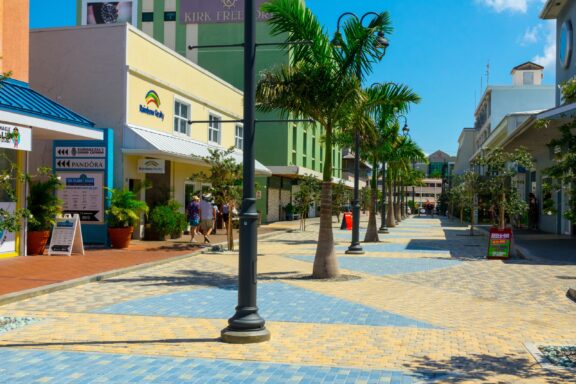
The Cayman Islands, a trio of islands in the western Caribbean Sea, are renowned for their tourist attractions, including extraordinary beaches, world-class diving sites, and vibrant coral reefs.
Grand Cayman, the largest island, hosts the famous Seven Mile Beach, one of the Caribbean’s most beautiful shorelines. The islands are a financial powerhouse, known globally as a major offshore banking center.
Aside from finance, the Cayman Islands offer a rich culinary scene, blending traditional Caribbean flavors with international cuisine, celebrated annually during the Cayman Cookout. The islands’ commitment to conservation is evident in protected areas such as the Cayman Turtle Centre, aimed at preserving marine life and educating visitors about local ecosystems.
Falkland Islands
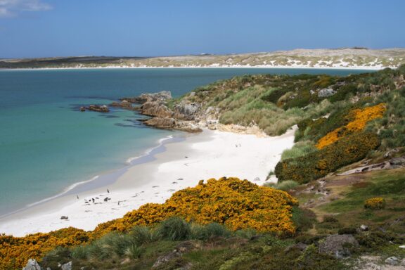
The Falkland Islands are a remote archipelago in the South Atlantic Ocean, known for their rugged terrain, diverse wildlife, and historical significance. Comprising East Falkland, West Falkland, and over 700 smaller islands, this British Overseas Territory has vast populations of penguins, seals, and bird species.
The islands’ history is marked by the 1982 Falklands War between the United Kingdom and Argentina, a conflict that remains a poignant chapter in the islands’ narrative, deeply influencing its identity and relations.
The capital, Stanley, offers insights into the islands’ heritage, with well-preserved Victorian-era architecture, the Falkland Islands Museum, and memorials commemorating the Falklands War.
Gibraltar
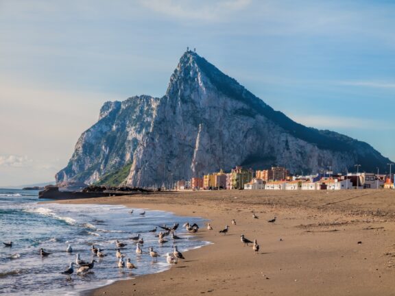
Gibraltar, positioned at the southern tip of the Iberian Peninsula, represents a unique fusion of British and Mediterranean cultures. This British Overseas Territory is famed for the Rock of Gibraltar, a towering limestone monolith that dominates the landscape and offers panoramic views of the surrounding area.
Gibraltar’s strategic location at the entrance to the Mediterranean has endowed it with a rich naval history and a diverse cultural heritage. The territory has been under British control since the early 18th century, a status that is reflected in its legal system, language, and customs, yet it also boasts a vibrant mix of Spanish, Moroccan, and Genoese influences.
Montserrat
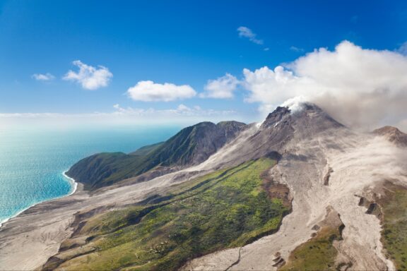
Montserrat, known as the “Emerald Isle” of the Caribbean for its resemblance to the coast of Ireland and the Irish ancestry of some of its inhabitants, is a British Overseas Territory characterized by lush, green mountains and a rich volcanic landscape.
The island experienced a dramatic transformation in 1995 when the Soufrière Hills Volcano erupted for the first time in centuries, rendering a significant portion of Montserrat uninhabitable and burying the capital, Plymouth, in ash.
This event has deeply impacted Montserrat’s geography and culture, leading to the creation of an Exclusion Zone that covers the southern half of the island, including the abandoned city of Plymouth, often described as a modern-day Pompeii.
Pitcairn Islands
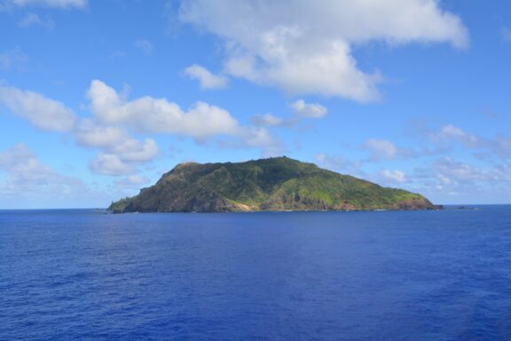
The Pitcairn Islands, a group of four volcanic islands in the remote South Pacific, are the last British Overseas Territory in the Pacific. Of these, only Pitcairn Island—the second largest—is inhabited, home to a small community descended from the mutineers of the HMS Bounty and their Tahitian companions, a story immortalized in literature and film.
Pitcairn is accessible only by sea, making the journey there an adventure in itself. The island offers unparalleled opportunities for snorkeling and diving among pristine coral reefs, exploring ancient Polynesian sites, and observing unique flora and fauna.
The governance of the island is unique; it has its own constitution and combines traditional leadership with British oversight, ensuring that despite its isolation, Pitcairn remains connected to the wider world through satellite internet and occasional supply ships.
Saint Helena, Ascension, and Tristan da Cunha
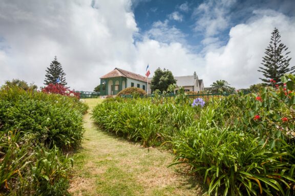
Saint Helena, Ascension, and Tristan da Cunha are some of the most isolated islands in the world, located in the South Atlantic Ocean.
Saint Helena, the most well-known of the trio, gained fame as the site of Napoleon Bonaparte’s exile and death. Its rugged terrain is laced with historic sites, including Napoleon’s residence and tomb. Today, the island is a sanctuary for endemic species and a destination for eco-tourism, following the opening of its airport in 2016.
Ascension Island serves as a crucial air and space monitoring station, thanks to its strategic location and the presence of the U.S. and UK military bases. Its volcanic landscapes are home to the green turtle, which comes ashore to nest in one of the world’s largest green turtle nesting sites.
Tristan da Cunha, the most remote inhabited archipelago globally, is known for its tight-knit community of about 250 people living in Edinburgh of the Seven Seas. The community’s lifestyle is a testament to self-sufficiency and resilience, heavily reliant on fishing and subsistence farming.
South Georgia and the South Sandwich Islands
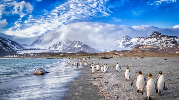
South Georgia and the South Sandwich Islands, located in the southern Atlantic Ocean and comprising a collection of mostly uninhabited islands, are known for their remote and rugged beauty.
South Georgia, the largest island, is famed for its dramatic mountainous landscapes and glaciers. It was a historical whaling station, notably in the hamlet of Grytviken, which is now home to a museum and the final resting place of the explorer Sir Ernest Shackleton.
The wildlife in South Georgia and the South Sandwich Islands is extraordinary, with vast colonies of king penguins, seals, and an array of bird species, making it a crucial area for biodiversity and conservation efforts. The islands are a key breeding ground for millions of seabirds, including albatrosses, which are threatened by global fishing practices.
Sovereign Base Areas of Akrotiri and Dhekelia (on Cyprus)
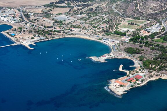
The Sovereign Base Areas of Akrotiri and Dhekelia on Cyprus are unique among British Overseas Territories. Established in 1960 during the independence of Cyprus from British rule, these areas serve strategic military purposes for the United Kingdom, hosting key military installations essential for operations in the Middle East and beyond.
Akrotiri and Dhekelia are positioned on the southern coast of Cyprus, covering a combined area of 254 square kilometers. Despite their primary military function, these territories also host vibrant civilian communities. The British administration ensures the protection of the environment and the well-being of the inhabitants, balancing military needs with civilian life.
The regions are noted for their rich biodiversity, including important wetlands in Akrotiri that are crucial for migratory birds.
Turks and Caicos Islands
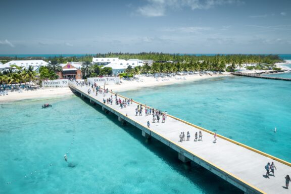
The Turks and Caicos Islands, located southeast of the Bahamas in the Atlantic Ocean, are a premier tourist destination known for their spectacular coral reefs, extensive sandy beaches, and clear turquoise waters. This British Overseas Territory comprises about 40 islands and cays, of which only a few are inhabited.
The economy of the Turks and Caicos is driven by tourism, offshore finance, and fishing, with the islands being particularly famous for their lobster and conch exports.
The territory’s commitment to preserving its marine environment is evident in the extensive network of protected areas, including the Columbus Landfall National Park, which marks the spot where Columbus is believed to have first made landfall in the New World.
Culturally, the islands celebrate their heritage through music, dance, and the annual Junkanoo festival, which features colorful costumes, parades, and traditional music.
Image Sources and Copyright Information
- Map of British Overseas Territories: © Peter Hermes Furian/Shutterstock
- Aerial View of a Luxurious Villa Perched on a Cliff Overlooking a Tropical Beach with a Boat and Swimmers: © Rob G Films/Shutterstock
- Ruins of the Unfinished Church in Bermuda under a Clear Blue Sky: © Felix Lipov/Shutterstock
- Penguins and a Red Hut in the Snowy Landscape of the British Antarctic Territory: © Anton_Ivanov/Shuttersotck
- Tropical Beach Paradise with Overhanging Palm Tree: © Stephen P. Mallory/Shutterstock
- Aerial View of the British Virgin Islands Archipelago with Turquoise Waters: © Taylor McBride/Shutterstock
- Sunny Pedestrian Street in George Town, Grand Cayman Island: © Dennis MacDonald/Shutterstock
- Serene Beach at Gypsy Cove with Lush Greenery and Golden Blooms: © GybasDigiPhoto/Shutterstock
- The Rock of Gibraltar with Beach and Birds in the Foreground: © Andreas Poertner/Shutterstock
- Aerial View of the Active Soufrière Hills Volcano on Montserrat with Ash Plume: © IndustryAndTravel/Shutterstock
- Serene View of the Remote Pitcairn Island Surrounded by the Vast Blue Ocean: © P Rusky/Shutterstock
- Longwood House on Saint Helena, the Final Residence of Napoleon Bonaparte: © Umomos/Shutterstock
- King Penguins and Seals on the Shoreline with Approaching Katabatic Winds in South Georgia: © jo Crebbin/Shutterstock
- Aerial View of a Coastal Bay with Buildings and Boats: © Kekyalyaynen/Shutterstock
- Aerial View of a Pier with Visitors on Grand Turk Island, Turks and Caicos: © Mikolaj Niemczewski/Shutterstock