Discovering Ireland’s hidden gems in summer invites you to venture beyond the familiar into a realm of secluded beauty and timeless charm.
These secret spots, set against Ireland’s lush summer landscapes, offer an escape into tranquility, history, and natural wonder.
From the hushed ruins of ancient abbeys to the serene shores of untouched islands, each destination is a portal to a more intimate Ireland, promising a journey of discovery away from the well-trodden tourist paths.
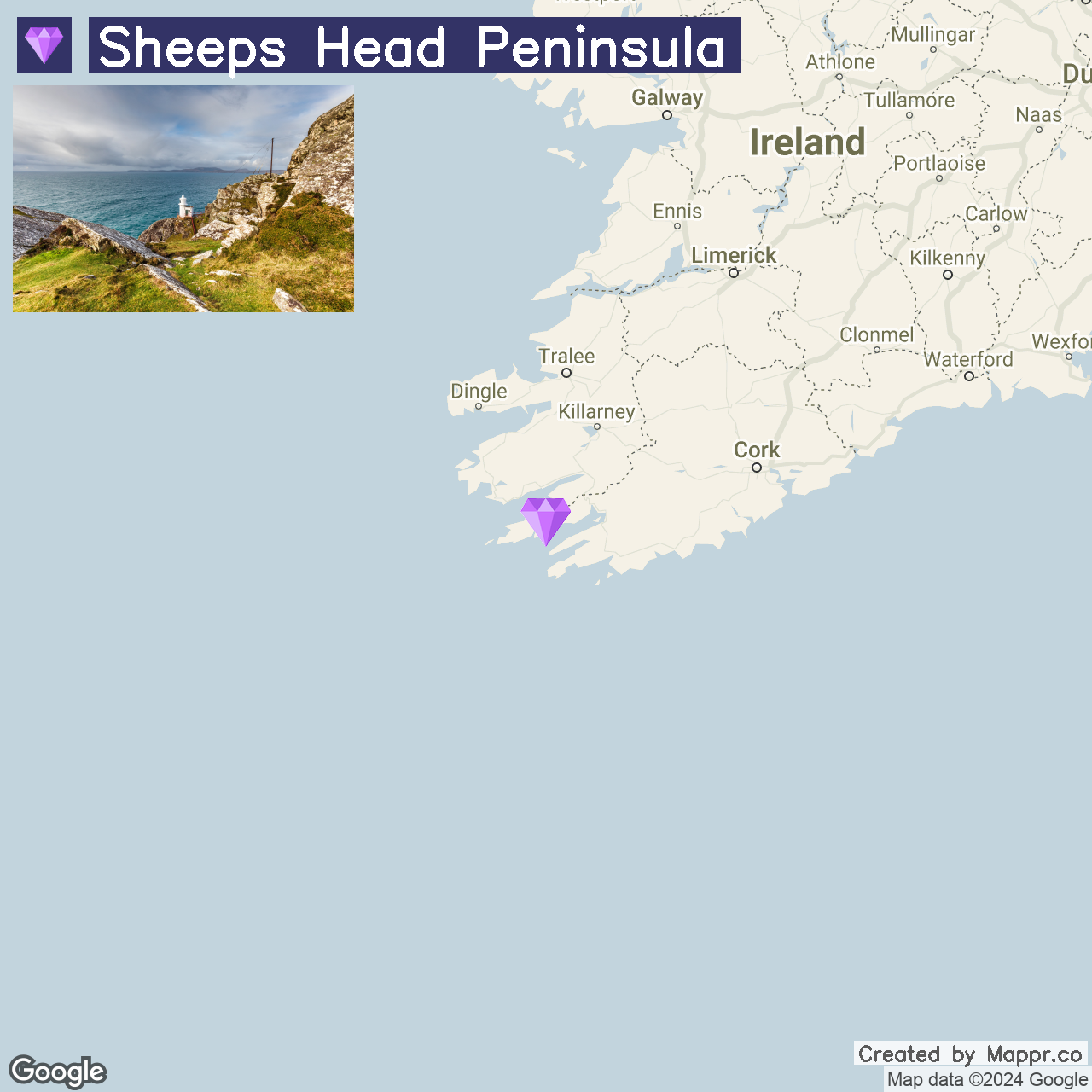
1. Sheep’s Head Peninsula

Sheep’s Head Peninsula, nestled in County Cork, offers a serene retreat with its rugged coastal walks, quaint villages, and the iconic Sheep’s Head Lighthouse.
This hidden gem is perfect for outdoor adventures or a peaceful getaway amidst Ireland’s stunning landscapes. The peninsula’s unspoiled natural beauty and the warm hospitality of its small communities make it an ideal spot for relaxation and exploration.
Whether hiking the Sheep’s Head Way or enjoying the panoramic ocean views, this tranquil destination promises a truly Irish experience away from the crowds.
- ✈️ How to Get There: Begin your journey to Sheep’s Head by driving to Bantry, a picturesque town that serves as a gateway to the peninsula. From major cities like Cork or Killarney, the drive to Bantry reveals the lush beauty of West Cork.
- 🏨 Where to Stay: For a comfortable stay, consider the Maritime Hotel in Bantry, known for its scenic views and upscale facilities. Alternatively, the Bridge View House B&B in Kilcrohane offers a charming and intimate setting, ideal for those looking to immerse themselves in the local culture.
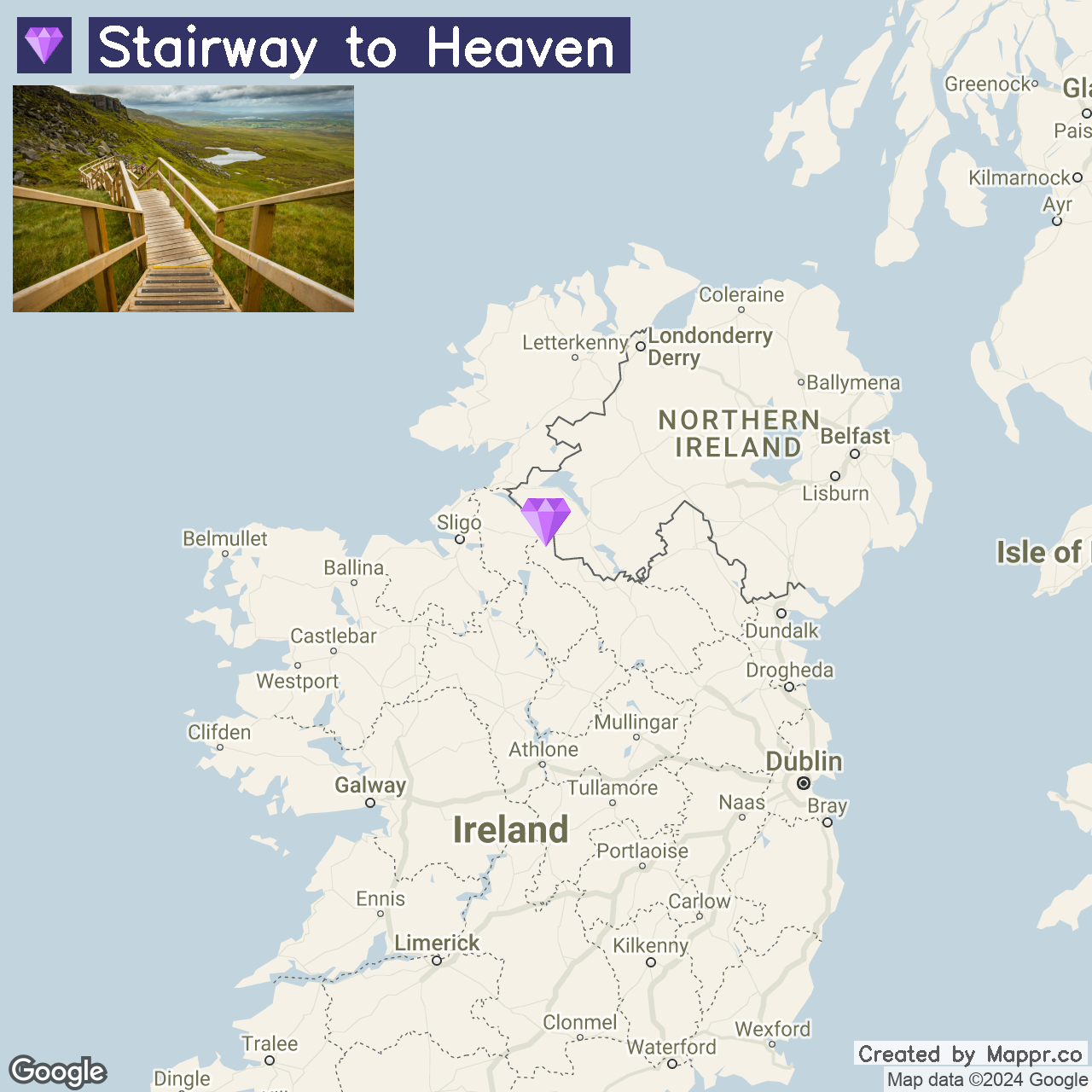
2. Stairway to Heaven

The Stairway to Heaven is an enchanting trail leading to the summit of Cuilcagh Mountain. Known officially as the Cuilcagh Legnabrocky Trail, this boardwalk path offers hikers breathtaking views over the surrounding landscape, making it a must-visit for nature enthusiasts and photographers alike.
The trail’s unique blend of natural beauty and accessibility has made it a favorite among both locals and tourists seeking to experience the tranquility of Northern Ireland’s countryside.
- ✈️ How to Get There: The trailhead is near Enniskillen in County Fermanagh. Visitors can drive to the Marble Arch Caves Global Geopark, where the walk begins.
- 🏨 Where to Stay: Consider staying at the Lough Erne Resort for a touch of luxury amidst the natural beauty of Fermanagh. For a more intimate experience, the Arch House B&B near Enniskillen offers cozy accommodations and a warm welcome.
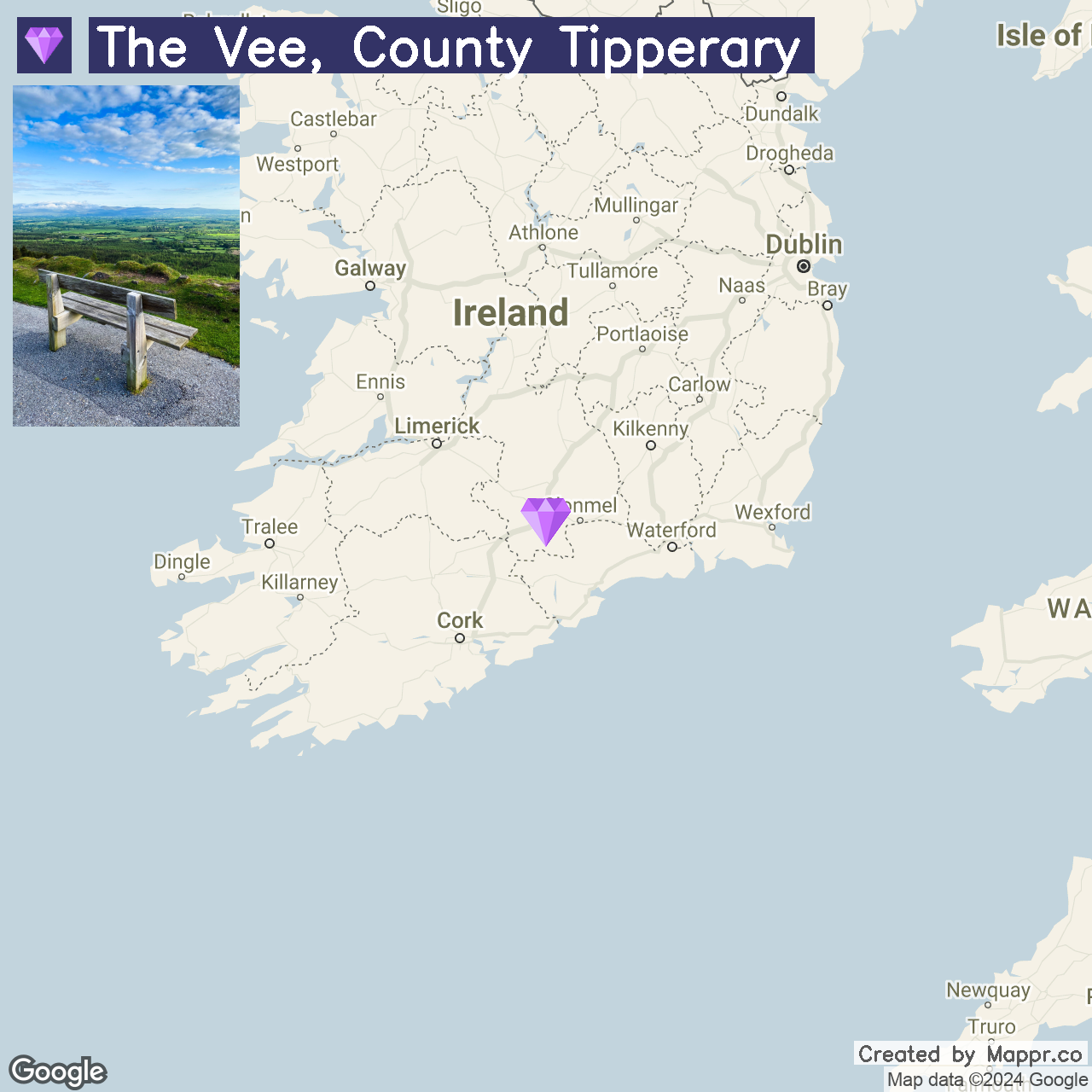
3. The Vee, County Tipperary

The Vee is celebrated for its breathtaking scenic drive and vibrant rhododendron blooms, particularly stunning in late spring.
This mountain pass offers panoramic views of the lush valleys and the Knockmealdown Mountains, attracting photographers, nature lovers, and driving enthusiasts for its unparalleled vistas and serene atmosphere.
- ✈️ How to Get There: The Vee is accessible by car via the R668 road, linking Lismore to Clogheen. It’s a favorite route for a scenic drive in the South of Ireland, and it is easily reached from Cork or Waterford.
- 🏨 Where to Stay: The Annaswood B&B, located in Cahir, offers a unique blend of elegance and modern comfort, perfect for unwinding after a day
- of exploration. Alternatively, Cahir House Hotel provides a quaint and welcoming setting known for its hospitality and beautiful gardens.
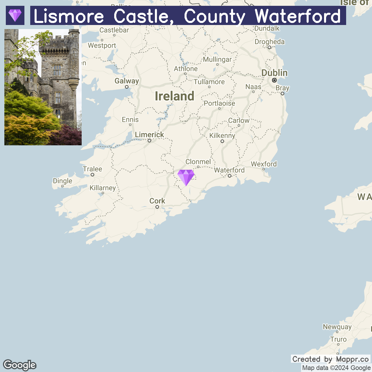
4. Lismore Castle, County Waterford

Lismore Castle stands out with its stunning architecture and historic gardens, offering visitors a glimpse into Ireland’s noble past. The castle grounds are a horticultural delight, featuring extensive gardens that are open to the public, while the castle itself remains a private residence.
- ✈️ How to Get There: Lismore Castle is situated in the town of Lismore, accessible by car from Waterford City via the N72 route, making for a pleasant journey through the Irish countryside.
- 🏨 Where to Stay: Lismore House Hotel, located in the heart of Lismore, provides easy access to the castle and comfortable accommodations with a touch of local heritage. For those seeking a cozy bed and breakfast experience, Ballyrafter House Hotel offers charming rooms with scenic views of the surrounding area.
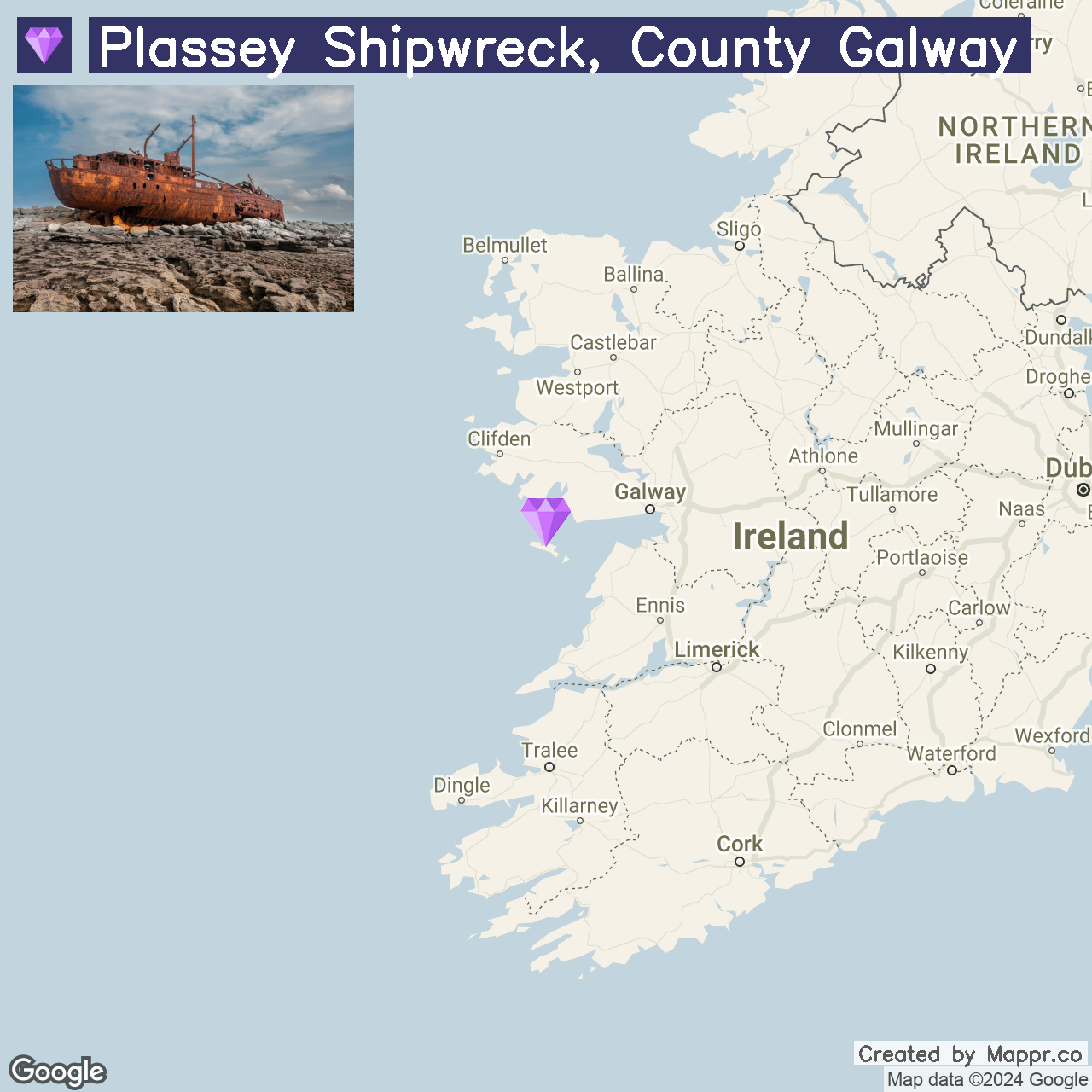
5. Plassey’s Shipwreck, County Galway

Plassey’s Shipwreck offers a unique glimpse into maritime history on the smallest Aran Islands, Inis Oirr. The wreck of the MV Plassey, cast ashore in 1960, has become an iconic landmark, immortalized by the popular TV show “Father Ted.”
The island is a tapestry of ancient forts, stunning seascapes, and traditional Irish culture, making it a captivating destination for adventurers and history enthusiasts.
- ✈️ How to Get There: Access to Inis Oirr is by ferry from Doolin, County Clare, or Rossaveal, County Galway. The journey offers spectacular views of the Cliffs of Moher and Galway Bay.
- 🏨 Where to Stay: On Inis Oirr, Aran Islands Hotel, Kilronan offers a warm, traditional stay, immersing guests in island life. For those preferring to stay on the mainland, Doolin Inn in Doolin provides modern comfort with easy access to ferry services.
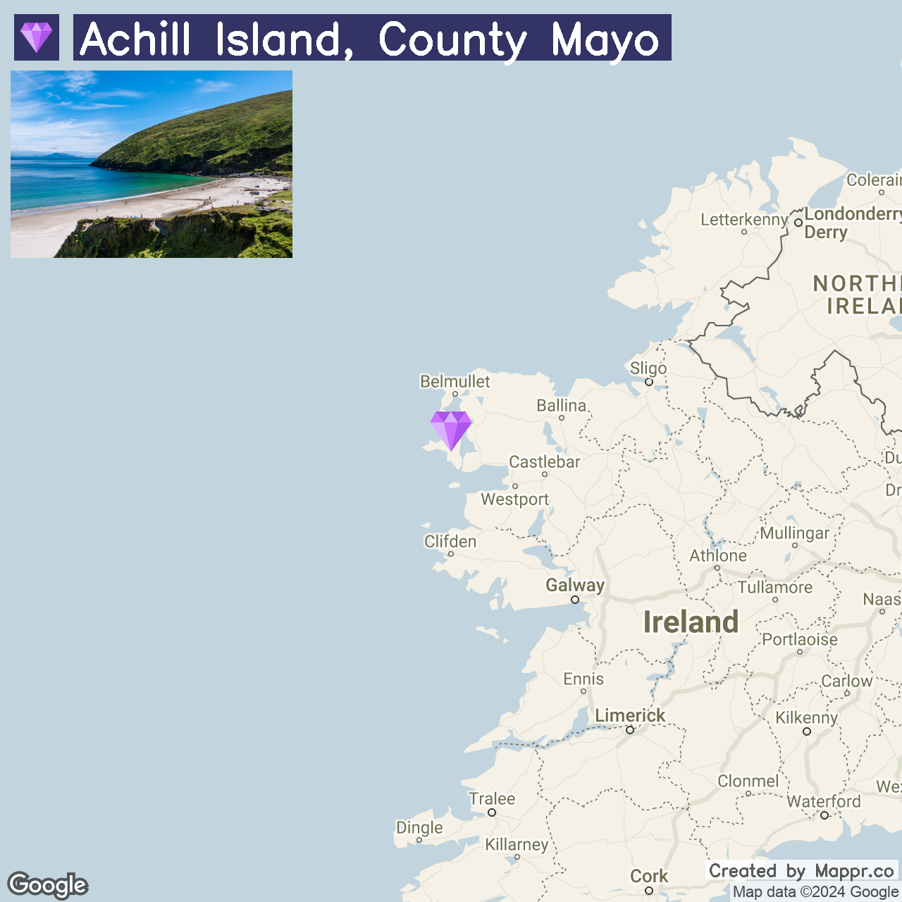
6. Achill Island, County Mayo

Achill Island is a haven of natural beauty with its dramatic cliffs, pristine beaches like Keem Bay, and rich cultural heritage. The island is connected to the mainland by a bridge, making it easily accessible for a scenic retreat.
Achill’s landscapes are a paradise for outdoor enthusiasts, offering activities from windsurfing to cycling along the Great Western Greenway.
- ✈️ How to Get There: Drive to Achill Island from Westport, County Mayo, via the N59 and R319 roads, enjoying the scenic route through the rugged Irish countryside.
- 🏨 Where to Stay: Achill Island’s Achill Cliff House Hotel & Restaurant provides stunning ocean views and local seafood dishes. For a homely stay, Ferndale Luxury Boutique Bed & Breakfast combines luxury with unique thematic decor inspired by global cultures.
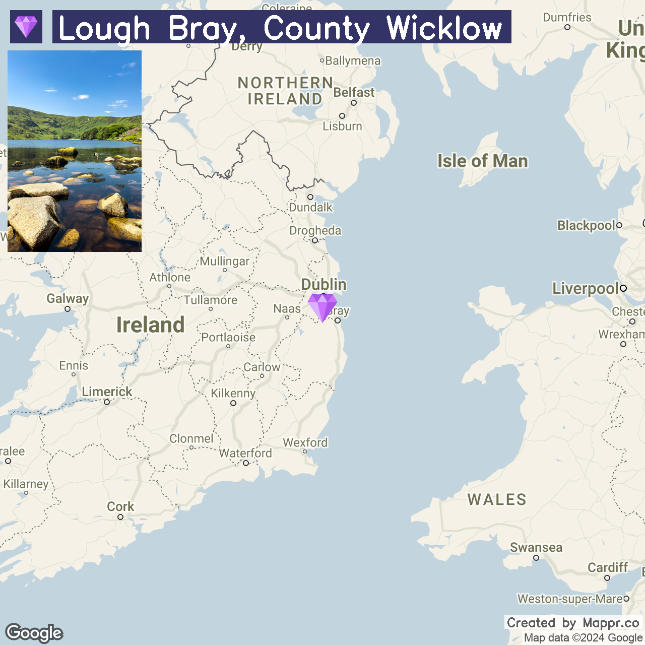
7. Lough Bray, County Wicklow

Lough Bray is a lesser-known gem in the Wicklow Mountains, offering serene beauty with its twin glacial lakes and rugged mountain backdrop.
The area is a haven for hikers and nature lovers, with trails offering splendid views of the lakes and surrounding landscapes, making it an ideal spot for a day trip or a quiet picnic away from the hustle and bustle.
- ✈️ How to Get There: Lough Bray is best accessed by car from Dublin, via the M50 and R115, providing a scenic drive through the Wicklow Mountains National Park.
- 🏨 Where to Stay: For those wishing to stay nearby, the Dublin Premier Suits, located in Sandyford, offers cozy accommodations with easy access to local attractions. Powerscourt Hotel, Resort & Spa, set in the magnificent Powerscourt Estate, offers luxury and elegance for those seeking a more upscale retreat.
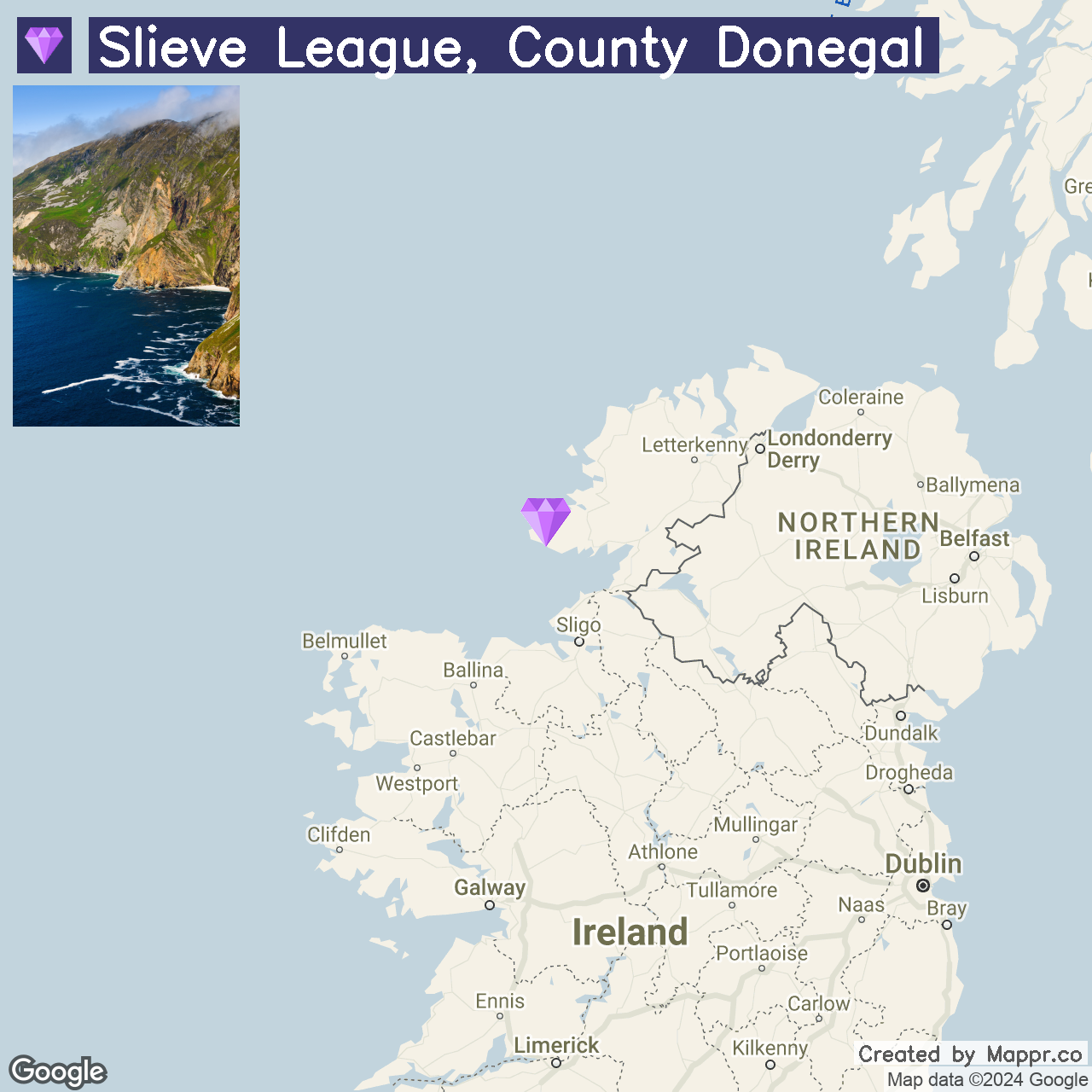
8. Slieve League, County Donegal

Slieve League stands as one of Europe’s highest sea cliffs, offering awe-inspiring vistas that rival the more famous Cliffs of Moher.
The sheer drop into the Atlantic Ocean, combined with the ancient pilgrimage path known as “One Man’s Pass,” provides an exhilarating experience for visitors. The area’s rich history, including early Christian monastic sites, adds depth to the natural beauty.
- ✈️ How to Get There: Slieve League is most accessible by car from Donegal Town, following the N56 and then the R263 towards Teelin, from where signposts lead to the cliffs.
- 🏨 Where to Stay: The Rusty Mackerel, located at the base of Slieve League in Teelin, offers cozy, traditional lodging and local cuisine. The Lough Eske Castle Hotel in Donegal Town combines historic elegance with modern comfort for a more luxurious stay.
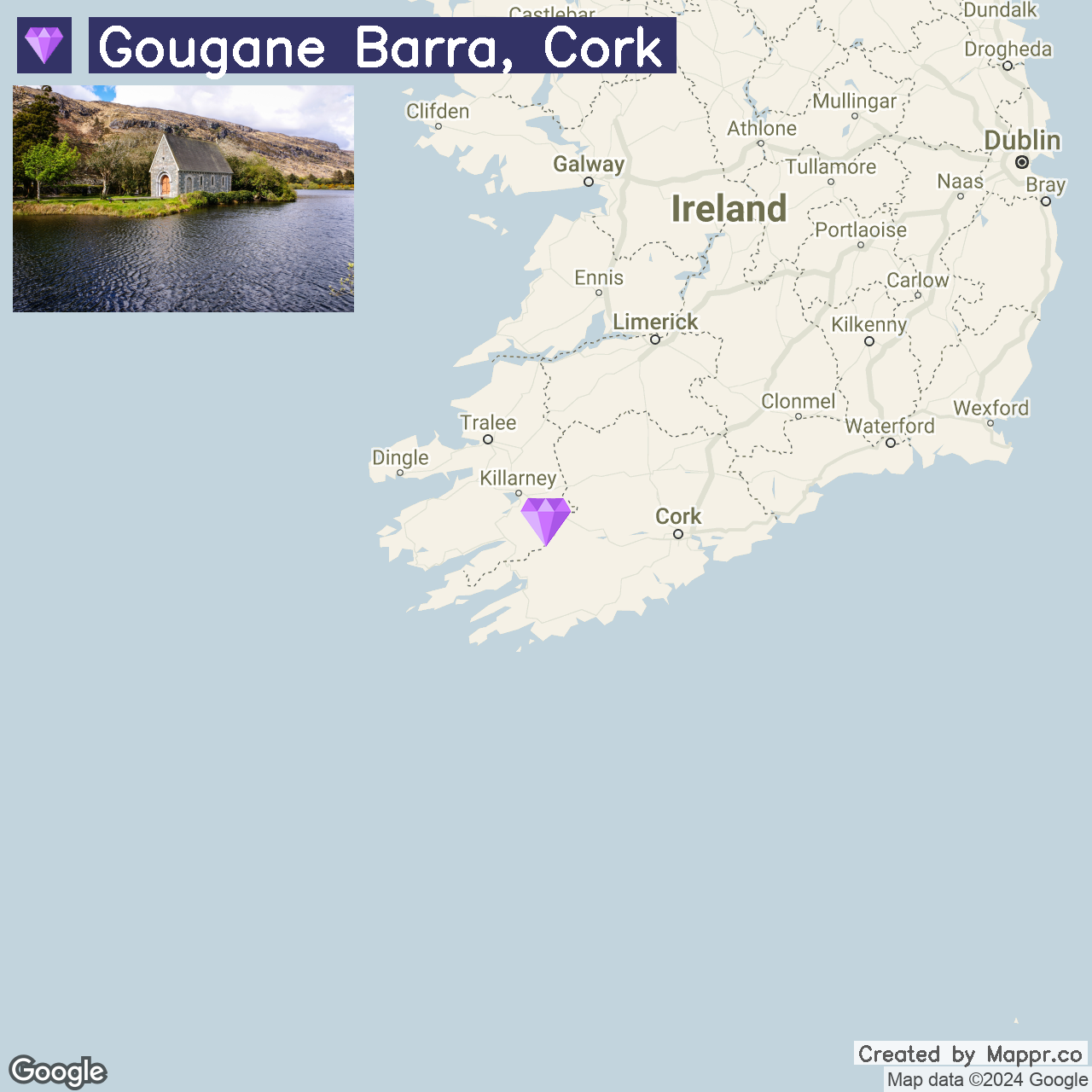
9. Gougane Barra, Cork

Gougane Barra is a serene haven where history and spirituality converge amidst stunning landscapes. The site offers a peaceful retreat with its picturesque forest park and the quaint St. Finbarr’s Oratory on the lake island.
This sacred spot, surrounded by rolling hills and lush woodlands, is perfect for reflection, photography, and exploring the great outdoors.
- ✈️ How to Get There: Gougane Barra is best reached by car from Cork City via the N22 towards Macroom and following signs for Gougane Barra through the scenic countryside.
- 🏨 Where to Stay: Gougane Barra Hotel, situated on the lakeshore near the oratory, offers stunning views and a cozy stay in this tranquil location. For those looking to stay closer to Macroom, the Castle Hotel offers luxury accommodations with easy access to the town’s amenities and natural beauty.
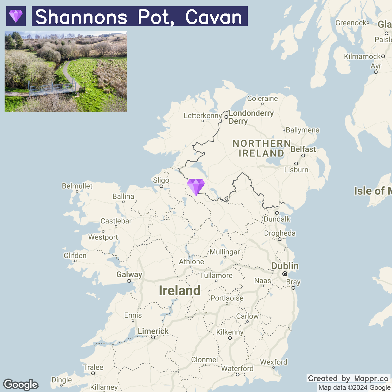
10. Shannon Pot, Cavan

The Shannon Pot, Cavan, marks the mystical source of Ireland’s longest river, the Shannon. Legend intertwines with the natural world here, where a small pool feeds the mighty river.
The area is steeped in myth and offers a tranquil setting for walks and contemplation, surrounded by the unspoiled landscapes of County Cavan.
- ✈️ How to Get There: The Shannon Pot is accessible by car, located near the village of Blacklion in County Cavan, with signage from the village leading to this natural wonder.
- 🏨 Where to Stay: The Five Glens Inn in Manorhamilton provides an exquisite culinary experience and comfortable accommodations, ideal after exploring the local countryside. Alternatively, the Slieve Russell Hotel offers luxury with its golf course, spa, and scenic grounds.
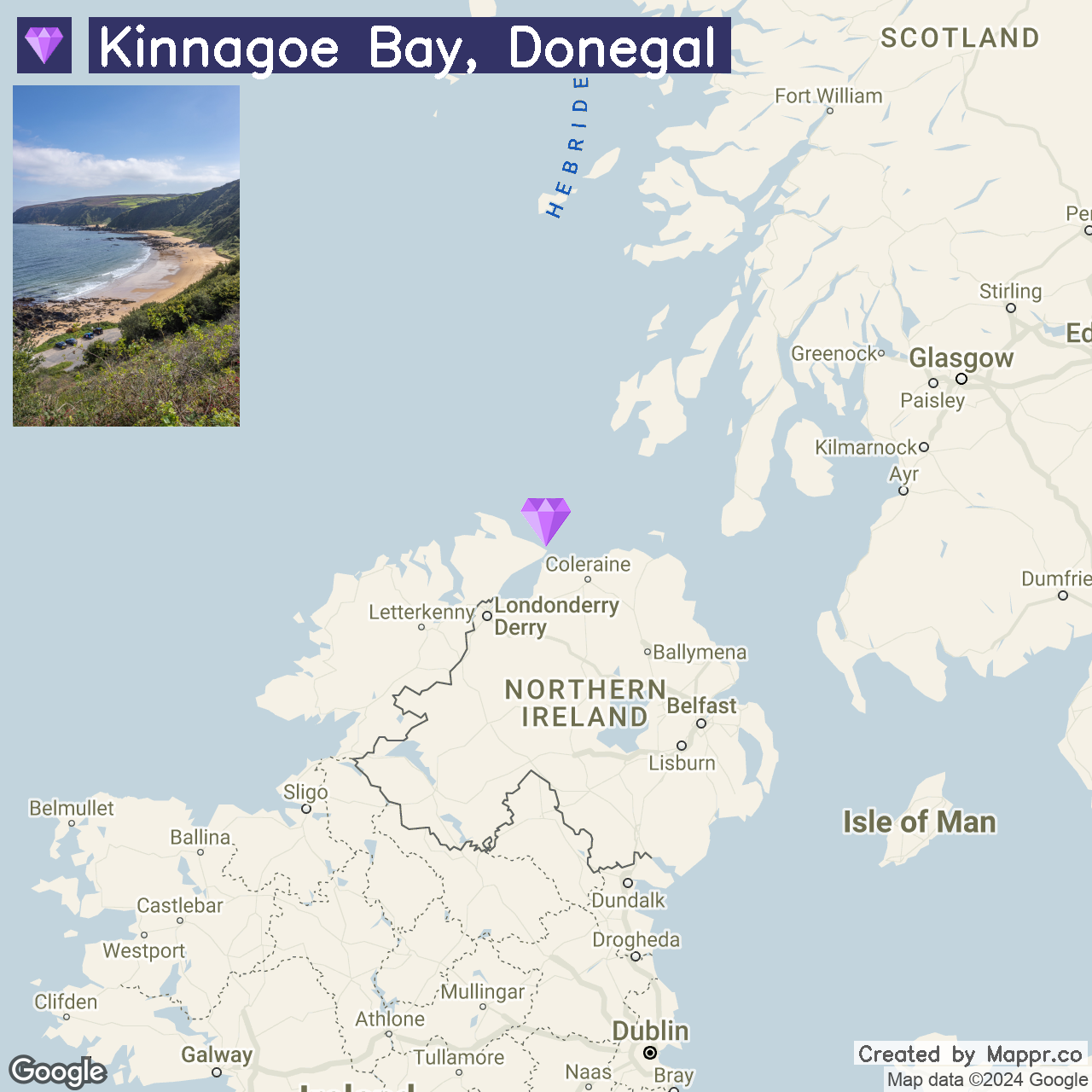
11. Kinnagoe Bay, Donegal

Kinnagoe Bay is a secluded beach between rolling hills and steep cliffs, known for its golden sands and crystal-clear waters. The bay’s serene atmosphere and natural beauty make it a hidden gem for those seeking tranquility and a connection with nature.
The historical significance of the bay, being the site of the wreck of the Spanish Armada ship La Trinidad Valencera in 1588, adds a layer of intrigue to its scenic charm.
- ✈️ How to Get There: Kinnagoe Bay is accessible via a narrow winding road off the R241, north of Greencastle in County Donegal. The journey to the bay is as picturesque as the destination.
- 🏨 Where to Stay: The McGrory’s Hotel in Culdaff offers a cozy stay with a rich musical tradition, only a short drive from Kinnagoe Bay. For those seeking a peaceful retreat, the Redcastle Hotel, Golf & Spa, located on the shores of Lough Foyle, provides luxury accommodations with panoramic views.
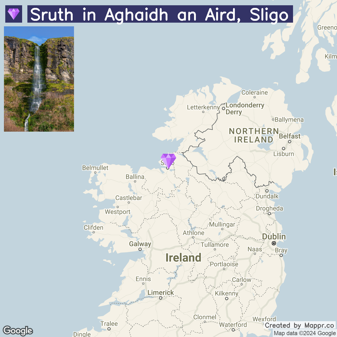
12. Sruth in Aghaidh an Aird, Sligo

Sruth in Aghaidh an Aird (The Devil’s Chimney), is Ireland’s tallest waterfall, only visible after heavy rain or during the wetter seasons.
This natural spectacle, also known as “The Devil’s Chimney,” offers a unique and somewhat ephemeral attraction, with water cascading down from the cliffs above Glencar Lake.
The surrounding area, with its lush forest trails and scenic viewpoints, provides a peaceful escape into nature.
- ✈️ How to Get There: Located near Glencar Lake in County Sligo, the waterfall is best accessed by car. Take the N16 towards Manorhamilton from Sligo town, and follow the Glencar Waterfall signs.
- 🏨 Where to Stay: The Riverside Hotel in Sligo, situated along the picturesque banks of the Garavogue River, presents charming and comfortable lodging. Alternatively, the luxurious Radisson BLU Hotel & Spa, situated on the shores of Lough Gill, provides a tranquil setting and elegant rooms a short drive from the waterfall.
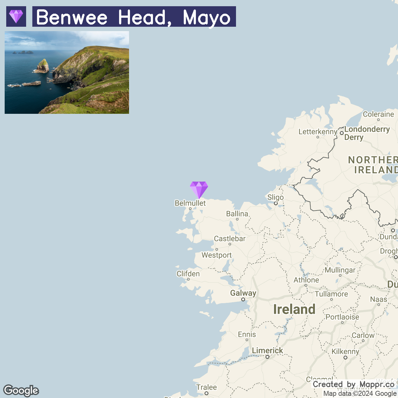
13. Benwee Head, Mayo

Benwee Head captivates with its raw and rugged coastline, offering some of Ireland’s most dramatic sea cliff views. The untouched beauty of this place, with its towering cliffs and expansive ocean vistas, makes it a paradise for hikers and nature lovers.
The Carrowteige Loop Walks here provide a perfect way to immerse oneself in the wild and pristine landscapes of North Mayo, often accompanied by the soothing sounds of the Atlantic waves crashing below.
- ✈️ How to Get There: Benwee Head is located in North Mayo and is most easily reached by car. From Ballina, follow the Wild Atlantic Way northwards, enjoying the scenic drive to Carrowteige, where the walking trails begin.
- 🏨 Where to Stay: The family-run Stella Maris Country House Hotel, situated in Ballycastle, offers comfort and stunning sea views, making it an ideal base for exploring Benwee Head. Alternatively, the Broadhaven Bay Hotel in Belmullet provides modern amenities and a warm welcome, a short drive from the dramatic coastline.
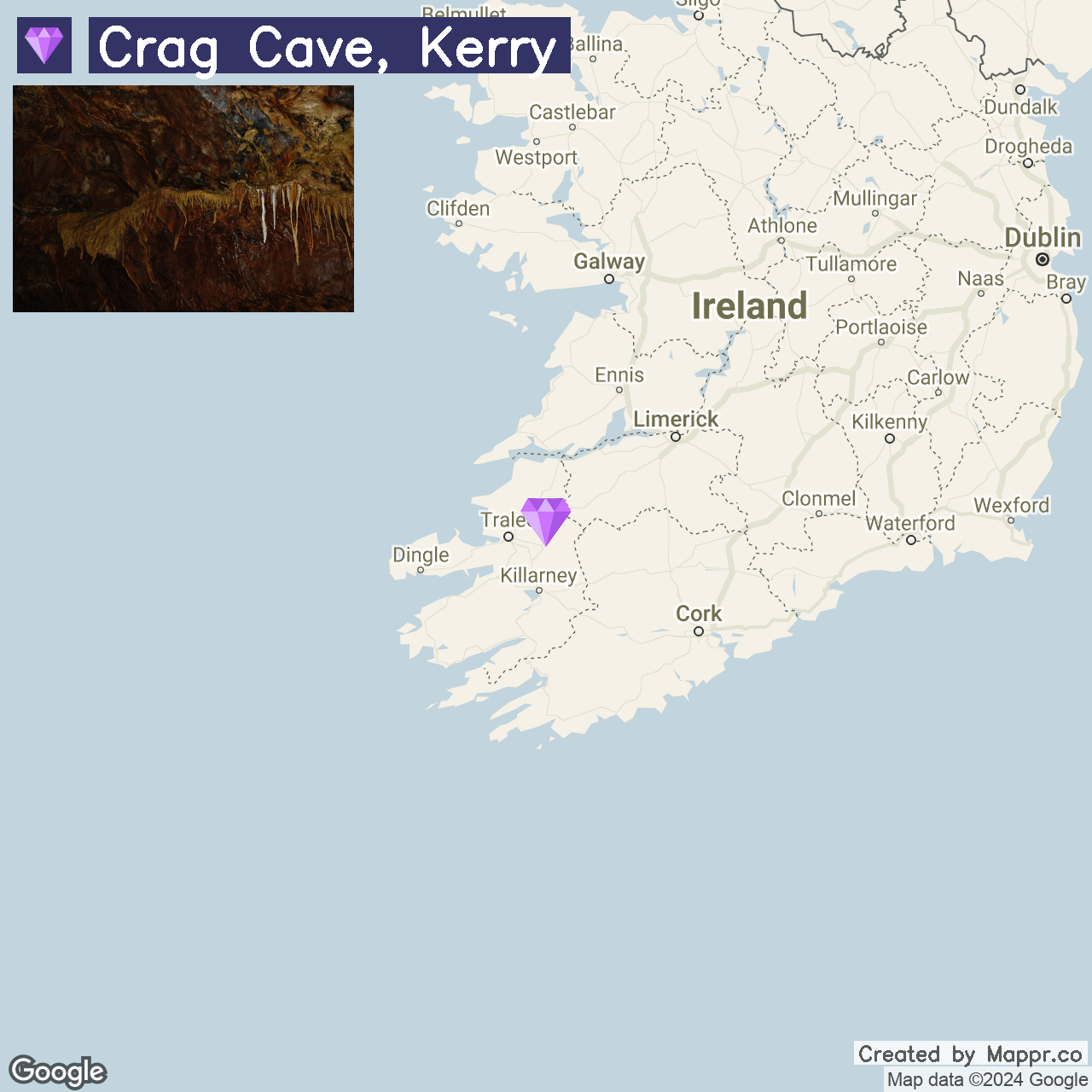
14. Crag Cave, Kerry

Crag Cave, discovered in 1983, is a fascinating underground network of limestone formations, including stalactites and stalagmites.
This million-year-old cave system offers guided tours, revealing the natural artistry and history beneath the Kerry landscape. It’s an educational and awe-inspiring visit for all ages.
- ✈️ How to Get There: Located just outside Castleisland in County Kerry, Crag Cave is easily reached by car via the N21, making it a convenient stop on a tour of the county’s rich offerings.
- 🏨 Where to Stay: The River Island Hotel in Castleisland provides a comfortable and convenient base for exploring Crag Cave and the surrounding area. For a more rural retreat, the Ballyseede Castle Hotel in Tralee offers historic accommodations in a luxurious estate.
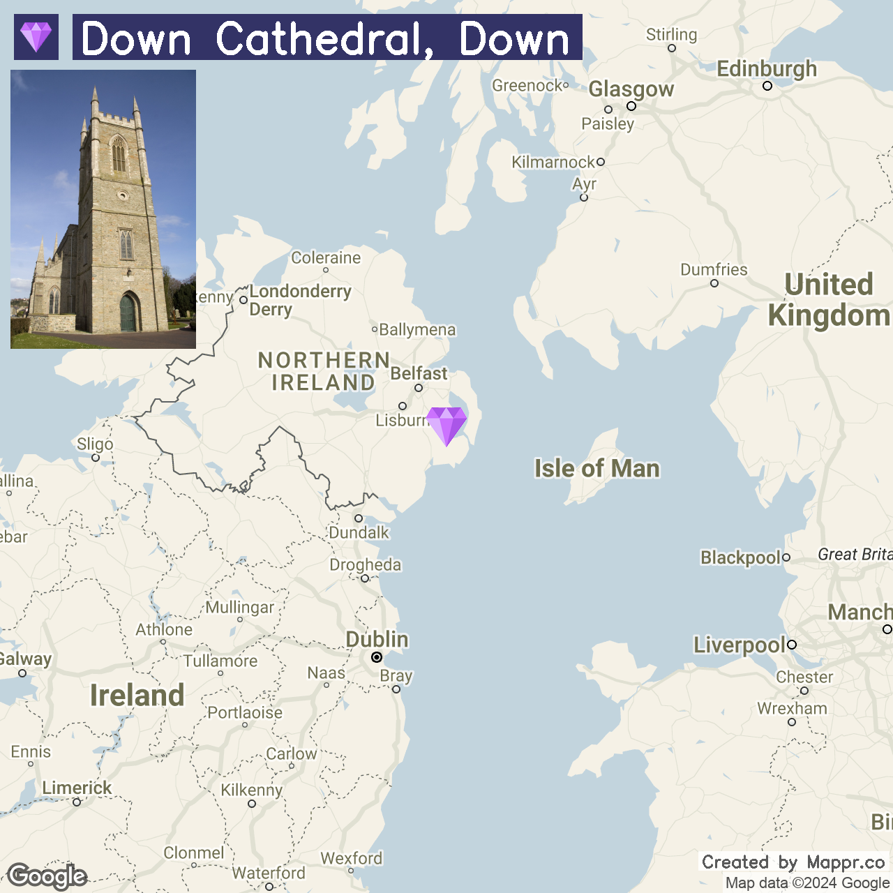
15. Down Cathedral, Down

Down Cathedral stands majestically on the Hill of Down, commanding views over the historic town of Downpatrick. This site, steeped in history and spirituality, is believed to be the final resting place of Saint Patrick, Ireland’s patron saint.
The cathedral’s striking architecture and the sacred atmosphere of its grounds make it a poignant destination for those interested in Ireland’s Christian heritage and the legacy of its most famous saint.
- ✈️ How to Get There: Down Cathedral is located in Downpatrick, easily accessible by car from Belfast via the A7. The drive-through County Down offers picturesque landscapes and a glimpse into the region’s rich history.
- 🏨 Where to Stay: The Denvir’s Coaching Inn, one of the oldest coaching inns in Ireland, located in Downpatrick, provides a historic backdrop for your stay. For a more rural setting, the Slieve Donard Resort and Spa in Newcastle offers luxurious accommodations with stunning views of the Mourne Mountains and the Irish Sea.
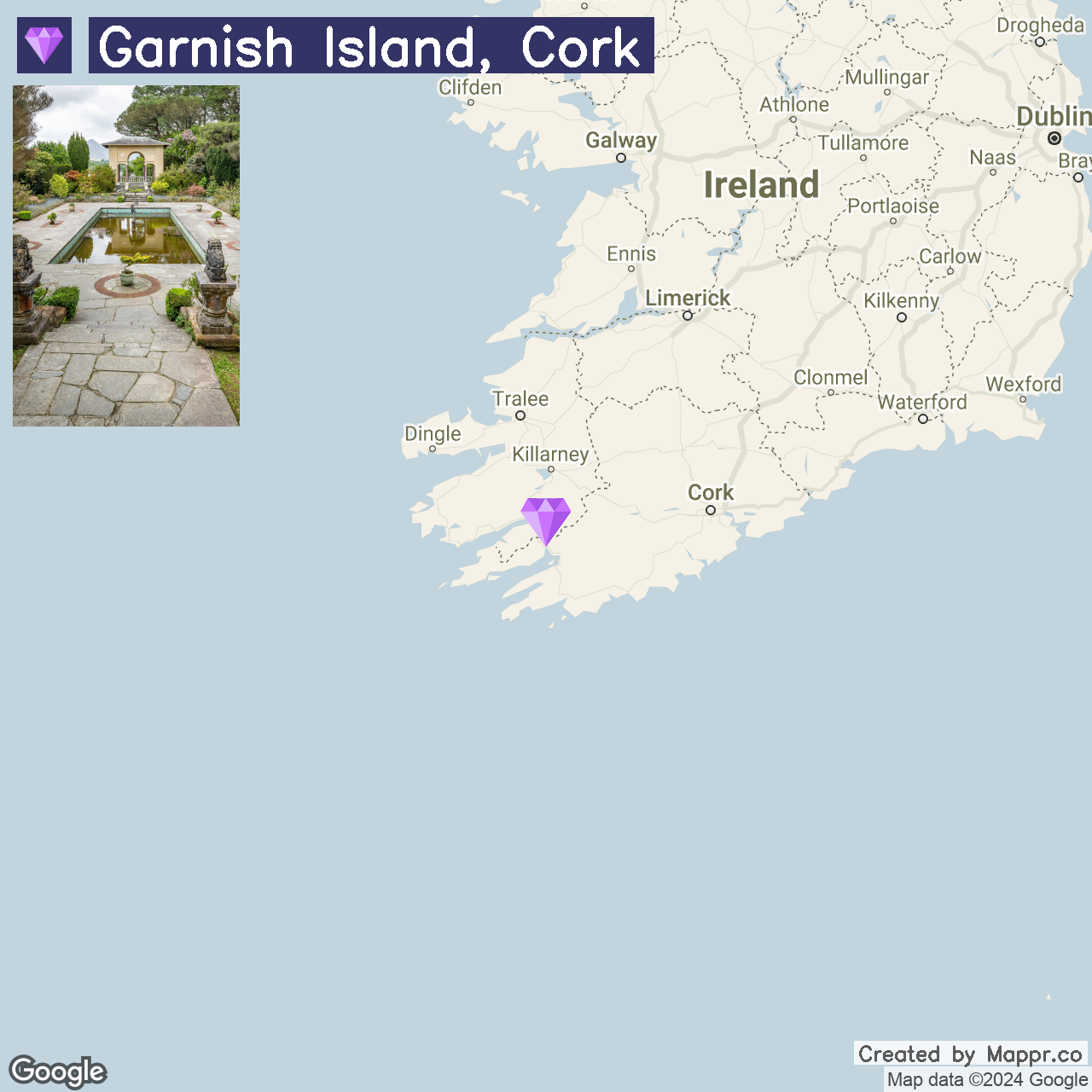
16. Garnish Island, Cork

Garnish Island is a unique island within the sheltered harbor of Glengarriff in Bantry Bay, known for its world-renowned gardens. The island’s microclimate allows for an extraordinary range of exotic plants and garden designs, making it a paradise.
A visit to Garnish Island is a journey into horticultural splendor and an escape into the tranquil beauty of Ireland’s southwest coast.
- ✈️ How to Get There: Garnish Island is accessible by a short ferry ride from Glengarriff. The charming village of Glengarriff is reachable by car from Cork City, following the N71 road through the scenic landscapes of West Cork.
- 🏨 Where to Stay: The Eccles Hotel in Glengarriff, overlooking Bantry Bay, offers a blend of historic charm and modern comfort. Casey’s Hotel, also in Glengarriff, provides a cozy and welcoming base with easy access to the ferry departure point.
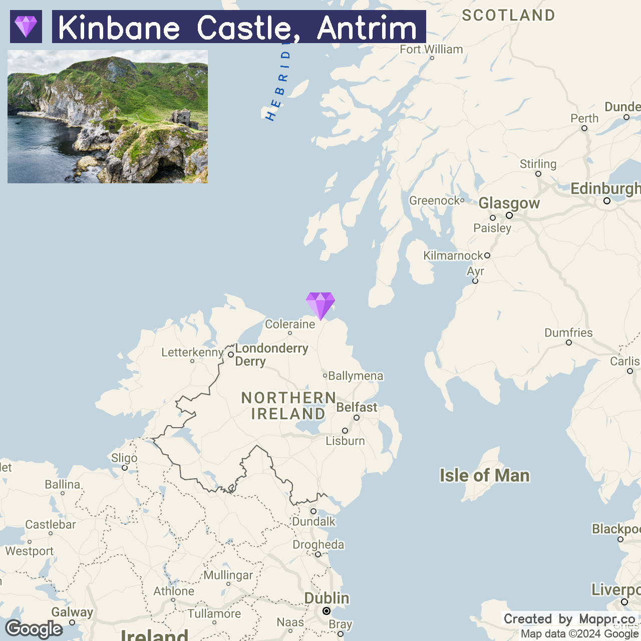
17. Kinbane Castle, Antrim

Kinbane Castle, perched on a dramatic headland jutting into the sea, offers some of the most breathtaking coastal views in Northern Ireland.
The ruins of this 16th-century castle hold tales of Gaelic chieftains and centuries of history against the backdrop of rugged cliffs and the expansive Atlantic.
The site’s remote beauty and the panoramic vistas make Kinbane Castle a captivating stop for history buffs and nature enthusiasts alike.
- ✈️ How to Get There: Kinbane Castle is located on the coast of County Antrim, reachable by car from Ballycastle via the A2, known as the Causeway Coastal Route.
- 🏨 Where to Stay: The Salthouse Hotel in the nearby town offers comfortable lodgings with sea views. On the other hand, The Fullerton Arms in Ballintoy provides a charming and intimate setting, further along the coastal route.
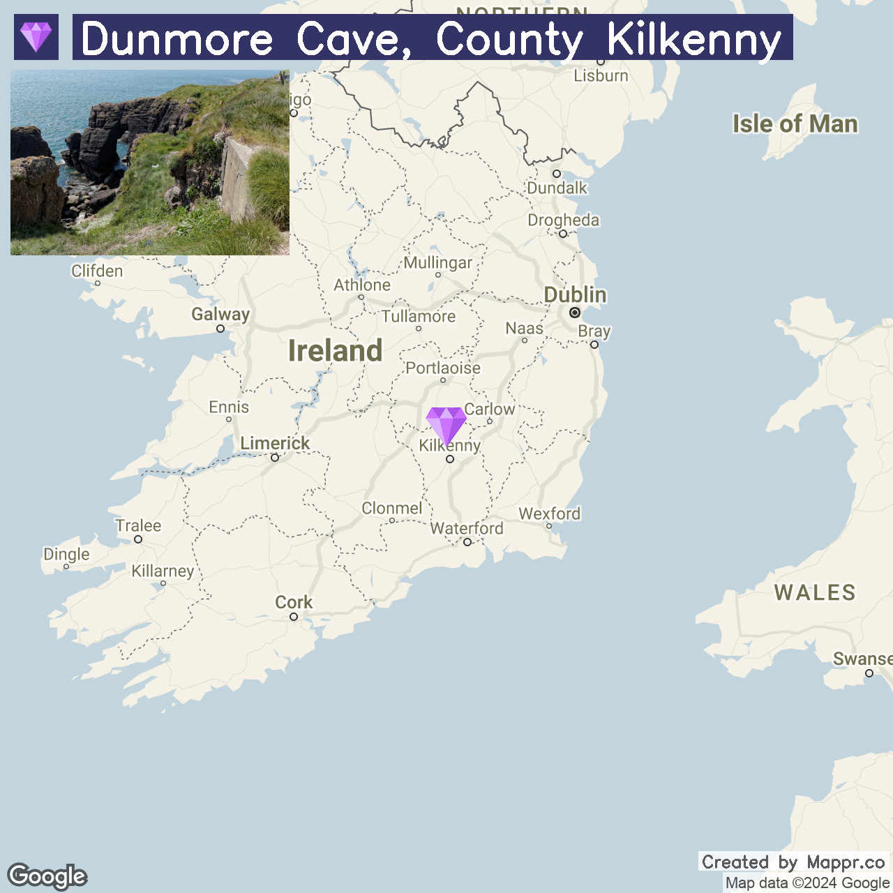
18. Dunmore Cave, County Kilkenny

Dunmore Cave presents a captivating underworld of stalactites and stalagmites formed over millions of years. This limestone cave is a geological wonder and a site of Viking massacre, adding a layer of historical intrigue.
The atmospheric chambers and calcite formations make Dunmore Cave a must-visit for those interested in natural science and ancient history.
- ✈️ How to Get There: Situated just north of Kilkenny City, Dunmore Cave is easily reached by car via the N77. The journey from Kilkenny provides a delightful glimpse into the rural charm of County Kilkenny.
- 🏨 Where to Stay: The Newpark Hotel in Kilkenny offers a comfortable base with extensive grounds and a spa, perfect for relaxing after a day of cave exploration. Butler House and Garden, nestled in the heart of Kilkenny, combines elegance, history, and serene garden views.
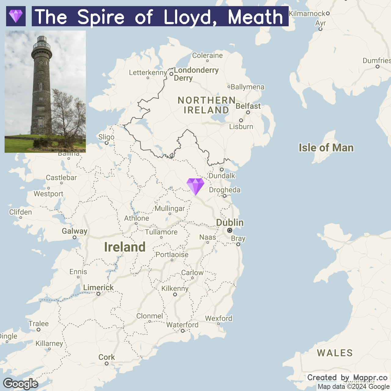
19. The Spire of Lloyd, Meath

The Spire of Lloyd, an intriguing inland lighthouse built in the 18th century, is a unique historical monument in County Meath. This 30-meter high tower, also known as the “Conolly’s Folly” of the North, offers panoramic views of the surrounding countryside.
The Spire’s unusual purpose and design make it a fascinating detour for those exploring Ireland’s rich architectural and navigational history.
- ✈️ How to Get There: The Spire of Lloyd is located near Kells in County Meath, accessible by car via the M3 motorway from Dublin, making for an easy and scenic drive through the heart of the Boyne Valley.
- 🏨 Where to Stay: Headfort Arms Hotel, situated in the heritage town of Kells, provides a warm, family-run accommodation experience. For a more secluded countryside retreat, the Lakeside Manor Hotel offers luxury in a picturesque setting on the shores of Lough Ramor.
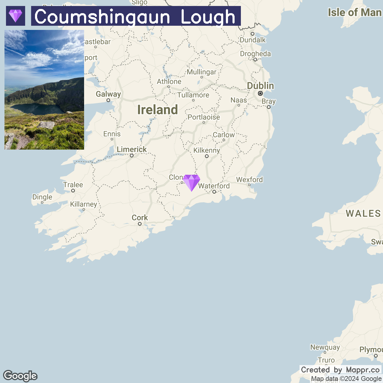
20. Coumshingaun Lough, County Waterford

Coumshingaun Lough is a glacial lake in the Comeragh Mountains, renowned for its almost perfect circular shape and crystal-clear waters.
The hike to the lake is as rewarding as the destination, with breathtaking views of the rugged mountain landscape. This spot is a haven for outdoor enthusiasts and photographers seeking the tranquility and beauty of Ireland’s mountainous terrain.
- ✈️ How to Get There: Coumshingaun Lough is best accessed from the village of Kilrossanty or the town of Clonmel, with signposted routes leading to the Comeragh Mountains.
- 🏨 Where to Stay: For those wishing to stay nearby, the Cliff House Hotel in Ardmore provides luxury accommodations with stunning sea views. Alternatively, Hanora’s Cottage in the Nire Valley offers a cozy, family-run guesthouse experience, ideal for hikers and nature lovers.
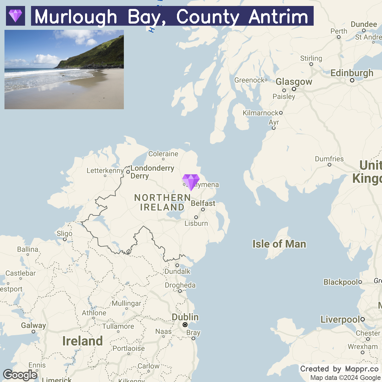
21. Murlough Bay, County Antrim

Murlough Bay is a hidden coastal gem offering tranquility and breathtaking views of the rugged Antrim coast. Known for its wild beauty, the bay features unspoiled beaches, dramatic cliffs, and sweeping views across the Irish Sea to Scotland.
The area is rich in wildlife and history, with ancient ruins and tales of smugglers adding to its allure, making Murlough Bay a perfect escape for those seeking solitude and natural beauty.
- ✈️ How to Get There: Murlough Bay is best accessed from the town of Ballycastle, County Antrim, via a narrow country road that descends towards the coast, offering dramatic views along the way.
- 🏨 Where to Stay: The Hedges Hotel provides a comfortable and convenient base for visitors wishing to explore Murlough Bay. For a more secluded stay, the Gary’s at Bushmills offers a private retreat in the scenic countryside near the bay.
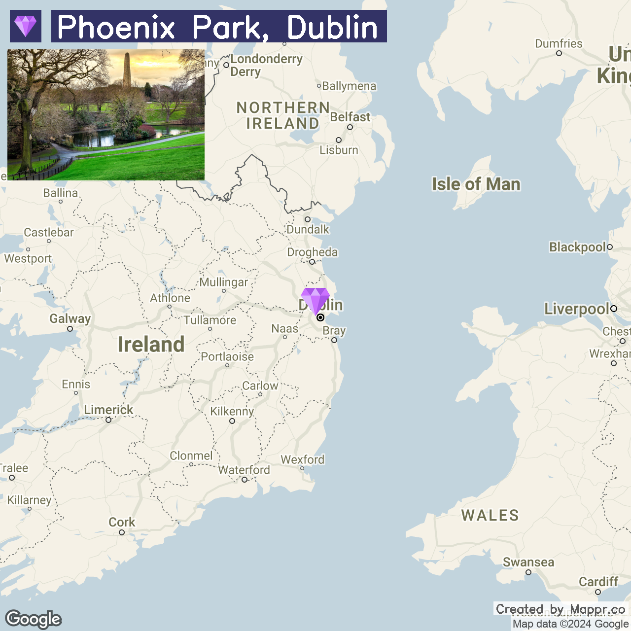
22. Phoenix Park, Dublin

Phoenix Park is one of the largest enclosed public parks in any European capital city, offering a vast green oasis in the heart of Dublin.
The park is home to herds of wild deer, the Dublin Zoo, numerous historic buildings, and monuments. It’s a favorite spot for Dubliners and visitors alike for picnics, walks, cycling, and tranquility away from the city bustle.
- ✈️ How to Get There: Phoenix Park is centrally located in Dublin, easily accessible by public transport, including buses and the Luas tram system, or by car. Its proximity to the city center makes it an easily reachable escape into nature for anyone visiting Dublin.
- 🏨 Where to Stay: The Ashling Hotel, situated near the park’s Heuston Gate entrance, offers elegant accommodations with easy access to Phoenix Park. For those looking for a more boutique experience, the Castleknock Hotel, located on the park’s outskirts, provides luxury and comfort in a more suburban setting.
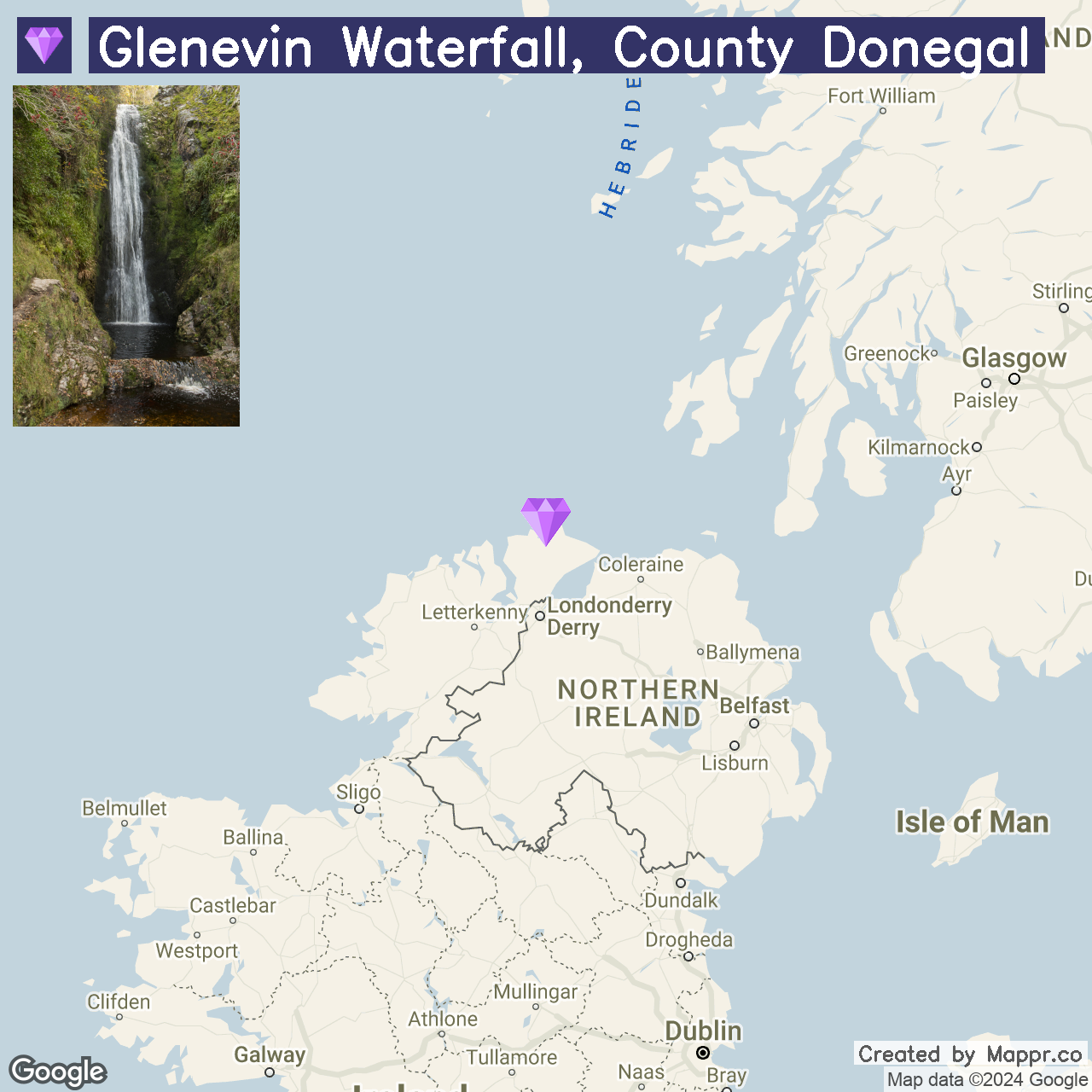
23. Glenevin Waterfall, County Donegal

Glenevin Waterfall is a picturesque cascade nestled within a lush woodland in the Inishowen Peninsula. The waterfall, dropping into a tranquil pool, creates a serene and photogenic spot perfect for nature walks and picnics.
With its well-maintained paths and bridges, the surrounding park makes this natural wonder accessible to all visitors, offering a peaceful retreat in the heart of Donegal’s stunning landscapes.
- ✈️ How to Get There: Glenevin Waterfall is just outside Clonmany village on the Inishowen Peninsula. It can be reached by car, with the route well-signposted from the main road.
- 🏨 Where to Stay: The Ballyliffin Lodge & Spa, located in the nearby town of Ballyliffin, offers luxurious accommodations and stunning views of the surrounding area. For a more intimate setting, the Harbour Inn in Buncrana provides a charming bed and breakfast experience set in a traditional Irish country house.
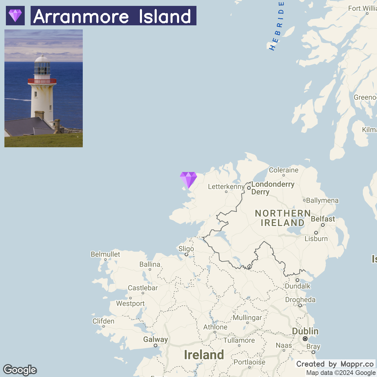
24. Arranmore Island

Arranmore Island, off the coast of Donegal, is a serene retreat known for its rugged landscapes and welcoming community. This island offers an escape into nature with its cliff-top walks, sandy beaches, and traditional Irish culture.
Visitors can immerse themselves in the island life, exploring its small but vibrant villages and experiencing the local hospitality. For those seeking tranquility and a break from the bustling mainland, Arranmore provides an idyllic setting.
- ✈️ How to Get There: Arranmore Island is accessible by a short ferry ride from Burtonport on mainland Donegal. The journey offers scenic views of the Atlantic and the surrounding landscapes.
- 🏨 Where to Stay: Consider the Arranmore Glamping for a cozy, budget-friendly option with stunning ocean views. Alternatively, the Waterfront Hotel Dungloe offers a more luxurious stay, with modern amenities and easy access to the surrounding Donegal countryside.
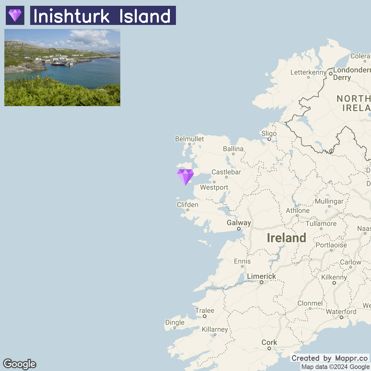
25. Inishturk Island

Inishturk Island, nestled in the wild Atlantic off the coast of County Mayo, is a hidden gem waiting to be discovered. This small, remote island is a haven of tranquility, offering breathtaking landscapes, unspoiled nature, and a warm community spirit.
With fewer than 60 residents, Inishturk is the perfect destination for those looking to unwind and connect with nature. The island’s rugged cliffs, clear waters, and diverse wildlife provide an idyllic backdrop for hiking, bird watching, and sea kayaking.
- ✈️ How to Get There: Reach Inishturk by ferry from Roonagh Pier near Louisburgh, with access to the pier available from Westport and Castlebar by car or public transport.
- 🏨 Where to Stay: The Inishbofin House Hotel offers comfortable accommodations with stunning sea views, catering to individuals and groups. For those looking for a more luxurious experience, Tranaun Beach House provides a peaceful retreat right on the shore with many amenities.
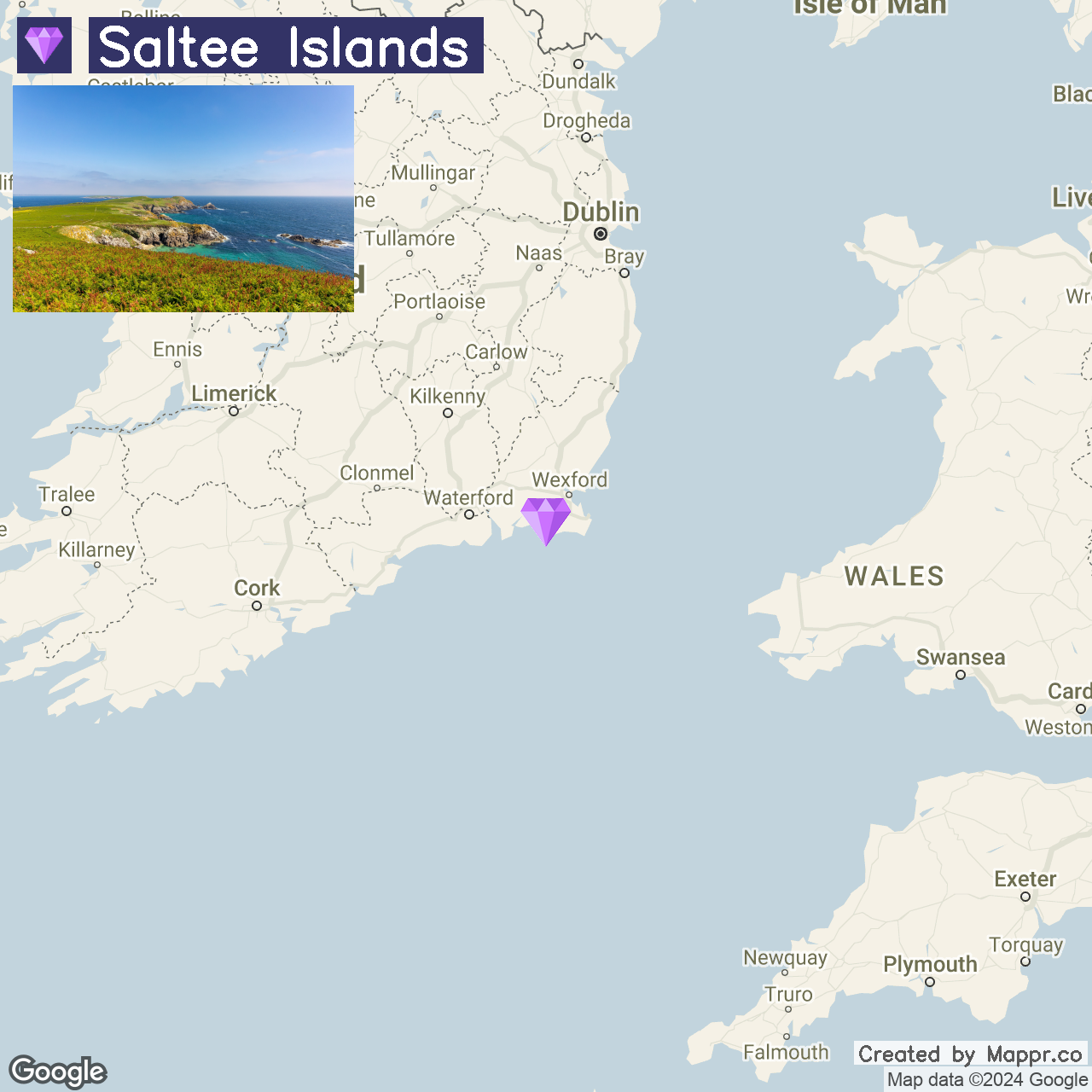
26. Saltee Islands

The Saltee Islands, located off the southern coast of County Wexford, are an enchanting duo of islands rich in wildlife and steeped in history. Great Saltee and Little Saltee are renowned for their bird colonies, making them a paradise for birdwatchers and nature enthusiasts.
The island’s clear waters and diverse marine life make it a popular spot for diving and snorkeling. Access to the Great Saltee is permitted during daylight hours, allowing visitors to explore its natural and historical wonders, including the impressive Saltee Throne.
- ✈️ How to Get There: Access to the Saltee Islands is by private boat from Kilmore Quay, a charming fishing village with regular boat services available during the warmer months.
- 🏨 Where to Stay: Stay at the Saltee Islands View B&B in Kilmore Quay for a comfortable base with panoramic views of the islands and the sea. Alternatively, the Quay House B&B offers a warm, welcoming environment and is ideally situated for those exploring the local area.
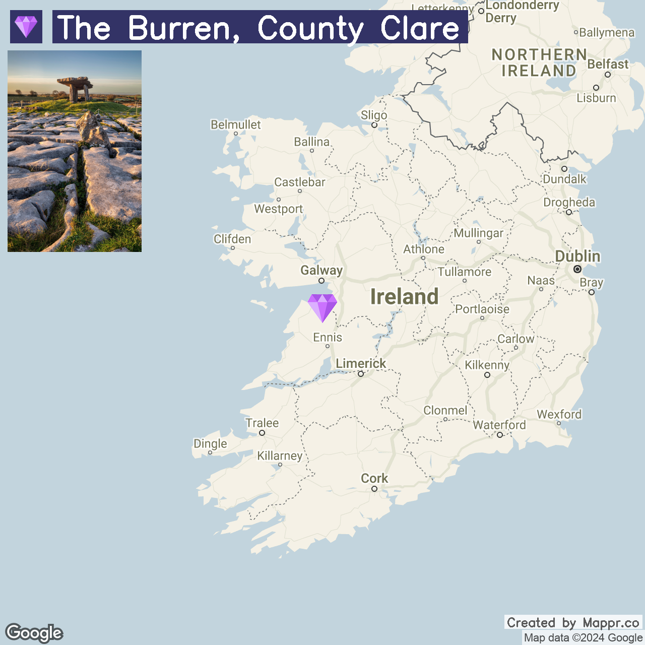
27. The Burren, County Clare

The Burren, a vast limestone plateau in County Clare, is a landscape of otherworldly beauty. Known for its unique flora, ancient megalithic sites, and intricate cave systems, The Burren offers an unforgettable experience for nature lovers and history buffs.
Hiking through this lunar-like terrain reveals hidden archaeological treasures and rare plant species thriving in the cracks of the limestone. The Burren National Park and the nearby Cliffs of Moher provide ample opportunities for exploration and stunning views of the Atlantic.
- ✈️ How to Get There: The Burren is most accessible by car from nearby towns like Ennis and Galway, with signposted routes leading into the heart of the landscape.
- 🏨 Where to Stay: The Wild Atlantic Lodge in Ballyvaughan offers a cozy retreat with easy access to the Burren’s walking trails. Ballinalacken Castle Country House Hotel, set amidst the breathtaking scenery of the Burren, provides luxury accommodation and fine dining.
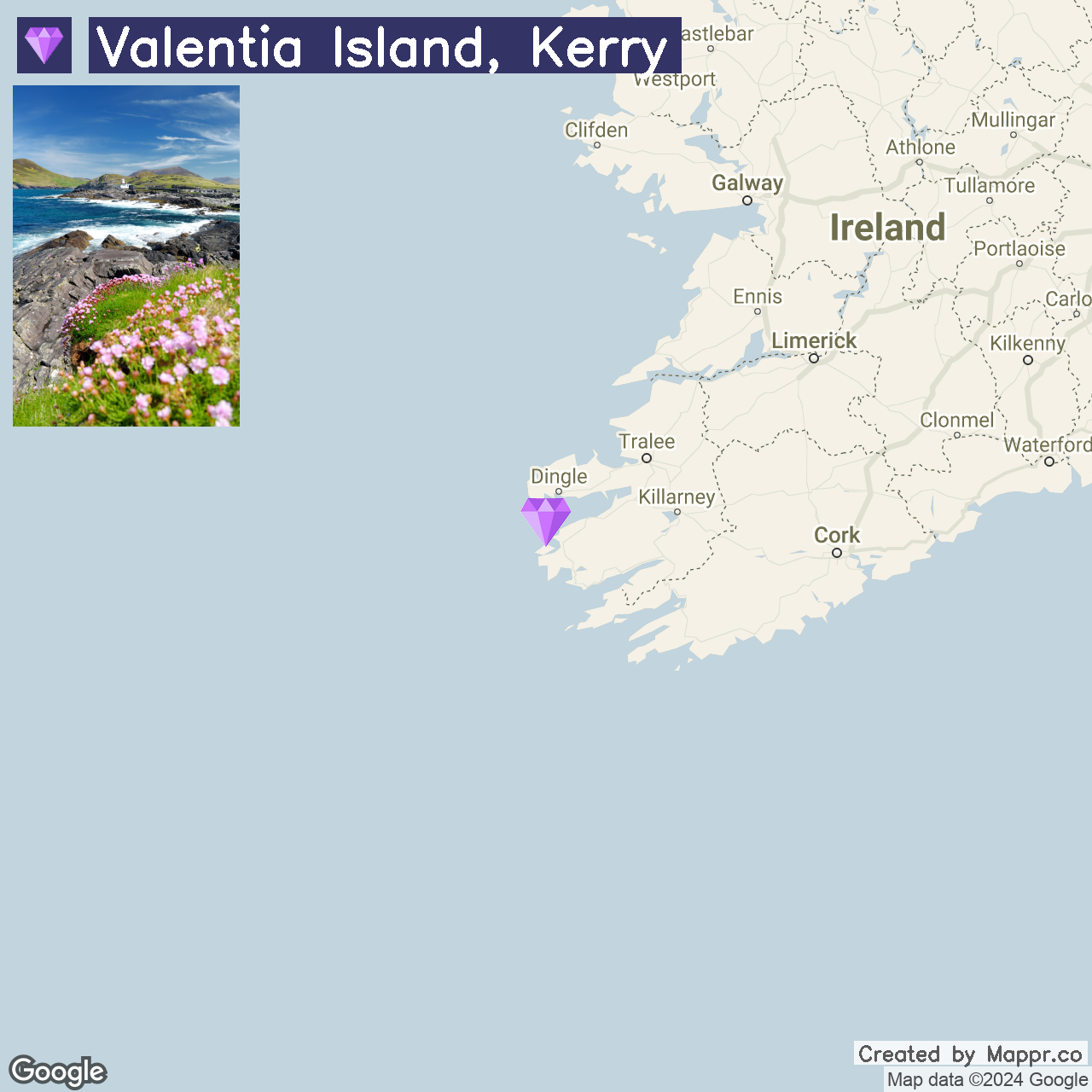
28. Valentia Island, Kerry

Valentia Island, situated off the Iveragh Peninsula in County Kerry, is a picturesque island known for its stunning landscapes, historical sites, and vibrant marine life.
The island’s diverse attractions include the Glanleam House Subtropical Gardens, the Valentia Lighthouse at Cromwell Point, and the Tetrapod Trackway, one of the earliest evidence of amphibian life.
With its mild climate and scenic beauty, Valentia Island offers a peaceful retreat with plenty of opportunities for outdoor activities, including hiking, fishing, and kayaking in the surrounding waters.
- ✈️ How to Get There: Valentia Island is accessible by car via the Maurice O’Neill Memorial Bridge from Portmagee or by ferry from Reenard Point, with connections from Cahersiveen and other towns in Kerry.
- 🏨 Where to Stay: The Royal Valentia Hotel provides comfortable accommodation with stunning views of the harbor and beyond. The Carraig Liath House offers charming rooms and a warm welcome for a more intimate setting.
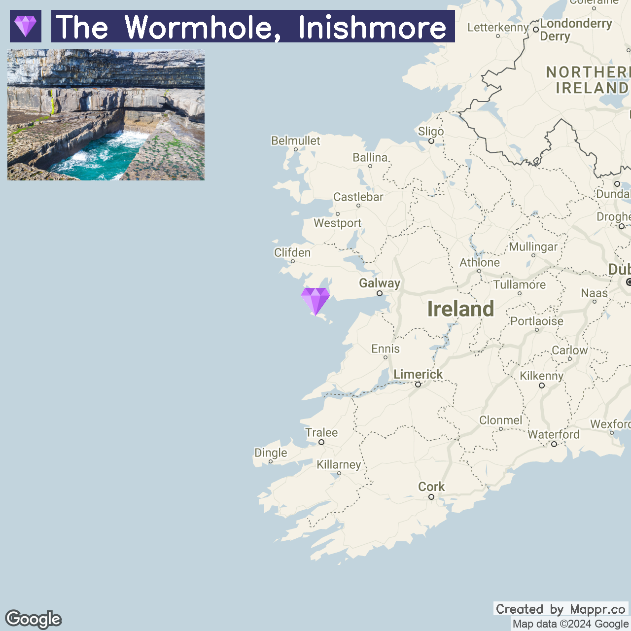
29. The Wormhole, Inishmore

The Wormhole, also known as Poll na bPéist, is a remarkable natural rectangle pool carved into the limestone of Inishmore, the largest of the Aran Islands.
This geological marvel, shaped by the Atlantic’s force, offers a unique spectacle, especially during high tide or when divers leap into its clear waters from the surrounding cliffs.
Inishmore combines this natural wonder with ancient ruins, like the iconic Dún Aonghasa fort, providing a deep dive into Ireland’s Celtic past amidst stunning coastal scenery.
- ✈️ How to Get There: Inishmore is accessible by ferry from Rossaveal in Connemara or Doolin in County Clare. Flights are also available from Connemara Airport.
- 🏨 Where to Stay: Kilmurvey House offers charming, traditional accommodation in the heart of Inishmore, close to major attractions. The Aran Islands Hotel provides comfortable rooms with scenic views of the island and the sea for a more modern stay.
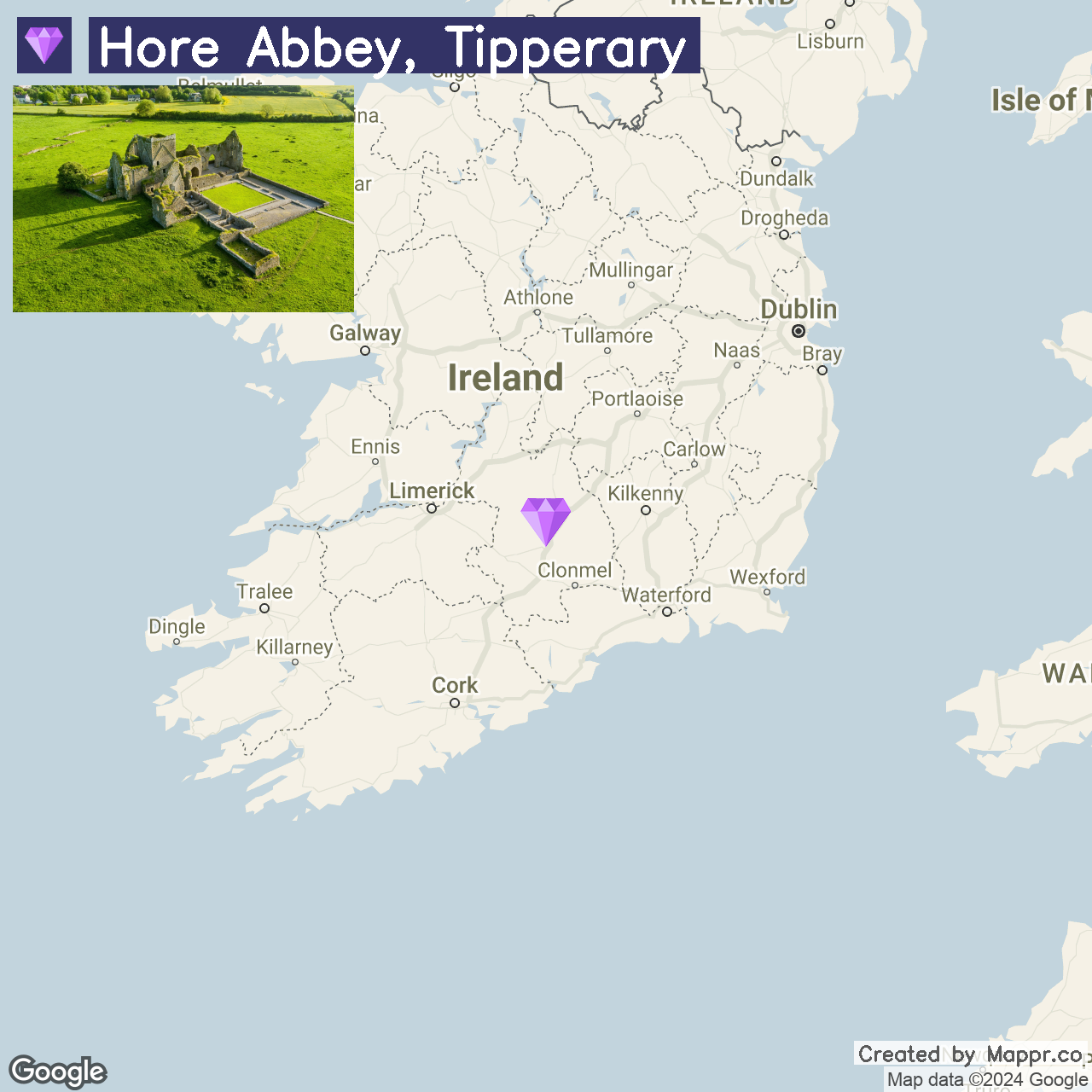
30. Hore Abbey, Tipperary

Hore Abbey, nestled in the shadow of the Rock of Cashel in County Tipperary, is a hidden monastic ruin with a rich history. This serene, off-the-beaten-path site offers a glimpse into Ireland’s medieval past, with its well-preserved ruins against a backdrop of lush green fields.
The tranquility of Hore Abbey makes it a perfect spot for contemplation and photography, away from the crowds of the nearby Rock of Cashel.
- ✈️ How to Get There: Hore Abbey is easily reachable by car from Cashel, with the site located just a short walk from the town center. Cashel is well-connected by road to major cities like Dublin, Cork, and Limerick.
- 🏨 Where to Stay: Baileys Hotel Cashel offers luxury and comfort in the heart of Cashel, with easy access to both Hore Abbey and the Rock of Cashel. For a more rural retreat, consider staying at the Rockville House B&B, known for its hospitality and proximity to local attractions.
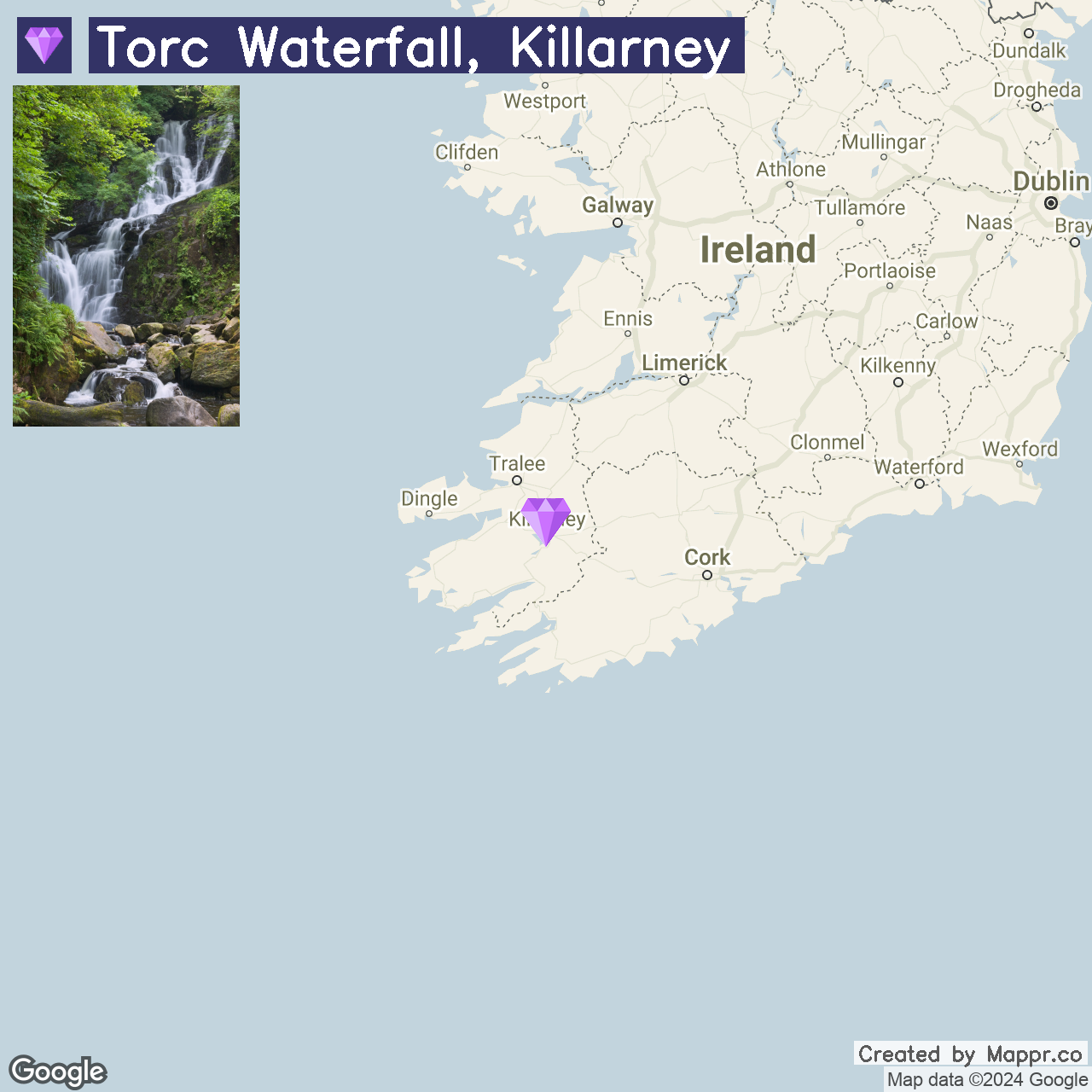
31. Torc Waterfall, Killarney National Park

Torc Waterfall, located in the heart of Killarney National Park in County Kerry, is a majestic waterfall cascading through lush woodland. A short walk from the parking area leads to this natural wonder, with the surrounding trails offering stunning views of the lakes and mountains.
Killarney National Park, a UNESCO Biosphere Reserve, has many attractions, including Muckross House and the Gap of Dunloe, making it a must-visit for nature lovers and outdoor enthusiasts.
- ✈️ How to Get There: Torc Waterfall is accessible by car or bike from Killarney, with the national park providing ample parking and signposted routes to the waterfall.
- 🏨 Where to Stay: The Lake Hotel Killarney offers a picturesque lakeside setting with views of the national park and Torc Mountain. For a cozy, family-run experience, the Kingfisher Lodge in Killarney provides a comfortable base within walking distance of the national park.
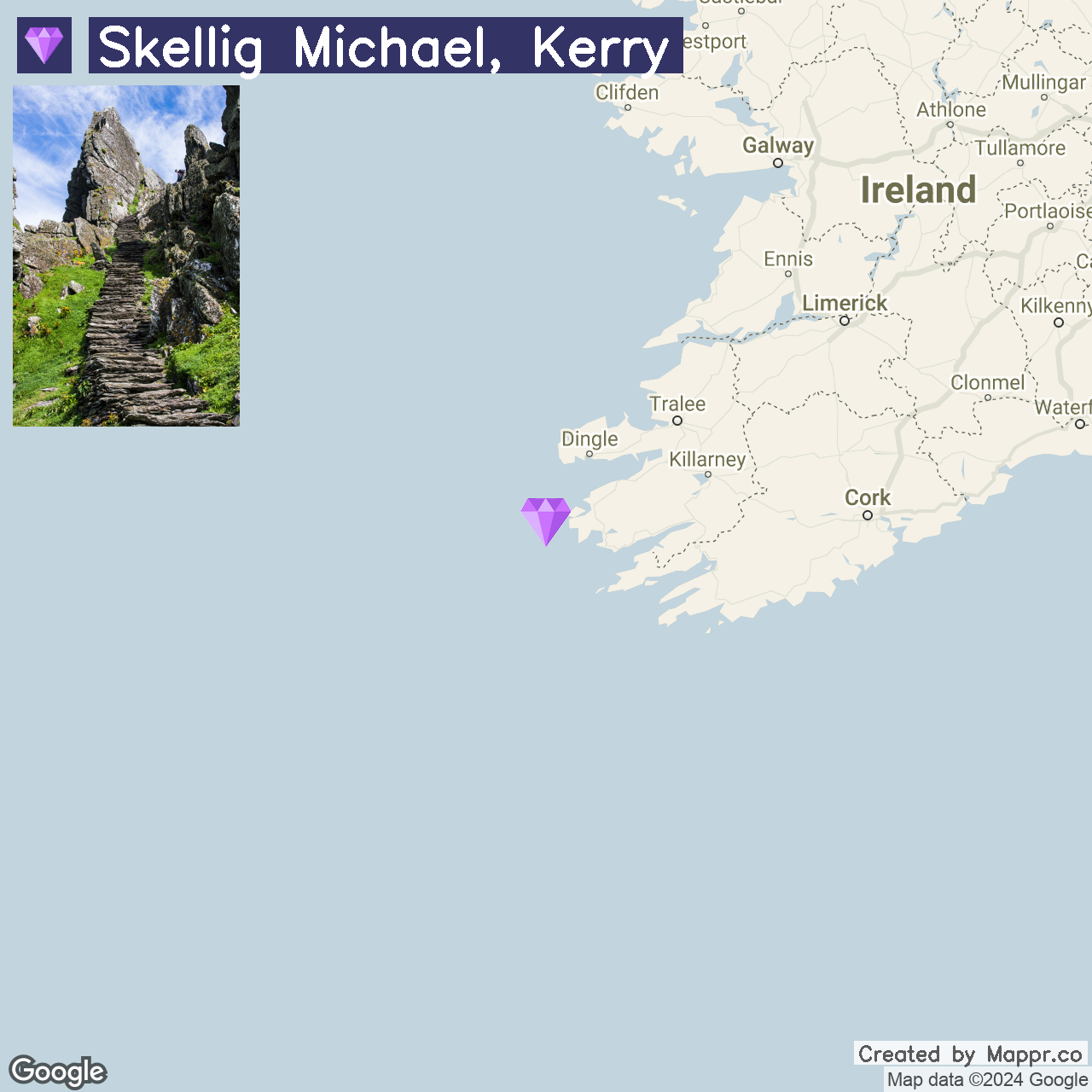
32. Skellig Michael, Kerry

Skellig Michael, a remote, rocky island off the Kerry coast, is famed for its early Christian monastery and its role in the “Star Wars” films. This UNESCO World Heritage site offers an unparalleled glimpse into monastic life, with well-preserved beehive huts and stunning ocean vistas.
Visiting Skellig Michael is an adventure, with boat trips providing an opportunity to experience the island’s rugged beauty and diverse birdlife, including puffins during the breeding season.
- ✈️ How to Get There: Boat trips to Skellig Michael depart from Portmagee, Ballinskelligs, and Caherdaniel, weather permitting, typically from May to October.
- 🏨 Where to Stay: The Moorings Guesthouse & Seafood Restaurant in Portmagee offers comfortable accommodations and fresh, locally sourced seafood. Alternatively, the Sea Lodge Hotel in Waterville provides budget-friendly options with a friendly atmosphere.
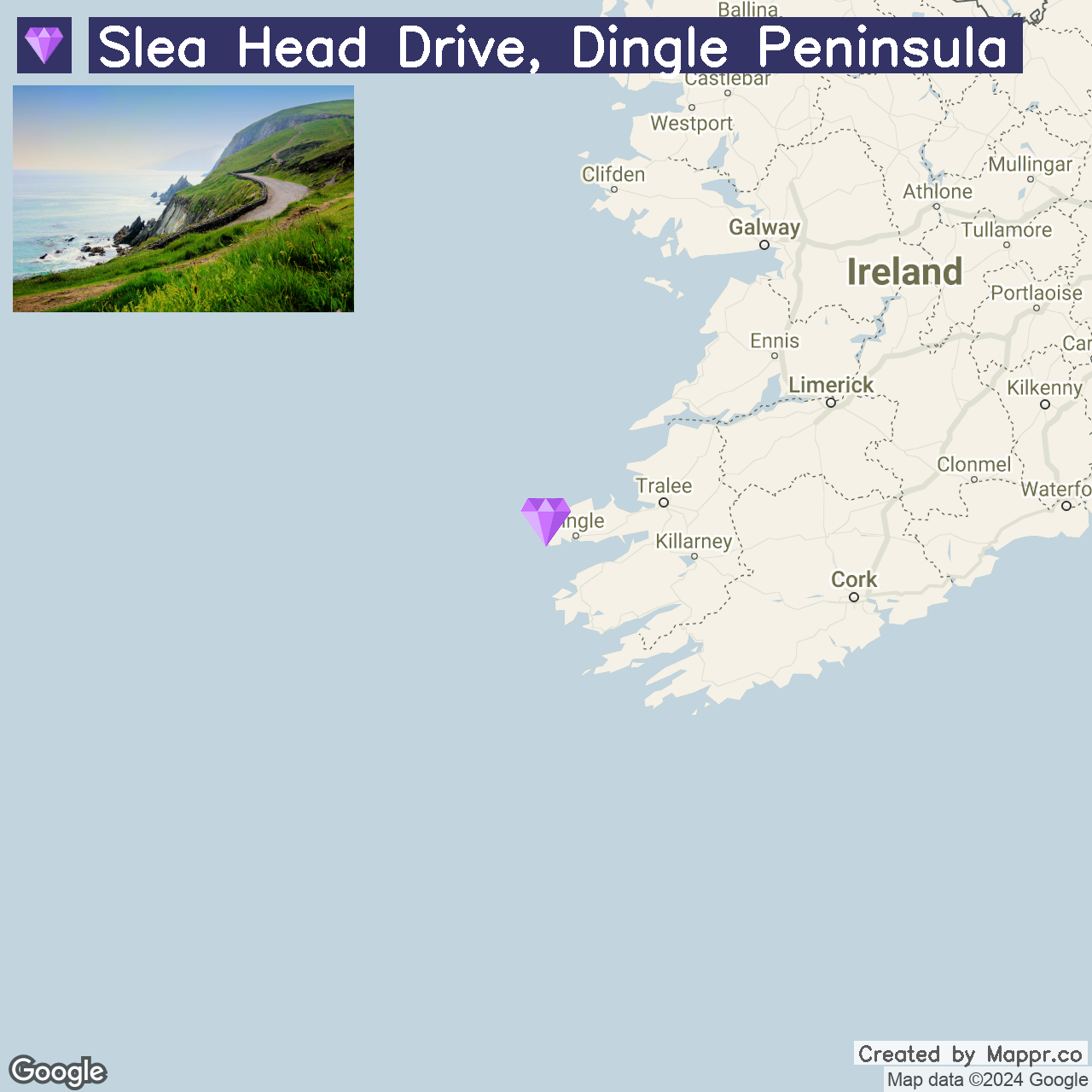
33. Slea Head Drive, Dingle Peninsula

Slea Head Drive on the Dingle Peninsula is a spectacular coastal route in County Kerry, offering some of Ireland’s most dramatic scenery. This circular route takes visitors through a landscape of ancient sites, sandy beaches, and rugged cliffs, with panoramic views of the Blasket Islands.
The drive, best enjoyed leisurely, allows for numerous stops to explore local attractions, including the Gallarus Oratory, Dunquin Harbour, and Coumeenoole Beach.
- ✈️ How to Get There: Slea Head Drive is best accessed by car from Dingle, the peninsula’s charming and lively hub. Dingle is reachable from Tralee and Killarney by bus or car.
- 🏨 Where to Stay: The Dingle Skellig Hotel offers luxurious accommodations, stunning views of Dingle Bay, and easy access to the peninsula’s attractions. For a more intimate setting, the Greenmount House provides a boutique experience with stunning panoramic views.
Final Thoughts
Ireland’s hidden gems offer a unique journey into the island’s heart, far from the usual tourist trails. Rich in tranquility and natural beauty, these spots promise an authentic experience of Ireland’s heritage and landscapes.
As you explore these lesser-known treasures, you’ll uncover a deeper connection to Ireland, its history, and its natural wonders, making your summer exploration truly unforgettable.
✈️ Getting there: flying into Ireland
Most travellers reach Ireland’s hidden gems by flying into one of its main international gateways — Dublin (DUB) — with Shannon (SNN) handy for the west coast. From there it’s a short domestic hop, train or drive to the spots on this list. For every major airport — where they are and which destinations they serve — see our guide to the major airports in Ireland.

- Coastal Lighthouse on Rocky Cliffside — © Fabiano's_Photo/Shutterstock
- Wooden Staircase Leading Up a Lush Hillside — © Paul_Shiels/Shutterstock
- Empty Bench Overlooking Scenic Valley — © D. Ribeiro/Shutterstock
- Lismore Castle Surrounded by Greenery — © Paul Vowles/Shutterstock
- Rusty Shipwreck on Rocky Shore — © mark gusev/Shutterstock
- Scenic Beach Cove with Lush Green Hills — © Mica Stock/Shutterstock
- Lough Bray in Wicklow with Clear Skies — © Patrycja St/Shutterstock
- Cliffside Ocean View at Slieve League — © alexilena/Shutterstock
- Chapel by the Lake in Gougane Barra — © Lukasz Janyst/Shutterstock
- Rural Pathway with Fence and Trees — © John Clarke Photography/Shutterstock
- Coastal View of Kinnagoe Bay with Beach and Cliffs — © jksz.photography/Shutterstock
- Waterfall Cascading Down a Rocky Cliff — © mark gusev/Shutterstock
- Coastal Cliffs and Sea Stacks — © teddiviscious/Shutterstock
- Stalactites in a Dimly Lit Cave — © Sarah-Jane Jones/Shutterstock
- Gothic Cathedral Tower Against Blue Sky — © Lance Bellers/Shutterstock
- Formal Garden with Reflecting Pool and Statues — © dvlcom/Shutterstock
- Kinbane Castle Ruins on Coastal Cliffs — © shawnwil23/Shutterstock
- Coastal Cave Entrance at Dunmore — © Andrzej Bartyzel/Shutterstock
- Spire of Lloyd Against Sky — © Michelle Holihan/Shutterstock
- Lake Nestled in Mountain Valley — © Eimantas Juskevicius/Shutterstock
- Sunny Day at Murlough Bay Beach — © SeraphP/Shutterstock
- Dusk at Phoenix Park with Wellington Monument, Dublin — © Bruno Negri/Shutterstock
- Secluded Forest Waterfall — © Michelle Holihan/Shutterstock
- Coastal Lighthouse on Arranmore Island — © Rob Crandall/Shutterstock
- Coastal Village on Inishturk Island with Docked Boat — © Maria_Janus/Shutterstock
- Coastal Landscape of Great Saltee Island — © Nicola_K_photos/Shutterstock
- Poulnabrone Dolmen at Dusk — © pics721/Shutterstock
- Coastal View of Valentia Island with Flowers — © MNStudio/Shutterstock
- Aerial View of Coastal Rock Formation with Sea Water — © mikecphoto/Shutterstock
- Aerial View of Ruins of Hore Abbey in Green Field — © MNStudio/Shutterstock
- Cascading Waterfall in Lush Forest — © Jane McIlroy/Shutterstock
- Stone Steps Leading Up Skellig Michael — © Armin Binz/Shutterstock
- Coastal Road Along Cliffs and Ocean — © JeniFoto/Shutterstock