The Ivory Coast flag is a vibrant emblem, encapsulating the nation’s journey and aspirations. Revered for its symbolism, it unites diverse communities and embodies their resilience and hope. As we delve into its design, we uncover the deep connections between the flag’s colors and the country’s rich cultural and natural tapestry.
Flag of Ivory Coast

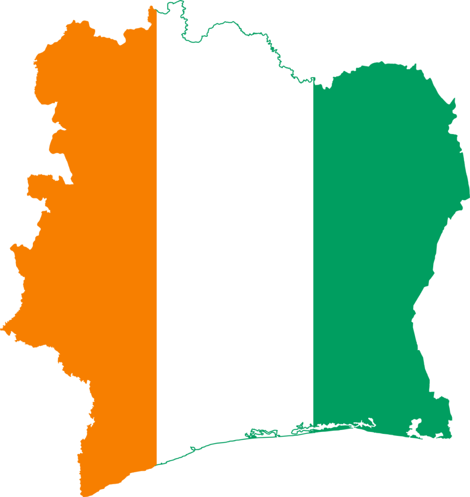
The Ivory Coast flag is characterized by its distinct tricolor design, consisting of three vertical bands. The flag’s layout is simple yet impactful, with the bands arranged equally from the hoist side to the fly side.
Notably, the flag’s straightforward design makes it recognizable and distinct among the world’s flags. A vertical tricolor pattern departs from many other national flags, setting it apart in symbolism and style.
Flag of Ivory Coast: Color Palette
Ivory Coast Flag Emoji: 🇨🇮
The Ivory Coast flag presents a harmonious color palette, each hue chosen for its profound significance. This trio of colors, distinct and vibrant, collectively embodies the essence and values of the nation, setting the stage for a deeper exploration of their meanings and the stories they tell.
Meaning of Each Color

Orange
The orange band in the Ivory Coast flag symbolizes the northern savannas of the country, rich in their fertility and crucial to the nation’s agriculture.
Historically, orange evokes the struggles and sacrifices made in the pursuit of emancipation, reflecting the resilience and vigor of a youthful nation on its path to self-determination.
White
The central white stripe on the flag stands for peace and unity. It glorifies the purity of peace and the union of hearts, embodying Ivory Coast’s aspiration for national harmony and tranquility.
The white band serves as a visual pledge of the country’s success, symbolizing a commitment to peace that stems from the unity and cooperation of its diverse communities.
Green
The green stripe at the fly side of the flag denotes hope for a better future and symbolizes the luxuriant virgin forests of the Ivory Coast.
The color green underscores the importance of nature in the nation’s identity and reflects the aspiration for continued growth and prosperity.
Ivory Coast’s Coat of Arms
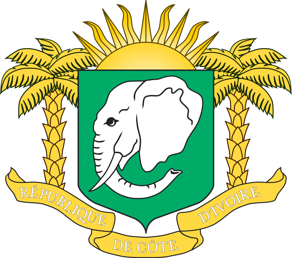
The Coat of Arms of Ivory Coast symbolizes sovereignty, heritage, and guiding principles. It embodies the country’s historical journey and cultural richness, representing a fusion of indigenous and historical influences.
This emblem underscores Ivory Coast’s commitment to unity, discipline, and progress while celebrating its natural and cultural diversity. As a national symbol, it reflects the collective spirit and aspirations of the Ivorian people.
Historical Evolution and the Meaning Behind Changes
The Ivory Coast flag has retained its original design throughout history, showcasing the nation’s stable vision and identity. This flag was introduced in the context of the decolonization period in Africa, during which many countries adopted new symbols to represent their newfound independence.
Distinct from the pan-African colors that were popular among neighboring states, Ivory Coast’s choice of a unique tricolor was a conscious decision to forge a distinct character. The vertical tricolor design is reminiscent of the French Tricolor, reflecting the country’s historical ties with France.
Maintaining the flag’s original design since its adoption signifies a solid commitment to the ideals and values it intends to represent.
Unlike many countries, which have seen changes to their flags corresponding with political shifts or cultural changes, the Ivory Coast flag stands as a symbol of continuity and enduring national unity.
Overall Symbolic Meaning of the Flag
The flag of Ivory Coast symbolizes the nation’s unity, resilience, and forward-looking ambition. It is a visual emblem of the country’s diverse cultural heritage and commitment to harmony and progress. The flag reflects Ivory Coast’s distinct identity and journey towards a prosperous future, embodying its people’s collective spirit and aspirations.
Similar Flags to the Flag of Ivory Coast
Several flags worldwide share a visual resemblance with the flag of Ivory Coast, each with its unique story and symbolism.
Ireland

The flag of Ireland also features three vertical bands but in the reverse order: green, white, and orange. The similarity is mainly coincidental, as the colors and arrangement of the Irish flag have different historical and cultural significances related to Irish history and identity.
India
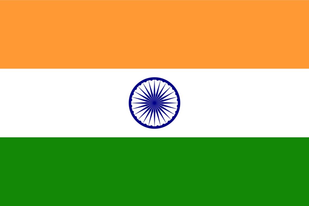
While the colors are not the same, the flag of India features a similar tricolor design with horizontal bands. The Indian flag’s colors (saffron, white, and green) represent different values and elements of Indian history and society.
Niger
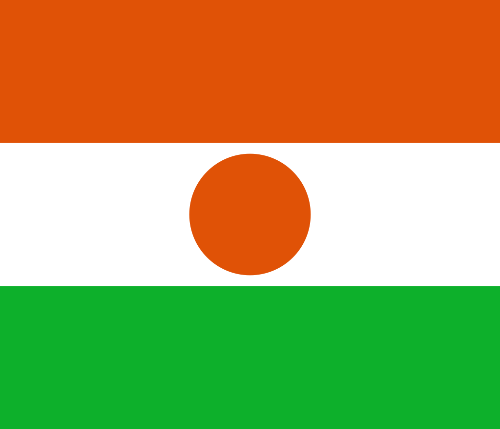
The flag of Niger shares a similar color scheme and layout, with horizontal bands of orange, white, and green. This similarity is primarily coincidental, as the colors in the Nigerien flag represent different aspects of the nation’s environment and history.
Conclusion
The flag of Ivory Coast is a symbol of national pride, embodying the country’s identity, heritage, and aspirations. It stands distinctively in the global array of flags, uniting citizens in their shared pursuit of progress and harmony.


- Ivory Coast Flag Against Blue Sky — © Creative Photo Corner/Shutterstock
- Flag of Ireland — The official flag of Ireland