Wyoming, known as the “Equality State” for being the first state to grant women the right to vote, embodies the spirit of the American West with its vast plains, towering mountain ranges, and majestic national parks.
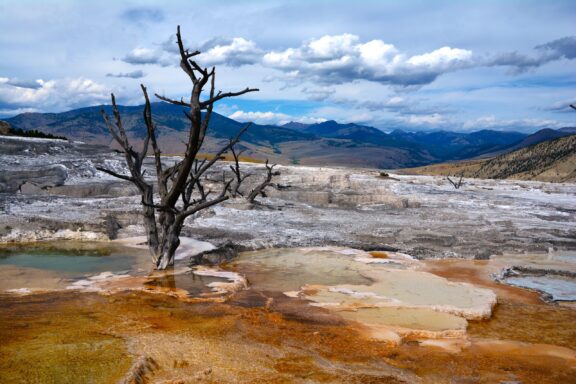
Home to iconic landmarks such as Yellowstone and Grand Teton National Parks, Wyoming’s natural beauty is unparalleled, featuring geysers, hot springs, and an abundance of wildlife.
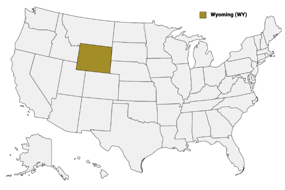
Wyoming (WY) on the US Map
Below is a map of the 23 counties of Wyoming (you can click on the map to enlarge it and to see the major city in each county).
Wyoming’s 23 counties each contribute a unique chapter to the state’s narrative, from the energy-rich fields of Campbell County to the historical trails of Natrona County. This post will explore the distinct qualities of Wyoming’s counties, highlighting the natural wonders, historical significance, and community life that make each one a vital part of the state’s identity.
Below is a Wyoming Counties Map, which shows the borders and largest cities of each county in the state.
Map of Wyoming Counties
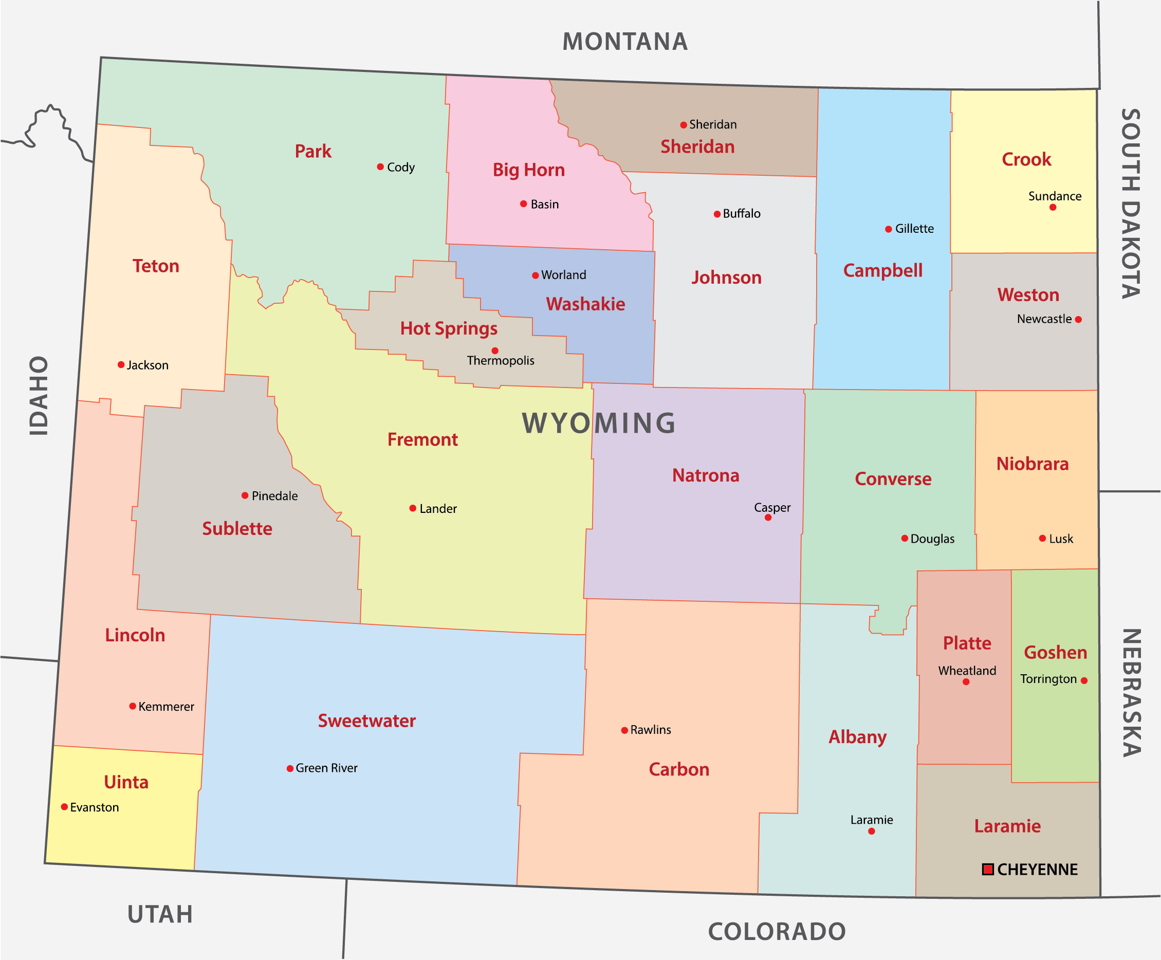
Interactive Map of Wyoming Counties
Click on any of the counties on the map to see its population, economic data, time zone, and zip code (the data will appear below the map). Data is sourced from the US Census 2021.
List of the Counties of Wyoming:
| County | Population | Per sq. km | Largest City |
|---|---|---|---|
| Albany County | 37,311 | 3.37 | Laramie |
| Big Horn County | 11,671 | 1.44 | Greybull |
| Campbell County | 46,758 | 3.76 | Gillette |
| Carbon County | 14,714 | 0.72 | Rawlins |
| Converse County | 13,702 | 1.24 | Douglas |
| Crook County | 7,185 | 0.97 | Sundance |
| Fremont County | 39,434 | 1.66 | Riverton |
| Goshen County | 12,642 | 2.19 | Torrington |
| Hot Springs County | 4,673 | 0.9 | Thermopolis |
| Johnson County | 8,457 | 0.79 | Buffalo |
| Laramie County | 99,905 | 14.36 | Cheyenne |
| Lincoln County | 19,457 | 1.84 | Kemmerer |
| Natrona County | 79,382 | 5.74 | Casper |
| Niobrara County | 2,486 | 0.37 | Lusk |
| Park County | 29,664 | 1.65 | Cody |
| Platte County | 8,607 | 1.6 | Wheatland |
| Sheridan County | 30,812 | 4.71 | Sheridan |
| Sublette County | 8,830 | 0.7 | Pinedale |
| Sweetwater County | 42,459 | 1.57 | Rock Springs |
| Teton County | 23,319 | 2.25 | Jackson |
| Uinta County | 20,514 | 3.8 | Evanston |
| Washakie County | 7,768 | 1.34 | Worland |
| Weston County | 6,891 | 1.11 | Newcastle |
Biggest Counties in Wyoming by Population
Laramie County
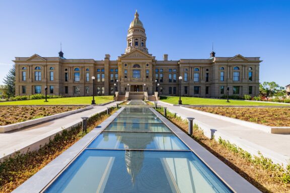
Laramie County, created in 1867, is Wyoming’s most populous county, with Cheyenne serving as both the county seat and the state capital. This region is a blend of Western heritage and contemporary lifestyle, where historic sites like the Cheyenne Depot Museum coexist with modern amenities and infrastructure.
Cheyenne is famous for hosting the annual Cheyenne Frontier Days, the world’s largest outdoor rodeo and Western celebration, attracting visitors from all over for its rodeos, concerts, and parades.
The county’s landscape is characterized by vast plains and rolling hills, offering outdoor activities such as hiking and biking in places like Curt Gowdy State Park, nestled between Cheyenne and Laramie. This park is a haven for anglers, boaters, and adventurers, with trails that cater to varying skill levels and scenic views that encapsulate Wyoming’s rugged beauty.
Laramie County’s economy benefits from a mix of government, military, and private sector jobs, with the Francis E. Warren Air Force Base contributing significantly to local employment. Education and healthcare are also central to the community’s well-being, supported by institutions like Laramie County Community College and Cheyenne Regional Medical Center.
Natrona County
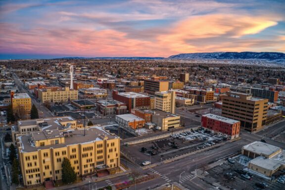
Natrona County, established in 1890, is centered around Casper, the second-largest city in Wyoming and the county seat. This area is steeped in the history of the oil industry, which played a significant role in its development and continues to impact its economy today.
Casper Mountain, rising dramatically from the plains, offers a backdrop to the city and a playground for outdoor enthusiasts, with activities ranging from skiing at Hogadon Basin Ski Area to hiking and bird-watching in the mountain’s numerous trails and natural areas.
The North Platte River flows through Natrona County, providing opportunities for fly fishing, rafting, and riverside picnics, contributing to the county’s appeal for those seeking outdoor adventure. The National Historic Trails Interpretive Center in Casper offers insights into the pioneer trails that crossed Wyoming, including the Oregon, Mormon, and California trails, highlighting the county’s role in westward expansion.
Natrona County’s cultural scene is vibrant, with the Ford Wyoming Center hosting concerts, sports events, and other entertainment, while the Nicolaysen Art Museum and Discovery Center cater to art lovers and families looking for educational experiences.
Campbell County
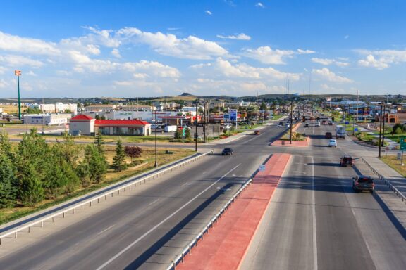
Campbell County, formed in 1911, is situated in northeastern Wyoming, known for its rich mineral resources, particularly coal, methane gas, and oil, earning it the nickname “Energy Capital of the Nation.” Gillette, the county seat, serves as a hub for the energy industry and the region’s ranching community.
The landscape of Campbell County features the rolling plains of the Powder River Basin, an area critical to the U.S. energy supply. Amidst this industrial backdrop, recreational opportunities abound, especially at Keyhole State Park, a haven for fishing, boating, and camping, centered around the Keyhole Reservoir.
The Rockpile Museum in Gillette offers visitors a glimpse into the county’s pioneering history and the importance of the energy sector, while the CAM-PLEX Multi-Event Facilities host a variety of events, from rodeos to concerts, reflecting the community’s diverse interests.
Sweetwater County
Sweetwater County, established in 1867, is located in southwestern Wyoming, featuring a landscape marked by vast high desert and the towering Wind River Range to the north. The county seat, Green River, alongside the city of Rock Springs, reflects the region’s rich mining heritage, particularly in trona, a mineral used in manufacturing soda ash.
This county is distinguished by its natural wonders, including the Flaming Gorge National Recreation Area, known for its dramatic red cliffs, deep blue waters, and excellent fishing, boating, and hiking opportunities. The Green River runs through the heart of the county, providing vital waterways for both recreation and wildlife.
Rock Springs hosts the annual Wyoming’s Big Show, a county fair and rodeo that draws crowds with its entertainment, competitions, and exhibitions, celebrating the community spirit and Western lifestyle. Sweetwater County’s history is also preserved in places like the Sweetwater County Historical Museum, which showcases the area’s diverse cultural heritage, from Native American artifacts to pioneer and mining exhibits.
Exploration opportunities are abundant in Sweetwater County, with the Pilot Butte Wild Horse Scenic Loop offering chances to observe wild horses in their natural habitat, illustrating the county’s commitment to preserving its wild and scenic landscapes.
Fremont County
Fremont County, organized in 1884, is located in central Wyoming and is known for its diverse landscapes that include parts of the Wind River Range, the state’s highest mountain range, and the Wind River Indian Reservation, home to the Eastern Shoshone and Northern Arapaho tribes.
The county seat, Lander, is a gateway to outdoor adventures, with access to Sinks Canyon State Park, where the Popo Agie River disappears into a large limestone cavern before reappearing in a pool below, a natural phenomenon that attracts geologists and tourists alike.
Riverton, another significant city in Fremont County, hosts the annual Riverton Rendezvous, celebrating the region’s trapping and trading heritage with hot air balloon rallies, Native American powwows, and historical reenactments. The Wind River Reservation offers insights into the cultural traditions and histories of the resident tribes, with community events and the Wind River Casino providing opportunities for cultural exchange.
Smallest Counties in Wyoming by Population
Niobrara County
Niobrara County, established in 1911, is Wyoming’s least populous county, exuding a quiet charm and a sense of untouched wilderness. Lusk, the county seat, offers a glimpse into Wyoming’s pioneering past, with historic sites such as the Stagecoach Museum, which houses artifacts from the region’s early settlers and the stagecoach era.
The county is characterized by its rolling hills, grasslands, and the Niobrara River, all of which contribute to its reputation as a serene place for residents and a peaceful retreat for visitors.
The landscape supports a range of outdoor activities, including hiking, bird watching, and hunting, with the local flora and fauna offering opportunities for nature photography and wildlife observation. Ranching remains a significant part of the county’s economy and cultural identity, with the annual Legend of Rawhide celebration commemorating Niobrara County’s heritage through a community-produced pageant and rodeo.
Education and community are important in Niobrara County, with local schools and organizations fostering a close-knit atmosphere. The county’s sparse population and expansive natural spaces allow for clear night skies, making it an ideal location for stargazing and appreciating the natural beauty of Wyoming’s landscape.
Hot Springs County
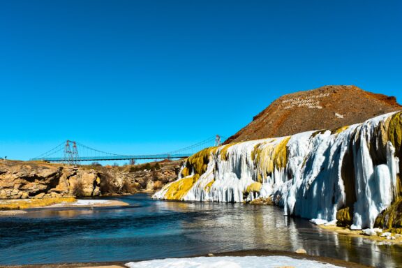
Hot Springs County, named for the world-renowned mineral hot springs located in the county seat of Thermopolis, is nestled in central Wyoming. These hot springs, part of Hot Springs State Park, are not only a natural wonder but also a cultural and recreational focal point, drawing visitors with their therapeutic properties and the beautifully terraced landscapes created by mineral deposits.
The county’s geological wonders extend beyond the hot springs, with the Wind River Canyon cutting through its landscape, offering dramatic views and a corridor between the Wind River Basin and the Big Horn Basin. This area is popular among fishermen, rafters, and geology enthusiasts, showcasing layers of rock formations that tell the story of millions of years.
Thermopolis hosts the Wyoming Dinosaur Center, a world-class museum and research facility where visitors can view impressive fossil collections and even participate in digs, reflecting Hot Springs County’s rich paleontological heritage.
Weston County
Weston County, established in 1890, is located in the northeastern corner of Wyoming, bordering South Dakota. The county seat, Newcastle, serves as a gateway to the Black Hills, offering access to outdoor activities and scenic beauty. The area is steeped in history, with remnants of the Texas Trail and the Vore Buffalo Jump, where Native American tribes once hunted buffalo by driving them into a natural sinkhole.
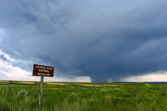
The landscape of Weston County is marked by rolling plains and pine-covered hills, providing habitat for wildlife such as deer, antelope, and turkeys, making it a popular area for hunting and nature observation. Thunder Basin National Grassland, part of this county, offers expansive spaces for hiking, bird watching, and experiencing the wide-open landscapes characteristic of Wyoming.
Coal mining and agriculture play significant roles in the local economy, with the county contributing to Wyoming’s status as a leading coal producer. Newcastle and other communities within Weston County maintain a small-town feel, with local events and festivals that bring residents together, reflecting the close-knit nature of this rural area.
Other Notable Counties in Wyoming
Teton County
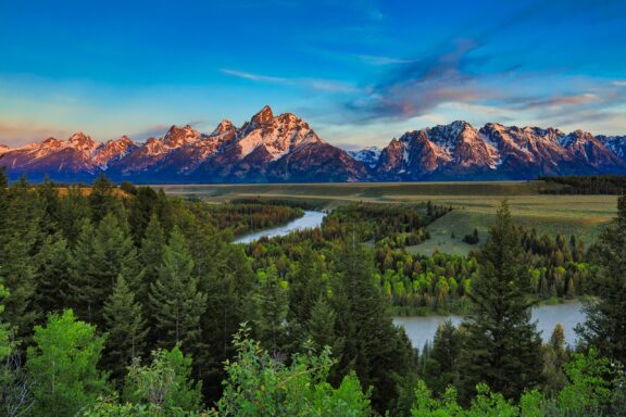
Teton County, established in 1921, is situated in northwestern Wyoming and is distinguished by the Grand Teton National Park, a natural marvel characterized by its striking mountain peaks, including the Grand Teton itself. Jackson, the county seat, is a bustling town that serves as a cultural and recreational hub, offering art galleries, fine dining, and access to world-class skiing at nearby resorts like Jackson Hole Mountain Resort.
This county is a haven for wildlife, with large populations of elk, bison, and grizzly bears, providing unique opportunities for wildlife photography and observation, especially in the National Elk Refuge. The Snake River flows through Teton County, offering rafting and fly-fishing experiences against the backdrop of the Teton Range.
Outdoor activities extend beyond skiing and wildlife viewing, with hiking, mountaineering, and camping widely popular in the summer months. The annual Jackson Hole Rodeo highlights the area’s cowboy culture, while the Grand Teton Music Festival showcases its artistic side, bringing classical music to the mountains.
Park County
Park County, established in 1909, lies in the northwest corner of Wyoming, serving as one of the primary gateways to Yellowstone National Park, one of the first national parks in the world.
Cody, the county seat, was founded by Buffalo Bill Cody, who embodied the spirit of the American West, and the town reflects this heritage through attractions like the Buffalo Bill Center of the West. This museum complex offers insights into natural history, art, and Western culture, drawing visitors from across the globe.
The geography of Park County is marked by dramatic mountain landscapes, including the Absaroka and Beartooth Ranges, offering scenic beauty and outdoor adventure. The Shoshone River, with its powerful waterfalls and deep canyons, provides opportunities for fishing, rafting, and exploration.
Cody hosts the annual Cody Stampede Rodeo, one of the longest-running and most celebrated rodeos, capturing the essence of rodeo culture and competition. The East Entrance to Yellowstone in Park County is a portal to geysers, hot springs, and an array of wildlife, making it a critical area for conservation and environmental education.
Sheridan County
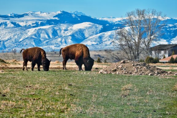
Sheridan County, situated in northern Wyoming, is framed by the picturesque Bighorn Mountains to the west and the rolling plains to the east. Established in 1888, its county seat, Sheridan, is renowned for its vibrant arts community, historic downtown, and Western heritage. The city is a focal point for cultural events, including the annual Sheridan WYO Rodeo, an event that draws crowds with its thrilling performances and embodies the spirit of the West.
Sheridan’s commitment to the arts is evident in its numerous galleries, the WYO Theater, and the annual Sheridan Public Arts program, which features sculptures throughout the city. The area’s rich history is preserved at sites like the Trail End State Historic Site, the former mansion of cattle baron John B. Kendrick.
The Bighorn National Forest, accessible from Sheridan County, offers endless outdoor recreation opportunities, from hiking and camping to skiing and snowmobiling, showcasing the natural beauty of the region.
Albany County
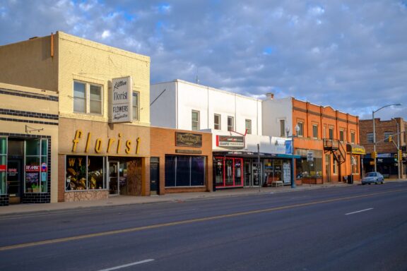
Albany County, established in 1868, lies in southeastern Wyoming, with Laramie as its county seat and the home of the University of Wyoming, the state’s flagship educational institution. This presence injects a vibrant, youthful energy into the county, evidenced by a variety of cultural and sporting events that draw both local and regional audiences.
Laramie offers a blend of historical charm and modern amenities, with its historic downtown district featuring shops, restaurants, and the Wyoming Territorial Prison State Historic Site, which once held the infamous outlaw Butch Cassidy. The surrounding landscape of Albany County is dominated by the Laramie Range and the Medicine Bow National Forest, providing abundant opportunities for outdoor activities such as hiking, biking, camping, and skiing at the Snowy Range Ski Area.
The county’s geography also includes the vast, high-altitude grasslands of the Laramie Plains, offering unique wildlife viewing and bird watching. Vedauwoo, an area within the Medicine Bow-Routt National Forests known for its distinctive rock formations, attracts climbers and geology enthusiasts from across the country.
More About Wyoming Counties: FAQs
What is the least expensive county in Wyoming?
Wyoming’s Carbon County has the least expensive real estate in the state.
Which Wyoming county is considered the most liberal?
Teton County is often considered the most politically liberal county in the state.
Which county in Wyoming has the highest elevation point?
Fremont and Sublette Counties in west-central Wyoming feature Ganett Peak, the highest peak in Wyoming with an elevation of 13,810 feet (4,210 m).

- Sunny View Of The Wyoming State Capitol Building At Cheyenne — © Kit Leong/Shutterstock
- Aerial View Of Downtown Casper Wyoming At Dusk On Christmas — © Jacob Boomsma/Shutterstock
- Cambpell County Gillette Wyusa Circa August Highway — © amadeustx/Shutterstock
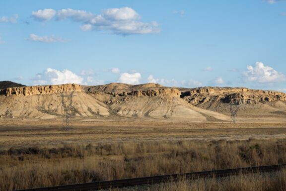
- Tall Plateaus With Talis To The Grassland Valley With Railroad — © Azariah Reese/Shutterstock
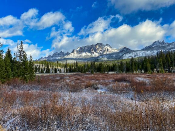
- A Fall Dusting Of Snow On The Breccia Cliffs In — © sean_in_307/Shutterstock
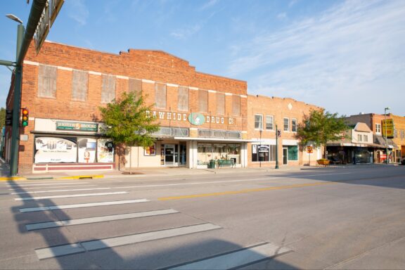
- Small Town Lusk In Wyoming Usa — © Traveller70/Shutterstock
- Hot Springs State Park Thermopolis Wyoming Usa — © Nichimar/Shutterstock
- Thunderstorm Over The Thunder Basin National Grassland Wyoming — © John D Sirlin/Shutterstock
- Sunrise From The Snake River Overlook In Wyoming With The — © aceshot1/Shutterstock
- Mammoth Hot Springs A Large Complex Of Hot Springs — © Romana Kontowiczova/Shutterstock
- Two Bison In Sheridan Wyoming — © Steve Creek/Shutterstock
- Albany County Laramie Wy Usa September Quiet — © Rolf_52/Shutterstock