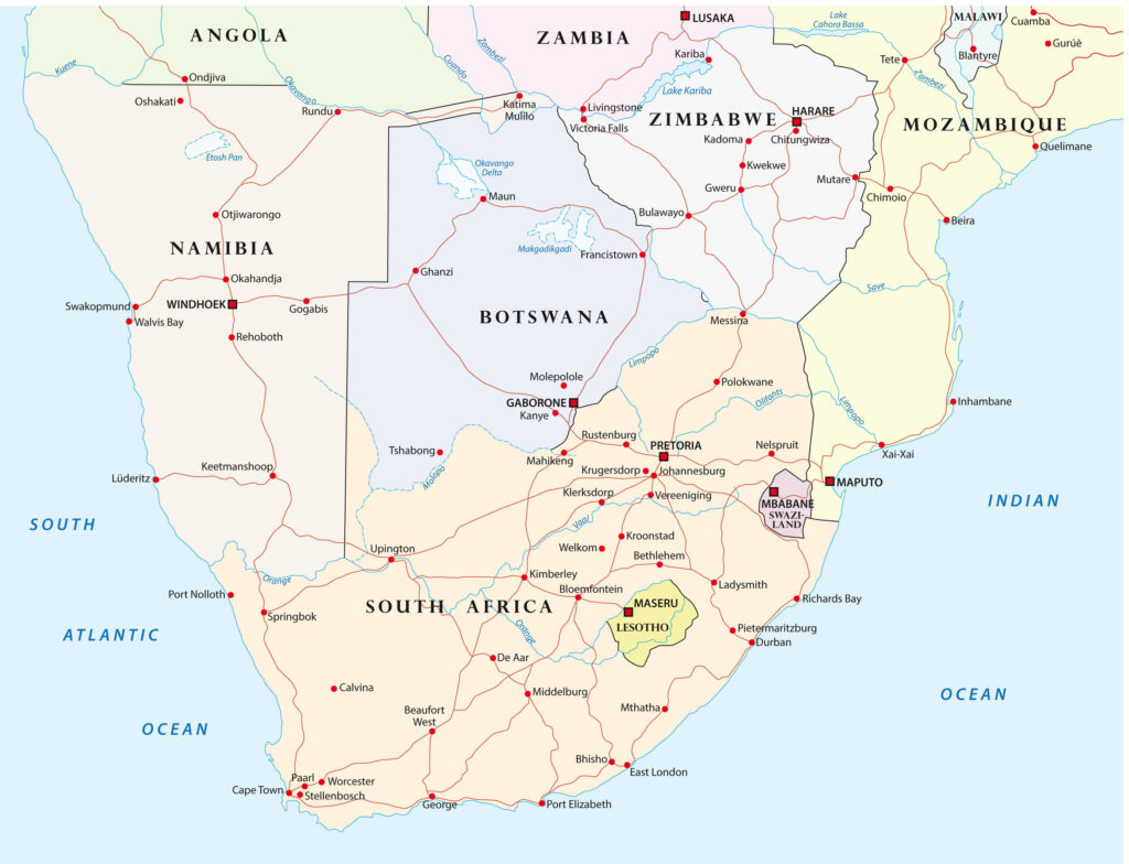
The Republic of South Africa consists of 9 provinces.
On the eve of the 1994 elections, the regions known as Bantustan were abolished and the present four administrative structures were established.
Each province is governed by a unicameral legislature. The number of members of the legislative bodies varies from 30 in the Northern Cape, where the provinces are the least populated, to 80 in KwaZulu-Natal, the highest.
The members of the Assembly elect one of them as the head of the executive (Premier).
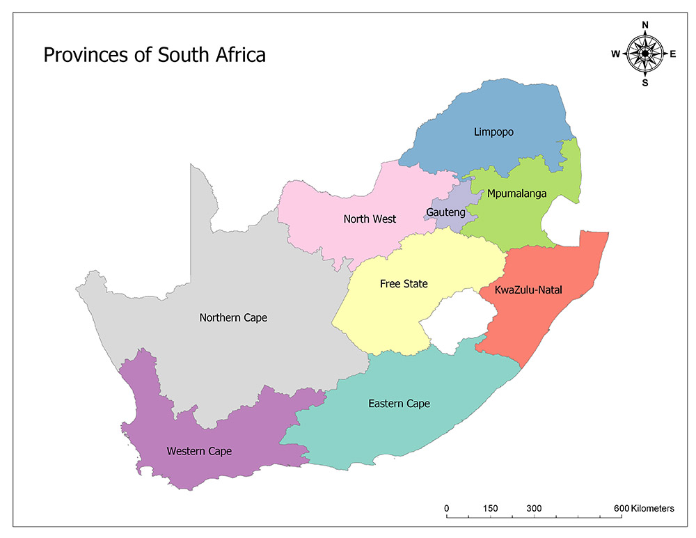
South Africa is divided into nine provinces as the highest administrative division. The provinces of South Africa are:
- Eastern Cape
- Western Cape
- Northern Cap
- North West
- Free State
- Gauteng
- KwaZulu-Natal
- Limpopo
- Mpumalanga
South Africa is further divided into 52 regions.
Nine Provinces of South Africa
Here is a brief description of each of the nine regions of South Africa:
1. Eastern Cape
The Eastern Cape is a province of South Africa. Its capital is Bhisho, but the two largest cities are Port Elizabeth and East London.
According to 2018 forecasts, the population of the region is 6,522,700. The province has an area of 168,966 square kilometers and is the second-largest province in South Africa.
2. Free State
Free State is one of the nine provinces of the Republic of South Africa, located in the south of the African continent. The borders of the province are the same as the independent Boer republic between 1854 and 1910, and the Free Orange State until 1995.
The province is located in the middle of the country and has a border with Lesotho.
The province has a surface area of 129,825 square kilometers and its population is 2,954,300 according to 2018 estimates. The center of the province is Bloemfontein.
As a result of the arrangements made in 1995, the name Orange in the province was removed and the name of the province was used only as Free State.
3. Gauteng
Gauteng is one of the nine provinces of the Republic of South Africa. It was formed on April 27, 1994, after the first-ever multiethnic elections in South Africa, as a part of the former Transvaal Province.
The first name given to this new region was “Pretoria-Witwatersrand-Vereeniging”, which was changed to “Gauteng” in December 1994.
The population of the province with an area of 18,176 square kilometers is 14,717,000 according to 2018 estimates. The province is the smallest province in South Africa.
4. KwaZulu-Natal
KwaZulu-Natal is one of the important provinces in the Republic of South Africa, often referred to as KZN. Before 1994, the place known today as KwaZulu-Natal was originally composed of the province of Natal and the territory of KwaZulu, the home of the Zulu tribe.
The administrative center of the province is in Pietermaritzburg. The largest city is Durban, which has the fastest growing port in Africa today.
The province has a surface area of 94,361 square kilometers and the population of the province is 11,384,700 according to 2018 estimates.
5. Limpopo
Limpopo is the province in the northernmost part of the Republic of South Africa. Its capital is Polokwane. The Province of Limpopo was formed from the north of the Transvaal Province with the end of the apartheid in 1994.
When it was first created, it was called Northern Transvaal. From the following year to July 11, 2003, it was called the Northern Province. When this changed, the name of the province was changed to “Limpopo”.
The name Limpopo was taken from the most important river of the province. The area of the province is 125,754 square kilometers and the population of the province is 5,797,300 according to 2018 estimates.
6. Mpumalanga
Mpumalanga is a province in the northeast of the Republic of South Africa. The name “Mpumalanga” means “east” or, more specifically, “the place where the sun rises” in Swati, Xhosa and Zulu.
The province was formerly known as Eastern Transvaal, but on August 24, 1995 it was renamed. The province has a surface area of 76,495 square kilometers and a population of 4,523,900 according to 2018 estimates.
7. North West
North West is one of the provinces of South Africa. With a surface area of 104,882 square kilometers, the population of the province is 3,979,000 according to 2018 estimates. The center of the province is Mahikeng and the largest city is Rustenburg.
8. Northern Cape
The Northern Cape is the largest and the least populated province in the South African Republic. Its largest city and capital is Kimberley.
The famous Augrabies Waterfall is also located in the Northern Cape. The area of the city is 372,889 square kilometers and the population is 1,225,600 according to 2018 estimates.
9. Western Cape
The Western Cape is one of the provinces of South Africa. The Western Cape is located in the southwest of the country.
The area of the province is 129,462 square kilometers and the population is 6,621,100 according to 2018 estimates.
The center of the city is Cape Town. Western Cape was separated from the province of Kap in 1994.
Districts of South Africa
South Africa has 9 provinces and 52 districts.
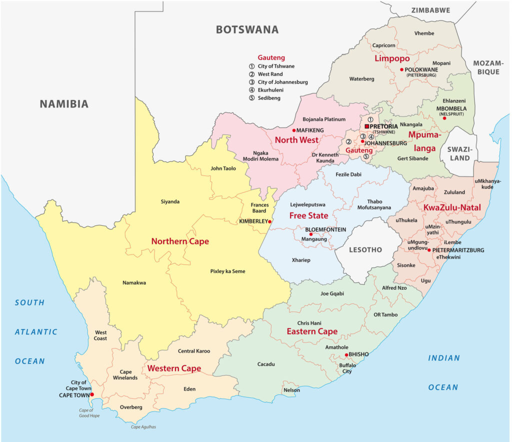
The 52 districts/regions of South Africa are:
- Alfred Nzo District Municipality
- Amajuba District Municipality
- Amatole
- Bohlabela District Municipality
- Bojanala District Municipality
- Boland District Municipality
- Bophirima District Municipality
- Cacadu District Municipality
- Capricorn District Municipality
- Central District Municipality
- Central Karoo District Municipality
- Chris Hani District Municipality
- City of Cape Town
- City of Johannesburg Metropolitan Municipality
- City of Tshwane Metropolitan Municipality
- Eden District Municipality
- Ehlanzeni
- Ekurhuleni Metropolitan Municipality
- Ethekwini Municipality
- FRANCES BAARD District Municipality
- Govan Mbeki Municipality
- iLembe District Municipality
- KAROO District Municipality
- KGALAGADI District Municipality
- Lejweleputswa District Municipality
- Metsweding District Municipality
- Mopani District Municipality
- Motheo District Municipality
- NAMAKWA District Municipality
- Nelson Mandela
- Nkangala
- Northern Free State District Municipality
- O.R.Tambo
- Overberg District Municipality
- Sedibeng District Municipality
- Sekhukhune Cross Boundary District Municipality
- Sisonke District Municipality
- SIYANDA District Municipality
- Southern District Municipality
- Thabo Mofutsanyane District Municipality
- Ugu District Municipality
- Ukhahlamba District Municipality
- UMgungundlovu District Municipality
- Umkhanyakude District Municipality
- Umzinyathi District Municipality
- Uthukela District Municipality
- Uthungulu District Municipality
- Vhembe District Municipality
- Waterberg District Municipality
- West Coast District Municipality
- West Rand District Municipality
- Xhariep District Municipality
- Zululand District Municipality
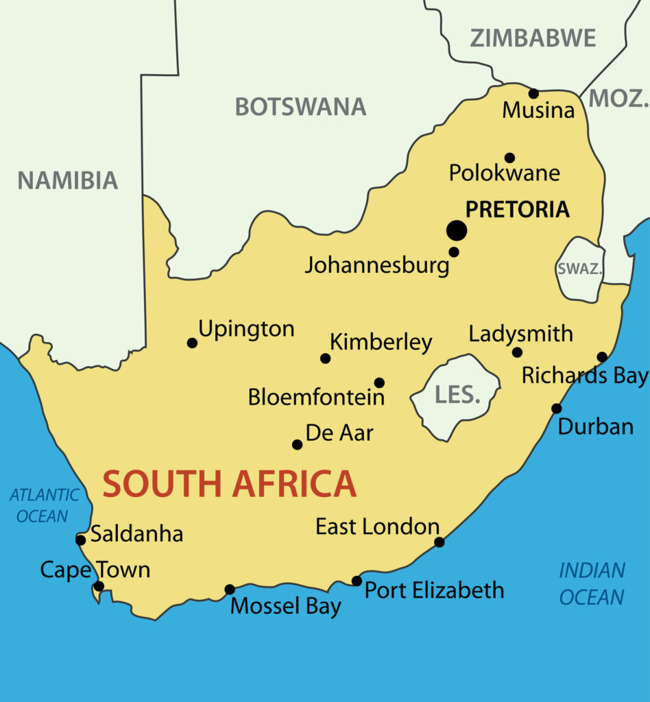
South Africa Map with Rivers and Cities
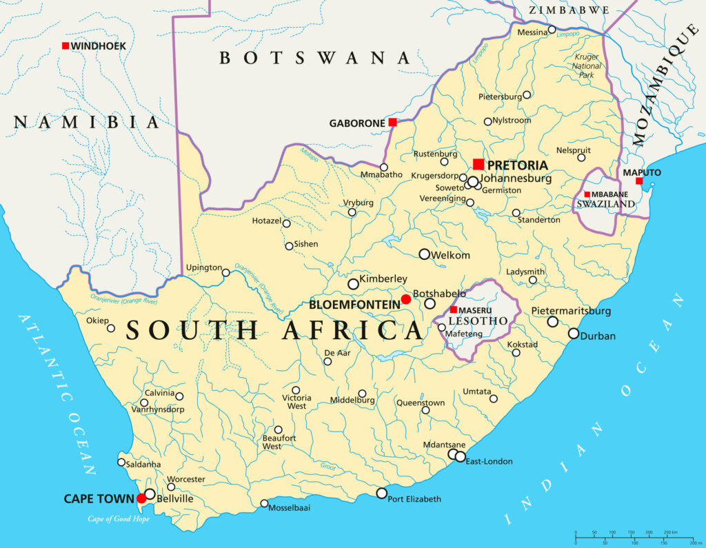
South Africa Main Cities Map
South Africa Road Map
