Oregon, a state celebrated for its stunning natural landscapes and environmental consciousness, includes rugged Pacific coastline, the majestic Cascade Range, and deserts in the Western United States.
Oregon (OR) on the US Map

There are 36 counties in Oregon, each with its unique blend of natural beauty, history, and culture. This post will explore the distinct features and attractions of Oregon’s counties, starting with an Oregon Counties Map that details the borders and major cities in each of Oregon’s largest administrative divisions.
Map of Oregon Counties
Below is a map of the 36 counties of Oregon (you can click on the map to enlarge it and to see the major city in each county).
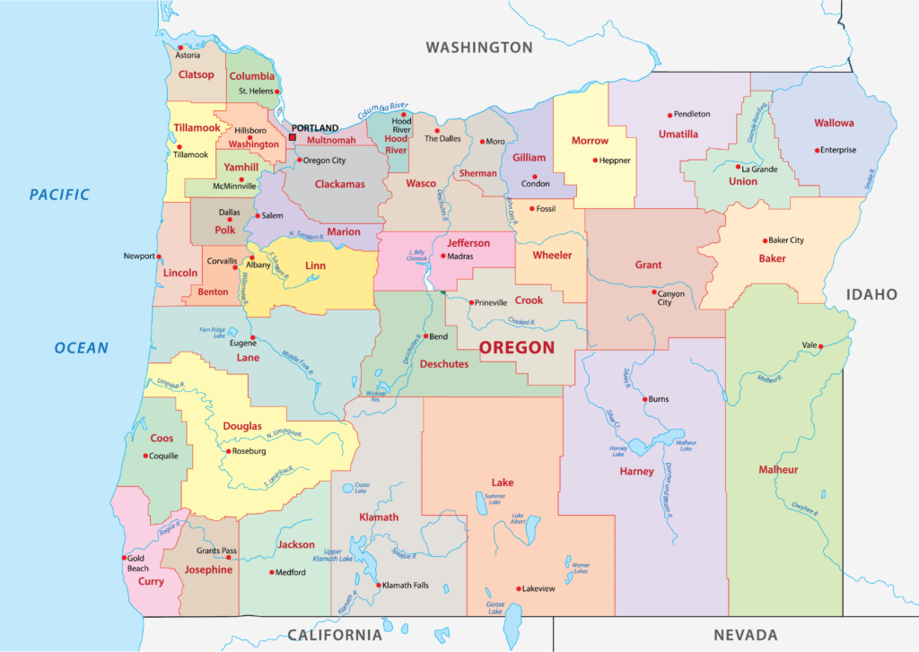
Interactive Map of Oregon Counties
Click on any of the counties on the map to see its population, economic data, time zone, and zip code (the data will appear below the map). Data is sourced from the US Census 2021.
List of the Counties of Oregon:
| County | Population | Per sq. km | Largest City |
|---|---|---|---|
| Baker County | 16,539 | 2.08 | Baker City |
| Benton County | 94,667 | 54.13 | Albany |
| Clackamas County | 418,577 | 86.39 | Portland |
| Clatsop County | 40,720 | 18.99 | Astoria |
| Columbia County | 52,381 | 30.7 | St. Helens |
| Coos County | 64,619 | 15.63 | Coos Bay |
| Crook County | 24,300 | 3.15 | Prineville |
| Curry County | 23,234 | 5.51 | Brookings |
| Deschutes County | 194,964 | 24.95 | Bend |
| Douglas County | 110,680 | 8.49 | Roseburg |
| Gilliam County | 1,954 | 0.63 | Condon |
| Grant County | 7,225 | 0.62 | John Day |
| Harney County | 7,454 | 0.28 | Burns |
| Hood River County | 23,915 | 17.69 | Hood River |
| Jackson County | 221,662 | 30.75 | Medford |
| Jefferson County | 24,232 | 5.25 | Madras |
| Josephine County | 87,686 | 20.66 | Grants Pass |
| Klamath County | 68,899 | 4.47 | Klamath Falls |
| Lake County | 8,119 | 0.39 | Lakeview |
| Lane County | 380,532 | 32.26 | Eugene |
| Lincoln County | 49,866 | 19.63 | Newport |
| Linn County | 127,200 | 21.45 | Albany |
| Malheur County | 31,313 | 1.22 | Ontario |
| Marion County | 344,037 | 112.47 | Salem |
| Morrow County | 11,964 | 2.27 | Boardman |
| Multnomah County | 810,011 | 725.42 | Portland |
| Polk County | 86,347 | 45 | Salem |
| Sherman County | 1,784 | 0.84 | Wasco |
| Tillamook County | 27,129 | 9.5 | Tillamook |
| Umatilla County | 79,509 | 9.55 | Hermiston |
| Union County | 26,255 | 4.98 | La Grande |
| Wallowa County | 7,330 | 0.9 | Enterprise |
| Wasco County | 26,603 | 4.31 | The Dalles |
| Washington County | 596,969 | 318.24 | Portland |
| Wheeler County | 1,477 | 0.33 | Fossil |
| Yamhill County | 107,024 | 57.72 | McMinnville |
Largest Counties in Oregon by Population
Multnomah County
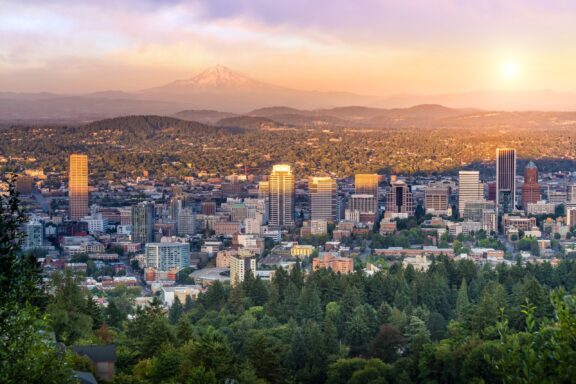
Multnomah County, established in 1854, is the most populous county in Oregon, encompassing Portland, the state’s largest city and cultural hub. The county is renowned for its vibrant arts scene, extensive park systems, and environmental initiatives. Portland’s downtown area features landmarks such as the Portland Art Museum, the historic Powell’s City of Books, and the riverfront Willamette Park.
The county is also home to several higher education institutions, including Portland State University, contributing to the area’s dynamic and innovative atmosphere. Multnomah County’s commitment to sustainability is evident in its urban planning and public transportation system, including the MAX Light Rail and numerous bike paths.
Natural beauty surrounds and permeates the county, with attractions like the Columbia River Gorge and Multnomah Falls offering hiking, sightseeing, and outdoor recreation just a short drive from the city center.
Washington County
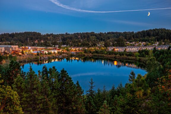
Washington County, created in 1843, is situated to the west of Portland, Oregon, and stands as one of the state’s most populous and economically vibrant counties. Home to cities like Beaverton and Hillsboro, the county is a key player in the “Silicon Forest”, hosting numerous technology companies and startups, notably Intel, which significantly contributes to the region’s economy and innovation landscape.
The county offers a mix of urban and rural experiences, with the Tualatin Valley providing fertile ground for vineyards and agriculture, contributing to Oregon’s renowned wine industry. Cultural attractions enrich the area, such as the Five Oaks Museum, which explores the region’s diverse histories and communities.
Washington County also features extensive park systems and natural areas, including the Tualatin Hills Nature Park and the Banks-Vernonia State Trail, catering to outdoor enthusiasts with miles of trails for hiking, biking, and equestrian use.
Clackamas County
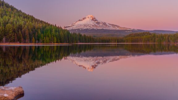
Clackamas County, established in 1843, is located to the southeast of Portland, encompassing urban centers like Lake Oswego and Oregon City as well as the forested slopes of Mount Hood. Oregon City, the county seat, holds the distinction of being the end of the Oregon Trail and the state’s first capital, featuring historic sites such as the End of the Oregon Trail Interpretive Center and the Museum of the Oregon Territory.
The county is a haven for outdoor activities, with Mount Hood offering skiing and snowboarding in the winter and hiking and camping during the warmer months. The Clackamas River, winding through the county, is popular for fishing, kayaking, and white-water rafting, providing ample recreational opportunities.
Agriculture plays a significant role in the county’s economy, with fertile lands producing a variety of crops, including Christmas trees, which Clackamas County is known for nationally. The county’s diverse economy and lifestyle options, from the urban amenities of its cities to the natural beauty and outdoor activities in its rural areas, contribute to its appeal.
Lane County
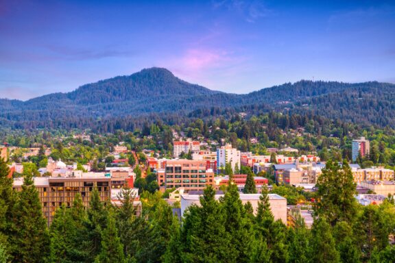
Lane County was established in 1851 and is located in western Oregon with Eugene as its county seat. Eugene is known for its outdoor recreation, arts, and as the home of the University of Oregon. The county stretches from the Pacific Ocean to the Cascade Mountains, encompassing a wide variety of ecosystems, including the stunning Oregon Dunes National Recreation Area along the coast.
The McKenzie River, flowing through the county, offers world-class fishing, whitewater rafting, and scenic beauty. Lane County’s diverse landscape supports a range of outdoor activities such as hiking in the Cascades, exploring the numerous wineries in the Willamette Valley, and enjoying the arts and cultural events in Eugene.
Eugene’s vibrant downtown is filled with unique shops, restaurants, and galleries, alongside green spaces like Alton Baker Park. The city hosts the Oregon Bach Festival and the Eugene Saturday Market, the oldest weekly open-air crafts market in the United States.
Smallest Counties in Oregon by Population
Wheeler County
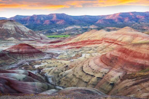
Wheeler County, established in 1899, is located in central Oregon and stands as one of the state’s least populous counties. Fossil, the county seat, embodies the essence of small-town charm and serves as a gateway to the region’s natural wonders and prehistoric past. The county is named for Henry Wheeler who operated the first stage route through the county.
The landscape of Wheeler County is marked by the Painted Hills, part of the John Day Fossil Beds National Monument, renowned for their striking layers of red, tan, orange, and black soils. These hills offer spectacular photography opportunities and insights into the geological history of the area.
Outdoor activities in Wheeler County include hiking, fishing, and exploring the rugged beauty of the Oregon badlands.
Sherman County
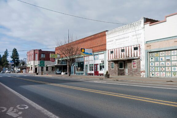
Sherman County, established in 1889, is nestled in the scenic Columbia River Gorge in north-central Oregon. Moro, the county seat, exemplifies the agricultural heritage and tight-knit community spirit of the area. Sherman County’s landscape is characterized by rolling wheat fields and wind turbines, highlighting its role in both traditional farming and renewable energy production.
The county’s location along the Columbia River makes it a prime spot for windsurfing, kiteboarding, and fishing, attracting outdoor enthusiasts from across the region. The Sherman County Historical Museum in Moro offers visitors a look into the pioneer days, agricultural development, and the community life of the area.
Sherman County also benefits from stunning natural views of the Columbia River Gorge, providing picturesque vistas and opportunities for photography. The county’s commitment to preserving its agricultural roots while embracing sustainable energy solutions marks it as a unique blend of the old and new.
Gilliam County
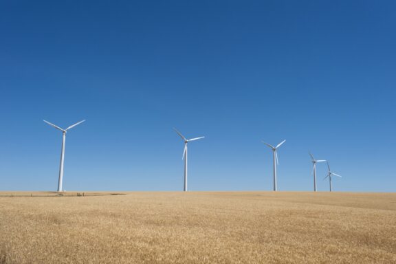
Gilliam County, created in 1885, is situated in north-central Oregon, characterized by its vast, rolling hills and strong agricultural economy, primarily wheat and cattle farming.
Condon, the county seat, offers a glimpse into Oregon’s rural life with its historic buildings and community-focused atmosphere. The county is also a leader in renewable energy, hosting several wind farms that take advantage of its windy landscape.
Significant for its contributions to Oregon’s energy sector and agriculture, Gilliam County is exploring innovations in sustainability and technology. Attractions like the John Day River provide recreational opportunities, including boating and fishing, amidst the serene backdrop of the county’s natural environment.
More Notable Counties in Oregon
Deschutes County
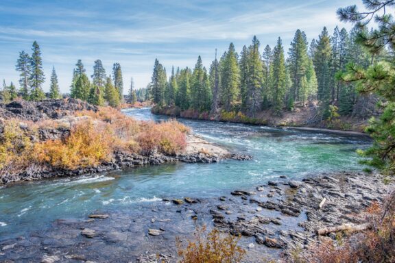
Deschutes County, established in 1916, is located in the heart of central Oregon and is one of the state’s fastest-growing areas.
Bend, the largest city and county seat, is a recreational haven known for its outdoor sports and activities, including mountain biking, skiing at Mount Bachelor, and numerous hiking trails throughout the Deschutes National Forest. The area’s natural beauty is complemented by the Deschutes River, a focal point for fishing, whitewater rafting, and leisurely floats.
The county also boasts a vibrant craft brewing industry, with Bend having one of the highest per capita rates of breweries in the country, making it a destination for beer enthusiasts. The cultural scene in Deschutes County is robust, featuring art galleries, theaters, and music venues that host a variety of events and festivals year-round.
Bend’s historic downtown area offers shopping, dining, and entertainment, blending the charm of small-town life with the amenities of a larger city. Deschutes County’s blend of natural beauty, recreational opportunities, and cultural richness makes it a dynamic and appealing place to live, work, and visit.
Jackson County
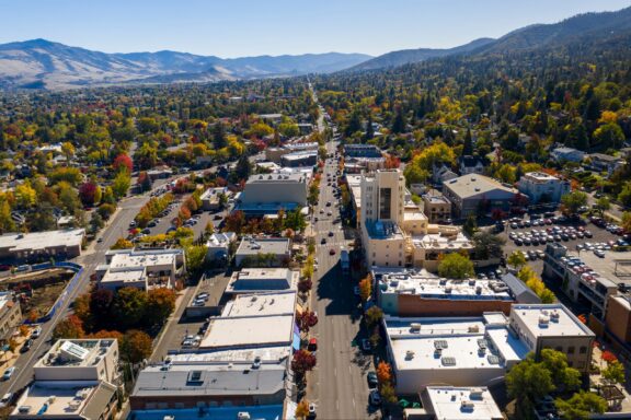
Jackson County, established in 1852, is situated in southern Oregon, with Medford as its county seat. The county is home to the renowned Oregon Shakespeare Festival in Ashland, attracting theater enthusiasts from around the globe. Ashland’s Lithia Park, with its sprawling landscapes and trails, adds to the city’s appeal.
Crater Lake National Park, partially located in Jackson County, draws visitors with its stunning blue water and dramatic caldera. The Rogue River, flowing through the county, offers opportunities for whitewater rafting and fishing, appealing to adventure seekers.
Medford and its surrounding areas are recognized for their wine production, contributing to Oregon’s reputation as a premier wine region. The county’s diverse geography, from the Siskiyou Mountains to the Rogue Valley, supports a variety of outdoor activities year-round.
Josephine County
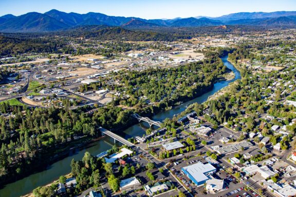
Josephine County, established in 1856, is nestled in southwestern Oregon with Grants Pass as its county seat. This region is celebrated for the Rogue River, renowned for its whitewater rafting and scenic beauty. The Illinois River, a tributary of the Rogue, offers additional recreational opportunities and is a key feature of the county’s landscape.
The Oregon Caves National Monument, located within the county, presents a remarkable marble cave system that attracts visitors for tours through its intricate underground passages. Grants Pass, known for its motto “It’s the Climate,” boasts a vibrant downtown with local boutiques, restaurants, and the historic Rogue Theatre, hosting a variety of live performances and events.
Josephine County’s commitment to preserving its natural and cultural resources is evident in community events like the Josephine County Fair, showcasing the county’s spirit and natural beauty.
Lincoln County
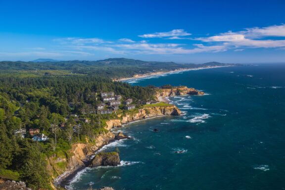
Lincoln County, established in 1893, stretches along the central Oregon Coast, offering a stunning interface between the Pacific Ocean and the forested coastline.
Newport, the county seat, is a key cultural and economic hub, known for its historic bayfront, bustling with shops, galleries, and seafood restaurants. The city is also home to the Oregon Coast Aquarium and the Hatfield Marine Science Center, an important center of marine research and education.
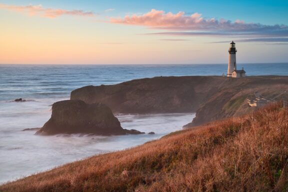
The iconic Yaquina Head Lighthouse, standing guard over the coastline, provides visitors with breathtaking views and a glimpse into maritime history. Lincoln County’s beaches, such as those at Lincoln City, are popular for kite flying, beachcombing, and surfing, drawing visitors throughout the year.
Whale-watching tours and deep-sea fishing expeditions embark from Depoe Bay, offering encounters with the Pacific’s marine life. Lincoln County’s rich natural habitats, cultural attractions, and commitment to marine conservation contribute significantly to Oregon’s coastal allure.
Douglas County
Douglas County, formed in 1852, is located in southwestern Oregon, characterized by its diverse landscapes that range from the Pacific Coast to the Cascade Mountains. The county seat, Roseburg, is nestled in the Umpqua River Valley, an area known for its timber industry history and as a gateway to outdoor adventures.
Douglas County is renowned for the Umpqua River, famous for steelhead fishing and its scenic beauty. The region also boasts the Umpqua National Forest, offering miles of hiking trails, waterfalls, and camping sites.
Wine enthusiasts are drawn to Douglas County for its part of the Umpqua Valley wine region, home to numerous wineries and vineyards that take advantage of the valley’s favorable climate and soil conditions for producing a variety of high-quality wines.
The county’s commitment to preserving its natural landscapes and promoting outdoor and cultural tourism makes it a notable destination for those seeking to explore Oregon’s natural beauty and agricultural bounty.
More About Counties in Oregon: FAQs
Which Oregon county has the youngest population?
Benton County typically has the youngest population in Oregon, largely due to the presence of Oregon State University in Corvallis.
Which county in Oregon has the lowest cost of living?
Malheur County, located in southeastern Oregon, has the lowest cost of living in the state.
Which Oregon county has the largest area?
Harney County is the largest by area in Oregon, covering a vast expanse of high desert, forests, and mountains over 10,135 square miles (26,250 km2).
Which Oregon county has a significant Native American reservation?
Jefferson County has the largest population of American Indian and Alaska Native residents. The county is home to the Warm Springs Reservation.
What county in Oregon produces the most wine?
Yamhill County is renowned for its wine production, hosting a significant number of vineyards and wineries in the Willamette Valley, known especially for its Pinot Noir.
Image Sources and Copyright Information
- Sunset Over Downtown Portland, Oregon with Mount Hood in the Background: © f11photo/Shutterstock
- Twilight Reflections at Progress Lake in Beaverton, Oregon: © Kushal Bose/Shutterstock
- Sunset Glow on Mount Hood Reflected in the Calm Waters of Trillium Lake: © Pugalenthi Iniabarathi/Shutterstock
- Dusk Over Eugene: A Panoramic View of the Cityscape with Lush Greenery and Rolling Hills: © Sean Pavone/Shutterstock
- Colorful Strata of the Painted Hills at Sunset in John Day Fossil Beds National Monument, Wheeler County: © Galyna Andrushko/Shutterstock
- Small Town Main Street in Moro, Oregon, USA: © Gary L. Quay/Shutterstock
- Wind Turbines Standing Tall in a Golden Wheat Field Under a Clear Blue Sky: © VCNW/Shutterstock
- Scenic View of Deschutes River with Hiking Trail in Deschutes County: © Wirestock Creators/Shutterstock
- Aerial View of a Tree-Lined Street in Ashland, Oregon with Surrounding Buildings and Mountains in the Distance: © Ahturner/Shutterstock
- Aerial View of a Bustling Town with River and Bridges Surrounded by Lush Greenery and Mountains in the Distance: © Bob Pool/Shutterstock
- Scenic Coastal View with Basalt Outcroppings and Lush Greenery: © Bob Pool/Shutterstock
- Sunset at Yaquina Head Lighthouse in Oregon with Coastal Cliffs and Ocean Waves: © Luis Boucault/Shutterstock