Found in the Southeastern United States, North Carolina is a state of striking natural beauty, rich history, and diverse cultures. From the majestic Appalachian Mountains in the west to the serene beaches of the Outer Banks in the east, North Carolina offers a wide array of landscapes and experiences.
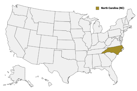
North Carolina (NC) on the US Map
There are 100 counties in North Carolina, each with its own unique character, including bustling urban centers like Charlotte and Raleigh in Mecklenburg and Wake Counties, in addition to the tranquil, rural charm found in counties like Tyrrell and Hyde.
This post will explore the distinctive features of North Carolina’s counties, shedding light on the historical landmarks, natural wonders, and cultural identities that define them. We’ll start with a color-coded North Carolina Counties Map that shows the borders and major cities of each county.
Map of North Carolina Counties
Below is a map of the 100 counties of North Carolina (you can click on the map to enlarge it and to see the major city in each county).

Interactive Map of North Carolina Counties
Click on any of the counties on the map to see its population, economic data, time zone, and zip code (the data will appear below the map). Data is sourced from the US Census 2021.
List of the Counties of North Carolina:
| County | Population | Per sq. km | Largest City |
|---|---|---|---|
| Alamance County | 169,185 | 154.26 | Burlington |
| Alexander County | 36,491 | 54.19 | Bethlehem |
| Alleghany County | 10,910 | 17.94 | Sparta |
| Anson County | 22,388 | 16.26 | Wadesboro |
| Ashe County | 26,598 | 24.09 | Jefferson |
| Avery County | 17,747 | 27.7 | Banner Elk |
| Beaufort County | 44,898 | 20.82 | Washington |
| Bertie County | 18,105 | 10 | Windsor |
| Bladen County | 30,105 | 13.28 | Elizabethtown |
| Brunswick County | 133,789 | 60.77 | Leland |
| Buncombe County | 266,981 | 157.02 | Asheville |
| Burke County | 87,829 | 66.99 | Hickory |
| Cabarrus County | 221,200 | 236.43 | Concord |
| Caldwell County | 80,705 | 66.03 | Hickory |
| Camden County | 10,353 | 16.63 | Elizabeth City |
| Carteret County | 67,944 | 51.68 | Morehead City |
| Caswell County | 22,785 | 20.68 | Yanceyville |
| Catawba County | 159,852 | 153.77 | Hickory |
| Chatham County | 75,070 | 42.52 | Cary |
| Cherokee County | 28,515 | 24.17 | Andrews |
| Chowan County | 13,796 | 30.85 | Edenton |
| Clay County | 10,997 | 19.75 | Hayesville |
| Cleveland County | 98,898 | 82.25 | Shelby |
| Columbus County | 51,474 | 21.19 | Whiteville |
| Craven County | 101,405 | 55.41 | New Bern |
| Cumberland County | 333,582 | 197.37 | Fayetteville |
| Currituck County | 27,575 | 40.65 | Moyock |
| Dare County | 36,718 | 36.99 | Kill Devil Hills |
| Davidson County | 168,002 | 117.26 | High Point |
| Davie County | 42,543 | 62.29 | Mocksville |
| Duplin County | 49,836 | 23.62 | Wallace |
| Durham County | 320,146 | 431.29 | Raleigh |
| Edgecombe County | 49,609 | 37.9 | Rocky Mount |
| Forsyth County | 380,583 | 360.29 | Winston-Salem |
| Franklin County | 67,598 | 53.07 | Wake Forest |
| Gaston County | 226,097 | 245.39 | Gastonia |
| Gates County | 10,584 | 12 | Gatesville |
| Graham County | 8,089 | 10.7 | Robbinsville |
| Granville County | 60,854 | 44.17 | Oxford |
| Greene County | 20,524 | 29.71 | Snow Hill |
| Guilford County | 537,113 | 321.06 | Greensboro |
| Halifax County | 49,291 | 26.3 | Roanoke Rapids |
| Harnett County | 133,074 | 86.36 | Anderson Creek |
| Haywood County | 61,695 | 43.03 | Waynesville |
| Henderson County | 115,613 | 119.69 | Hendersonville |
| Hertford County | 22,010 | 24.06 | Ahoskie |
| Hoke County | 52,169 | 51.63 | Raeford |
| Hyde County | 4,697 | 2.96 | Ocracoke |
| Iredell County | 183,965 | 123.65 | Mooresville |
| Jackson County | 42,983 | 33.79 | Cullowhee |
| Johnston County | 211,320 | 103.02 | Clayton |
| Jones County | 9,326 | 7.64 | Maysville |
| Lee County | 62,676 | 94.88 | Sanford |
| Lenoir County | 55,344 | 53.54 | Kinston |
| Lincoln County | 85,670 | 111.81 | Lincolnton |
| Macon County | 36,532 | 27.36 | Franklin |
| Madison County | 21,269 | 18.26 | Mars Hill |
| Martin County | 22,213 | 18.79 | Williamston |
| McDowell County | 44,527 | 39.08 | Marion |
| Mecklenburg County | 1,100,984 | 811.86 | Charlotte |
| Mitchell County | 14,951 | 26.09 | Spruce Pine |
| Montgomery County | 25,891 | 20.34 | Biscoe |
| Moore County | 98,618 | 54.58 | Pinehurst |
| Nash County | 94,628 | 67.6 | Rocky Mount |
| New Hanover County | 225,175 | 452.22 | Wilmington |
| Northampton County | 17,917 | 12.89 | Garysburg |
| Onslow County | 201,597 | 102.14 | Jacksonville |
| Orange County | 147,376 | 143.13 | Chapel Hill |
| Pamlico County | 12,293 | 14.1 | Bayboro |
| Pasquotank County | 40,240 | 68.48 | Elizabeth City |
| Pender County | 59,964 | 26.57 | Hampstead |
| Perquimans County | 13,002 | 20.31 | Hertford |
| Person County | 38,999 | 38.38 | Roxboro |
| Pitt County | 170,600 | 100.97 | Greenville |
| Polk County | 19,413 | 31.53 | Tryon |
| Randolph County | 143,735 | 70.94 | High Point |
| Richmond County | 43,301 | 35.29 | Rockingham |
| Robeson County | 118,836 | 48.44 | Lumberton |
| Rockingham County | 90,903 | 62.05 | Eden |
| Rowan County | 145,784 | 110.02 | Kannapolis |
| Rutherford County | 64,592 | 44.11 | Forest City |
| Sampson County | 59,468 | 24.27 | Clinton |
| Scotland County | 34,345 | 41.55 | Laurinburg |
| Stanly County | 62,148 | 60.74 | Albemarle |
| Stokes County | 44,588 | 38.31 | King |
| Surry County | 71,439 | 51.78 | Mount Airy |
| Swain County | 14,166 | 10.36 | Cherokee |
| Transylvania County | 32,979 | 33.65 | Brevard |
| Tyrrell County | 3,436 | 3.39 | Columbia |
| Union County | 235,699 | 143.83 | Indian Trail |
| Vance County | 42,650 | 65.24 | Henderson |
| Wake County | 1,112,883 | 514.83 | Raleigh |
| Warren County | 18,889 | 16.98 | Norlina |
| Washington County | 11,183 | 12.46 | Plymouth |
| Watauga County | 54,077 | 66.83 | Boone |
| Wayne County | 117,692 | 82.04 | Goldsboro |
| Wilkes County | 66,335 | 33.98 | North Wilkesboro |
| Wilson County | 78,844 | 82.82 | Wilson |
| Yadkin County | 37,198 | 42.88 | Yadkinville |
| Yancey County | 18,357 | 22.67 | Burnsville |
Biggest Counties in North Carolina by Population
Wake County

Wake County is the most populous county in North Carolina. It was established in 1771 and named after Margaret Wake, the wife of colonial Governor William Tryon. Centered around Raleigh, the state capital and county seat, Wake County is a hub of political activity, education, and technology.
The county is home to North Carolina State University and part of the Research Triangle Park, one of the country’s largest and most successful research parks, contributing to its role as a leader in innovation and education.
Raleigh’s vibrant cultural scene includes the North Carolina Museum of Art, the North Carolina Museum of Natural Sciences, and a thriving music and nightlife scene. The county’s growth is also reflected in its diverse communities, with Cary, Apex, and Wake Forest being notable towns that combine suburban living with easy access to urban amenities.
Mecklenburg County

Mecklenburg County, established in 1762, is named after the German region of Mecklenburg. It centers around Charlotte, North Carolina’s largest city and the county seat. Charlotte is a major financial hub, home to Bank of America’s headquarters and Wells Fargo’s east coast operations, making it the second-largest banking center in the United States.
The county boasts a rich cultural scene, with institutions such as the Mint Museum, the Bechtler Museum of Modern Art, and the Blumenthal Performing Arts Center. Additionally, the NASCAR Hall of Fame in Charlotte highlights the region’s deep connection to motorsports, a significant aspect of its cultural identity.
Mecklenburg County is also home to several higher education institutions, including the University of North Carolina at Charlotte, further enriching its vibrant community. The county’s extensive park system, including Freedom Park and the Little Sugar Creek Greenway, provides ample outdoor recreational opportunities for residents and visitors.
Guilford County

Guilford County, established in 1771, is named after the Battle of Guilford Court House, a pivotal engagement in the American Revolutionary War. Greensboro, the largest city and county seat, plays a central role in the region’s economy and culture. High Point, another major city within the county, is internationally recognized for its semi-annual High Point Market, the largest home furnishings industry trade show in the world.
The county is also home to several institutions of higher learning, including the University of North Carolina at Greensboro and Guilford College, contributing to a vibrant academic community. The International Civil Rights Center & Museum, located in Greensboro, offers a profound look into the civil rights movement, marking the site of the 1960 Woolworth sit-ins.
Outdoor activities abound in Guilford County, with numerous parks and the Greensboro Arboretum offering green spaces for relaxation and recreation.
Forsyth County

Forsyth County, established in 1849, is centered around Winston-Salem, known for its strong ties to the tobacco industry and as the birthplace of notable companies like R.J. Reynolds Tobacco and Krispy Kreme Doughnuts. It’s also the county seat.
Winston-Salem is celebrated for its dedication to the arts and innovation, housing the University of North Carolina School of the Arts and the Innovation Quarter, a research and business park focused on biomedical research, information technology, and clinical services.
Historically, Forsyth County has played a significant role in the Moravian Church in America, with Old Salem Museums & Gardens offering a living history experience that explores Moravian culture and Southern life. The Reynolda House Museum of American Art showcases American art in a historic mansion setting.
Winston-Salem’s revitalized downtown area features a mix of art galleries, shops, restaurants, and entertainment venues, reflecting the city’s ongoing growth and development.
Cumberland County

Cumberland County, established in 1754, is named after Prince William, the Duke of Cumberland. Its county seat, Fayetteville, is a city with rich historical significance and a strong military presence, home to Fort Liberty, one of the largest military installations in the world.
Fayetteville offers various historical sites, including the Airborne & Special Operations Museum, which provides an in-depth look at the history of airborne and special operations forces. The city also features the Cape Fear Botanical Garden, showcasing the natural beauty of the region with themed gardens and walking trails.
The community in Cumberland County is closely tied to the military, with many residents connected to Fort Liberty. This relationship has fostered a diverse and supportive community atmosphere.
Smallest Counties in North Carolina by Population
Tyrrell County

Tyrrell County, established in 1729, is the least populous county in North Carolina, offering a glimpse into the state’s vast natural landscapes and rich biodiversity. Located in the eastern part of the state, its county seat, Columbia, serves as a gateway to the unique ecosystems of the region.
Tyrrell County is encompassed by the Albemarle-Pamlico Peninsula, characterized by its extensive wetlands, including parts of the Alligator River National Wildlife Refuge and the Pocosin Lakes National Wildlife Refuge.
These protected areas are critical habitats for a wide variety of wildlife, including black bears, red wolves, and migratory birds, making the county a prime location for nature enthusiasts and wildlife photographers. The county’s economy is closely tied to its natural resources, with forestry, agriculture, and commercial fishing playing significant roles.
Hyde County

Hyde County, established in 1705, is located in eastern North Carolina and is known for its expansive natural beauty and remote landscapes. The county seat, Swan Quarter, offers a quiet, rural setting that reflects the county’s laid-back lifestyle.
Hyde County includes significant portions of the Pamlico Sound and is home to the Lake Mattamuskeet National Wildlife Refuge, the largest natural freshwater lake in North Carolina, which attracts birdwatchers and nature enthusiasts for its abundant wildlife and migratory waterfowl.
A major highlight of Hyde County is Ocracoke Island, accessible only by ferry, plane, or private boat. Ocracoke is part of the Outer Banks and is famed for its picturesque village, pristine beaches, and the Ocracoke Lighthouse, one of the oldest operating lighthouses in the United States. The island’s rich history, including tales of Blackbeard the pirate, adds to its allure.
Graham County

Graham County, established in 1872, is nestled in the rugged mountains of western North Carolina. Its county seat, Robbinsville, is a gateway to outdoor adventures and breathtaking natural beauty.
The county is renowned for its portion of the Nantahala National Forest, offering extensive trails, whitewater rivers, and scenic drives, including the Cherohala Skyway and Tail of the Dragon, which are popular with motorcyclists and driving enthusiasts for their stunning views and challenging curves.
Graham County is also home to the Fontana Dam, the tallest dam in the Eastern United States, providing spectacular views and recreational opportunities around Fontana Lake. The county’s rich Appalachian culture and history are preserved in its traditions and hospitality, offering a glimpse into the heritage of western North Carolina.
Jones County

Jones County, established in 1779, is located in eastern North Carolina and is characterized by its rural landscape and rich agricultural heritage. The county seat, Trenton, is a small town emblematic of the county’s quiet, agrarian lifestyle.
Jones County is part of the Inner Banks region and is bordered by the Trent and White Oak rivers, which provide natural resources and recreational opportunities for fishing and boating enthusiasts.
The county’s economy is largely based on farming, with crops such as tobacco, corn, and soybeans being significant. Jones County also places a strong emphasis on conservation, with areas like the Croatan National Forest partially within its borders, offering habitats for diverse wildlife and a variety of outdoor activities, including hiking, camping, and bird watching.
Despite its small population, Jones County maintains a close-knit community atmosphere, with annual events, such as the Jones County Heritage Festival, that bring residents together to celebrate their local culture and traditions.
More Notable Counties in North Carolina
Buncombe County

Buncombe County, established in 1791, is nestled in the Blue Ridge Mountains of western North Carolina. Asheville, the county seat, is celebrated for its vibrant arts scene, historic architecture, and the Biltmore Estate, America’s largest private home.
The city is also a culinary hotspot, known for its farm-to-table restaurants and a thriving craft beer industry, boasting more breweries per capita than any U.S. city.
The county’s natural beauty is a draw for outdoor enthusiasts, with the Blue Ridge Parkway offering panoramic views, hiking trails, and waterfalls. The surrounding mountains provide opportunities for outdoor activities year-round, from hiking and mountain biking in warmer months to skiing and snowboarding in winter.
Buncombe County’s blend of cultural richness, historic significance, and natural beauty makes it a distinctive and appealing destination in North Carolina, attracting visitors and new residents alike with its unique charm and diverse offerings.
Dare County

Dare County, established in 1870, is located on the Outer Banks of North Carolina, a region famous for its expansive beaches, historic sites, and national parks. The county seat, Manteo, is situated on Roanoke Island, known for the “Lost Colony,” one of the first English settlements in the New World.
Dare County is home to the Wright Brothers National Memorial in Kill Devil Hills, commemorating the site of the world’s first controlled-powered flight. The Cape Hatteras National Seashore, with its iconic lighthouse, offers miles of pristine shoreline, attracting visitors for its natural beauty and recreational activities like fishing, surfing, and kiteboarding.
Additionally, the county encompasses parts of the Pea Island National Wildlife Refuge, a haven for bird watchers and nature enthusiasts. Dare County’s unique geographical location, rich history, and commitment to preserving its natural landscapes and historical sites make it a notable and attractive area for both tourism and residence within North Carolina.
New Hanover County

New Hanover County, established in 1729, is located in southeastern North Carolina with Wilmington as its county seat.
Wilmington, a historic port city, is known for its scenic Riverwalk, vibrant arts and culture scene, and significant contributions to the film and television industry, earning it the nickname “Hollywood of the East.” The city’s historic downtown is rich with architecture from the Victorian era, bustling with shops, restaurants, and galleries.
The county also features Wrightsville Beach, a popular destination for water sports, sunbathing, and its accessible beachfront. New Hanover County plays a pivotal role in maritime commerce and education, hosting the University of North Carolina Wilmington.
Orange County

Orange County, founded in 1752, is located in the central part of North Carolina, with Hillsborough as its county seat.
This county is renowned for its educational institutions, notably the University of North Carolina at Chapel Hill, the nation’s first public university. Chapel Hill, along with Carrboro and Hillsborough, forms a trio of vibrant communities known for their rich arts scene, diverse culinary offerings, and progressive spirit.
The area is steeped in history, evident in sites like the Historic Hillsborough District, which offers a well-preserved look into early American life. Orange County is also home to the Morehead Planetarium and Science Center, one of the oldest and largest planetariums in the United States, where astronauts were once trained in celestial navigation.
Outdoor enthusiasts enjoy the extensive network of trails and parks, including the Eno River State Park, which provides a natural retreat with its hiking trails and scenic river views.
Watauga County

Watauga County, formed in 1849, is located in the High Country of northwestern North Carolina, with Boone as its county seat. This area is distinguished by its mountainous terrain, offering a variety of outdoor recreational opportunities that include hiking, skiing, and snowboarding.
Boone is also home to Appalachian State University, which injects a youthful energy and academic presence into the county, contributing to its vibrant community and cultural activities.
The county is a gateway to the Blue Ridge Parkway, renowned for its breathtaking scenic beauty and access to numerous trails and overlooks. In winter, Watauga County becomes a destination for snow sports enthusiasts, with resorts like Appalachian Ski Mountain providing slopes for all skill levels.
The town of Blowing Rock, another key community in Watauga County, offers unique shops, dining, and the Blowing Rock, a natural formation with sweeping views of the surrounding forests and mountains.
More About Counties in North Carolina: FAQs
What is the highest point in North Carolina, and which county is it in?
Mount Mitchell, with an elevation of 6,684 feet (2,037 km), is the highest point in North Carolina and East of the Mississippi River. It’s located in Yancey County.
Which North Carolina county is the largest by area?
Robeson County is the largest by area in North Carolina, covering 949 sq mi (2,459 km2) in total area.
Which county in North Carolina has the most significant Native American population?
Robeson County has the most significant Native American population, primarily from the Lumbee tribe.
What is the oldest town in North Carolina, and in which county is it located?
Bath, the oldest town in North Carolina, is located in Beaufort County.
What is the most affordable county in North Carolina?
In 2023, the most affordable county in North Carolina was Bladen County, closely followed by Bertie County.

- Aerial View of Raleigh, North Carolina Skyline — © Mihai_Andritoiu/Shutterstock
- Downtown Charlotte Skyline in Mecklenburg County, North Carolina — © Kevin Ruck/Shutterstock
- Aerial View of Downtown Greensboro, North Carolina with Clear Skies — © Kevin Ruck/Shutterstock
- Dusk Skyline of Winston-Salem, North Carolina with Colorful Clouds — © Sean Pavone/Shutterstock
- Old Town Hall with Historical Marker in Cumberland County, Fayetteville — © refrina/Shutterstock
- Sunrise Over Alligator River with Pier and Rock Jetty in Tyrrell County, North Carolina — © JMY Photography/Shutterstock
- Aerial View of Ocracoke Lighthouse and Surrounding Village at Dusk — © Chansak Joe/Shutterstock
- Serene Waterfall Amidst Lush Greenery — © MarksPursuit/Shutterstock
- Serene Tidal Marsh Landscape in Jones County on a Quiet Morning — © Ryan McGurl/Shutterstock
- Majestic Estate with Lush Green Lawns and Mountain Backdrop — © Bob Pool/Shutterstock
- Serene Sunrise at Bodie Island Lighthouse in Dare County, North Carolina — © MarkVanDykePhotography/Shutterstock
- Aerial View of Wilmington, North Carolina at Dusk — © Sean Pavone/Shutterstock
- Busy Farmers Market Day in Carrboro, North Carolina — © Wileydoc/Shutterstock
- Sunny Day on a Main Street in a Small Mountain Town — © Nolichuckyjake/Shutterstock