Found in the Northeastern United States, New Hampshire is a state renowned for its landscapes, history, and New England charm. From the rugged beauty of the White Mountains to the serene shores of its lakes, New Hampshire’s natural beauty is as captivating as it is diverse.
The state is celebrated for its role in early American history, being the first to have its own constitution and for hosting the first primary in the U.S. presidential election cycle, reflecting its political significance.
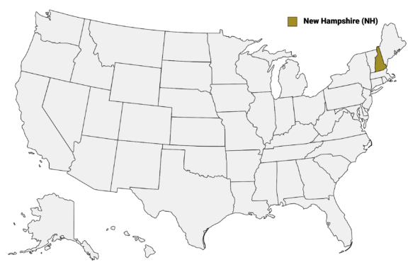
New Hampshire (NH) on the US Map
New Hampshire comprises 10 counties, each with its distinct character and attractions. From the bustling streets of Hillsborough County’s Manchester and Nashua to the tranquil wilderness of Coos County, this post will explore the unique aspects of each county.
We’ll delve into the cultural landmarks, natural beauty, and historical sites that define each of the counties of New Hampshire, starting with a detailed map.
Map of New Hampshire Counties
Below is a map of the 10 counties of New Hampshire (you can click on the map to enlarge it and to see the major city in each county).

Interactive Map of New Hampshire Counties
Click on any of the counties on the map to see its population, economic data, time zone, and zip code (the data will appear below the map). Data is sourced from the US Census 2021.
List of the Counties of New Hampshire:
| County | Population | Per sq. km | Largest City |
|---|---|---|---|
| Belknap County | 63,395 | 60.91 | Laconia |
| Carroll County | 49,961 | 20.7 | Conway |
| Cheshire County | 76,473 | 41.78 | Keene |
| Coos County | 31,360 | 6.75 | Berlin |
| Grafton County | 91,025 | 20.57 | Lebanon |
| Hillsborough County | 420,504 | 185.23 | Nashua |
| Merrimack County | 152,983 | 63.32 | Concord |
| Rockingham County | 312,771 | 173.66 | Portsmouth |
| Strafford County | 130,598 | 137.22 | Dover |
| Sullivan County | 43,105 | 30.94 | Claremont |
Belknap County

Belknap County, established in 1840, is nestled in the heart of New Hampshire’s Lakes Region. The county is named after Dr. Jeremy Belknap, a renowned preacher, historian, and author. Laconia serves as the county seat, known for hosting the annual Laconia Motorcycle Week, one of the largest motorcycle rallies in the world.
The county’s landscape is dominated by its lakes, including Lake Winnipesaukee, the largest lake in New Hampshire, and Lake Winnisquam. These lakes are central to Belknap County’s identity, drawing visitors for boating, fishing, and picturesque lakefront scenery. The region’s natural beauty is complemented by attractions like the Gunstock Mountain Resort, offering year-round activities from skiing to zip-lining.
Belknap County also holds historical significance with sites like the Belknap Mill in Laconia, the oldest unaltered brick textile mill in the United States, now serving as a museum and cultural center.
The county combines the charm of small-town New England with the natural allure of its lakes and mountains, making it a popular destination for tourists and a cherished home for residents.
Carroll County

Carroll County, also established in 1840, is named after Charles Carroll of Carrollton, a signer of the Declaration of Independence. With Ossipee as its county seat, the county is renowned for its stunning natural landscapes, including parts of the White Mountains and the scenic Lakes Region.
Carroll County’s allure lies in its picturesque towns like Wolfeboro, known as “The Oldest Summer Resort in America,” and the charming village of North Conway, a hub for skiing and mountaineering. The county is a haven for outdoor enthusiasts, offering activities from hiking and skiing in the White Mountains to boating and fishing in Lake Winnipesaukee.
Historically, the county has maintained a strong agricultural presence, which still plays a role in its economy and culture. Carroll County’s covered bridges, such as the Honeymoon Bridge in Jackson, add to its quaint New England charm.
The county’s blend of natural beauty, recreational opportunities, and historical sites make it a key destination in New Hampshire’s landscape.
Cheshire County

Cheshire County, one of New Hampshire’s original five counties, was established in 1769 and named after the English county of Cheshire. Keene, the county seat, is known for its picturesque central square and as a cultural center for the Monadnock region, hosting events like the annual Keene Pumpkin Festival.
Cheshire County is characterized by its rolling hills, rural landscapes, and significant portions of the Monadnock region, including Mount Monadnock itself, one of the most climbed mountains in the world. The region’s natural beauty attracts hikers, artists, and nature lovers.
The county also boasts a rich history in manufacturing and industry, with towns like Harrisville and Jaffrey preserving the legacy of New England’s mill towns. The historic architecture, combined with the county’s commitment to arts and education, as seen in institutions like Keene State College and the Marlboro College Graduate School, contribute to Cheshire County’s vibrant community life.
The Ashuelot Covered Bridge in Winchester and the historic Colonial Theatre in Keene add to the county’s charm, reflecting its blend of history, culture, and natural beauty.
Coos County

Coos County, established in 1803, is the northernmost county in New Hampshire, named after the Native American word “Coös,” meaning “dwellers in the pine tree place.” The county seat, Lancaster, epitomizes the serene and rustic charm of New Hampshire’s North Country.
Coos County is renowned for its expansive wilderness, including parts of the White Mountains and the Great North Woods. This vast area offers unparalleled opportunities for outdoor activities such as hiking, skiing, snowmobiling, and fishing, particularly in the White Mountain National Forest and along the Connecticut River.
Berlin, a city within the county, reflects the region’s industrial past, having been a major center for paper and pulp manufacturing. Today, the county is also known for the Mount Washington Auto Road and the Cog Railway, offering unique ways to experience Mount Washington, the highest peak in the Northeast.
The county’s landscape, characterized by its rugged natural beauty and small, close-knit communities, attracts those seeking a quieter pace of life amidst the backdrop of New Hampshire’s scenic wilderness.
Grafton County

Grafton County, established in 1769, is located in the heart of New Hampshire and named after Augustus FitzRoy, 3rd Duke of Grafton. The county seat, North Haverhill, is part of a region rich in natural beauty and New England charm.
Grafton County is home to Dartmouth College in Hanover, one of the Ivy League universities, adding a vibrant cultural and intellectual atmosphere to the county. The presence of Dartmouth-Hitchcock Medical Center also makes the county a hub for healthcare and medical research.
The county encompasses part of the White Mountains, including Franconia Notch State Park, with its iconic Old Man of the Mountain site which collapsed in 2003, and the Appalachian Trail, offering endless opportunities for outdoor activities like hiking, skiing, and leaf-peeping.
Grafton County’s blend of picturesque towns, such as Littleton and Plymouth, and its wealth of outdoor recreational areas, including the scenic Lakes Region, make it a popular destination for tourists and a beloved home for residents. The county’s historical sites, covered bridges, and cultural institutions add depth to its appeal.
Hillsborough County

Hillsborough County, established in 1769, is named after Wills Hill, the Earl of Hillsborough and a British official. As the most populous county in New Hampshire, it includes two of the state’s largest cities, Manchester and Nashua, two major economic and cultural centers.
Manchester, the county seat, is known for its rich industrial history, now transformed into a hub for education, healthcare, and technology. The city’s landmarks, such as the Millyard Museum and the Currier Museum of Art, offer insights into its past and present cultural landscape. Nashua, recognized for its quality of life, boasts a blend of urban amenities and suburban charm.
Hillsborough County is also home to the historic town of Peterborough, the inspiration for Thornton Wilder’s play “Our Town.” The county offers diverse landscapes, from urban settings to rural areas with apple orchards and farms.
As a key location during presidential primaries, the county plays a pivotal role in state politics. Its blend of urban development, historical towns, and scenic beauty makes Hillsborough County a dynamic and significant region in New Hampshire.
Merrimack County

Merrimack County, established in 1823, is named after the Merrimack River, a major waterway in the state. The county seat, Concord, is the capital of New Hampshire and a hub for political and cultural activity. The New Hampshire State House, located in Concord, is the nation’s oldest statehouse in which a legislature still meets in its original chambers.
The county is characterized by a mix of urban and rural landscapes. Concord offers a rich array of cultural institutions, such as the McAuliffe-Shepard Discovery Center, dedicated to space science education. The city’s historic downtown area features a variety of shops, restaurants, and theaters, contributing to its vibrant community life.
Merrimack County’s rural areas are known for their picturesque beauty, with rolling hills, farmlands, and quaint towns like Hopkinton and Henniker. The county is also home to several colleges and universities, adding to its educational landscape.
Outdoor enthusiasts enjoy the county’s recreational opportunities, including hiking and skiing, particularly in areas like Bear Brook State Park.
Rockingham County

Rockingham County, one of New Hampshire’s original counties, was established in 1769 and named for Charles Watson Wentworth, the 2nd Marquis of Rockingham. The county seat, Brentwood, is part of a region that blends coastal charm with historical richness.
Rockingham County occupies a significant portion of New Hampshire’s small coastline, including popular destinations like Hampton Beach, known for its lively boardwalk, beaches, and summer concerts. The county’s coastal area is also home to the historic town of Portsmouth, a cultural hub with a vibrant downtown, historic homes, and the Strawbery Banke Museum.
The county’s interior is dotted with traditional New England towns and scenic rural landscapes. Exeter, with its prestigious Phillips Exeter Academy, adds an educational and cultural dimension to the county.
Rockingham County’s strategic location near Boston and its mix of coastal attractions, historical sites, and suburban communities make it a popular area for residents and tourists alike.
Strafford County

Strafford County, established in 1773, is named after William Wentworth, 2nd Earl of Strafford. The county seat, Dover, is one of the oldest permanent settlements in New Hampshire and a city rich in history. Dover’s Woodman Institute Museum offers a deep dive into local and natural history, housed in a classic 19th-century building.
The University of New Hampshire, located in Durham within Strafford County, is a major educational and cultural institution. Its presence brings a youthful vibrancy and contributes significantly to the local economy and cultural scene.
Rochester, another key city in Strafford County, offers a blend of historic charm and modern development. The Rochester Opera House, a historic theater, serves as a cultural cornerstone for the county.
Strafford County’s landscape is varied, featuring both urban centers and rural areas, with farms and open spaces characterizing much of the region. The county’s proximity to the New Hampshire Seacoast and the Lakes Region makes it an ideal location for both residents and visitors.
Sullivan County

Sullivan County, established in 1827, is named after John Sullivan, a Revolutionary War general and former governor of New Hampshire. The county seat, Newport, embodies New England charm with historic buildings and a welcoming community. Newport’s downtown area showcases classic architecture and hosts various community events throughout the year.
Lake Sunapee, a popular destination within the county, offers recreational activities such as boating, fishing, and swimming. The surrounding area is also a favorite for hikers and skiers, with Mount Sunapee State Park providing year-round outdoor opportunities.
The county maintains a blend of small-town life and rural tranquility. Historical sites like the Cornish-Windsor Covered Bridge, one of the longest covered bridges in the United States, and the Saint-Gaudens National Historical Park, the home and studio of sculptor Augustus Saint-Gaudens, add to its cultural richness.
More About Counties in New Hampshire: FAQs
What is the most beautiful county in New Hampshire?
Although beauty is subjective and each of New Hampshire’s counties is beautiful, many consider Coos County, with the Great North Woods and parts of the White Mountains, to be particularly stunning.
What is the smallest county in New Hampshire?
Strafford County is the smallest by land area in New Hampshire, covering just 369 square miles (956 km2).
Which county in New Hampshire has the lowest cost of living?
Coos County generally has a lower cost of living compared to other counties in New Hampshire, largely due to its more rural nature and lower housing costs.
Which is the youngest county in New Hampshire?
Demographically, Hillsborough County tends to have a younger population, partly due to the presence of cities like Nashua and Manchester and their appeal to younger residents and families.

- Aerial View of a Snow-Covered Town in Winter — © Mark F Lotterhand/Shutterstock
- Aerial View of a Serene Lake Surrounded by Autumn-Colored Foliage — © NEKVT/Shutterstock
- Aerial View of a Snowy Town with Frozen Lake and College Campus — © Mark F Lotterhand/Shutterstock
- Sunny Day on a Quaint Main Street with Colorful Storefronts and Wooden Bear Sculptures — © Jeff Holcombe/Shutterstock
- Early Fall at Dartmouth College with Baker-Berry Library and Clear Blue Sky — © Bo Shen/Shutterstock
- Sunny Day on a Bustling Street in Hillsborough County, Manchester, NH — © Wangkun Jia/Shutterstock
- Aerial View of the New Hampshire State House with Surrounding Townscape — © Wangkun Jia/Shutterstock
- Scenic View of Portsmouth Old Harbor with Moored Boats and Historic Buildings — © pitsch22/Shutterstock
- Old Mill Building Beside a Waterfall in Dover, New Hampshire — © Enrico Della Pietra/Shutterstock
- Autumnal Scene with Historic Corbin Covered Bridge in Newport, New Hampshire — © Catharine Britt/Shutterstock