Located in the Northeastern United States, the state of Maryland’s history is closely intertwined with that of the country. It was one of the original 13 colonies, played an important role in the Civil War, and is the birthplace of the national anthem.
Today, Maryland is known for its connection to the sea – particularly blue crabs and sailing – and its largest city, Baltimore.
There are 23 counties in Maryland and one independent city. These counties play important roles in local governance across the state and each has its own cultural and historical identity.
In this post, we’ll look at detailed information for each county and learn more about some of the most interesting counties in the state.
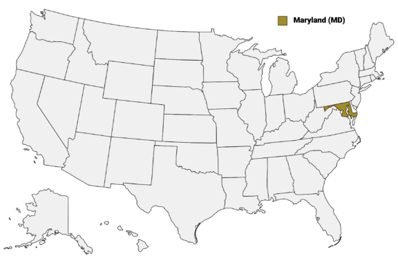
Below is a Maryland Counties Map describing each county’s borders and major cities.
Map of Maryland Counties
Below is a map of the 23 counties of Maryland (you can click on the map to enlarge it and to see the major city in each county).

Interactive Map of Maryland Counties
Click on any of the counties on the map to see its population, economic data, time zone, and zip code (the data will appear below the map). Data is sourced from the US Census 2021.
List of the Counties of Maryland:
Note: Baltimore City is an independent city and not part of any county, even though it is surrounded by Baltimore County. It is considered a county equivalent.
| County | Population | Per sq. km | Largest City |
|---|---|---|---|
| Allegany County | 68,684 | 62.81 | Cumberland |
| Anne Arundel County | 584,064 | 543.64 | Glen Burnie |
| Baltimore City | 592,211 | 2824.77 | Baltimore |
| Baltimore County | 850,702 | 548.93 | Dundalk |
| Calvert County | 92,515 | 167.55 | Chesapeake Ranch Estates |
| Caroline County | 33,234 | 40.17 | Denton |
| Carroll County | 172,148 | 148.49 | Eldersburg |
| Cecil County | 103,370 | 115.25 | Elkton |
| Charles County | 165,209 | 139.33 | Waldorf |
| Dorchester County | 32,486 | 23.19 | Cambridge |
| Frederick County | 267,498 | 156.35 | Frederick |
| Garrett County | 28,955 | 17.22 | Oakland |
| Harford County | 259,162 | 228.91 | Bel Air South |
| Howard County | 329,248 | 506.57 | Columbia |
| Kent County | 19,335 | 26.95 | Chestertown |
| Montgomery County | 1,057,201 | 827.75 | Germantown |
| Prince George’s County | 957,767 | 766.18 | Bowie |
| Queen Anne’s County | 49,702 | 51.63 | Stevensville |
| Somerset County | 24,834 | 29.99 | Princess Anne |
| St. Mary’s County | 113,209 | 121.89 | California |
| Talbot County | 37,510 | 53.93 | Easton |
| Washington County | 153,956 | 129.85 | Hagerstown |
| Wicomico County | 103,223 | 106.44 | Salisbury |
| Worcester County | 52,322 | 43.13 | Ocean Pines |
Largest Maryland Counties by Population
Montgomery County

Montgomery County, nestled in the southern part of Maryland, is the most populous county in the state. Established in 1776 and named after Richard Montgomery, an American Revolutionary War general, the county is a key player in Maryland’s diverse economic and cultural landscape.
Rockville, the vibrant county seat, is not only a governmental center but also a thriving hub for technology and biotech industries. The county boasts rich cultural diversity, reflected in its wide array of international cuisines, arts, and festivals.
Montgomery County is known for its affluent suburbs, top-rated schools, and numerous parks and recreational areas, including the scenic Great Falls of the Potomac River. These features make it an attractive location for families and professionals alike.
The county also hosts significant events such as the Montgomery County Agricultural Fair, drawing crowds from across the region. Landmarks like the Strathmore Music Center and the Glenstone Museum highlight the county’s commitment to arts and culture.
Prince George’s County

The second-most populous county in Maryland is Prince George’s County, located in the central part of the state. Established in 1696, it was named in honor of Prince George of Denmark. The county seat, Upper Marlboro, is a blend of historic charm and modern development.
Home to the University of Maryland, the county is a hub of education and innovation, and the National Harbor on the Potomac River adds a unique waterfront atmosphere with its shops, restaurants, and entertainment venues.
Prince George’s County also hosts the celebrated Maryland Renaissance Festival, drawing visitors from across the state. With its blend of urban and suburban areas, the county offers a diverse living experience, embodying the vibrant spirit of Maryland.
Baltimore County

Towson, the county seat, blends suburban living with a touch of urban vibrancy. It is home to Towson University and a variety of cultural and recreational amenities.
The county’s eastern region offers access to the Chesapeake Bay, making it a popular spot for boating and water activities. Baltimore County is also known for its historic sites, including the Hampton National Historic Site and the Benjamin Banneker Historical Park and Museum.
The area’s rural northern parts feature rolling hills and horse farms, providing a contrast to the more urbanized southern regions. Annual events like the Baltimore County Farmers Market and the Maryland State Fair highlight the county’s agricultural heritage and community spirit.
Baltimore City

Baltimore City, distinct from Baltimore County, stands as the largest city in Maryland and an independent city since 1851. Although the city’s government is separated from the surrounding county, it is considered on par with county jurisdictions.
The city’s Inner Harbor, once a major port, is now a major tourist attraction with the National Aquarium and Maryland Science Center. Baltimore is also famous for its historic neighborhoods like Fells Point and Mount Vernon, each offering unique cultural and architectural charm.
Baltimore’s contributions to the arts are significant, with institutions such as the Baltimore Museum of Art and the Walters Art Museum. The city’s diverse culinary scene, highlighted by its famous Maryland crab cakes, reflects its cultural variety.
Prominent educational institutions like Johns Hopkins University and the University of Maryland, Baltimore, are key drivers of innovation and research in the city.
Anne Arundel County

Anne Arundel County, located along Chesapeake Bay in Maryland, is known for its rich colonial history and maritime heritage. Established in 1650, the county is named after Lady Anne Arundell, a member of the ancient Arundell family of Cornwall, England.
Annapolis, the state capital of Maryland, is the county seat and is renowned for its well-preserved historic district, including the Maryland State House and the United States Naval Academy. The county’s extensive shoreline offers numerous recreational opportunities, including sailing and fishing, making it a favorite destination for water enthusiasts.
Anne Arundel County’s proximity to both Baltimore and Washington, D.C. contributes to its diverse and dynamic economy. The county also boasts several parks and natural areas, such as the Quiet Waters Park, providing residents and visitors with scenic beauty and outdoor activities.
Smallest Maryland Counties by Population
Kent County

Kent County, situated in the Eastern Shore region of Maryland, is celebrated for its picturesque landscapes and deep historical roots. Founded in 1642, it’s one of the state’s oldest counties and named after the English county of Kent. It is the least populous county in Maryland.
Chestertown, the county seat, is a charming town rich in colonial history, evident in its well-preserved architecture and the annual Chestertown Tea Party Festival. The town is also home to Washington College, one of the oldest liberal arts colleges in the United States.
Kent County’s rural scenery is marked by its scenic byways, sprawling farms, and access to the Chesapeake Bay, making it a haven for outdoor activities like boating, fishing, and bird watching. The county is known for its commitment to preserving natural landscapes and historic sites, providing a peaceful retreat and a glimpse into Maryland’s heritage.
Somerset County

Somerset County, located on the southern tip of Maryland’s Eastern Shore, is known for its rich history and natural beauty. Established in 1666, it’s one of the state’s earliest settlements and is named after Lady Mary Somerset, a British noblewoman and sister of Lady Anne Arundell.
The county seat, Princess Anne, embodies a blend of historical charm and quiet rural life. It’s home to the University of Maryland Eastern Shore, adding an educational and cultural dimension to the county.
Somerset County’s landscape is characterized by its extensive waterfront along the Chesapeake Bay and the Tangier Sound, making it a prime location for fishing, boating, and birdwatching. The county is also a part of the picturesque Delmarva Peninsula, offering unspoiled natural beauty and outdoor activities.
This region’s heritage is further celebrated through events like the annual Somerset Strawberry Festival, which showcases the county’s agricultural traditions and community spirit.
Garrett County

Garrett County, nestled in the westernmost part of Maryland, is renowned for its natural landscapes and outdoor recreational opportunities. Established in 1872, it was named after John Work Garrett, a former president of the Baltimore and Ohio Railroad.
The county seat, Oakland, exudes a small-town atmosphere and is known for its historic architecture and the Garrett County Historical Museum. Garrett County is particularly famous for Deep Creek Lake, Maryland’s largest freshwater lake, which attracts visitors year-round for boating, fishing, skiing, and hiking.
The county is also home to a portion of the Allegheny Mountains, offering stunning scenery and a range of outdoor activities, including hiking in the Savage River State Forest and skiing at Wisp Resort.
Dorchester County

Dorchester County is situated in the heart of Maryland’s Eastern Shore and is steeped in history and natural beauty. Established in 1669, it’s named after the Earl of Dorset, a prominent British nobleman.
Cambridge, the county seat, is one of the oldest towns in Maryland and is known for its rich maritime history and well-preserved historic district. Dorchester County’s landscape is characterized by its extensive wetlands and waterways, including a significant portion of the Chesapeake Bay and the Blackwater National Wildlife Refuge, a haven for birdwatching and nature photography.
The county’s connection to Harriet Tubman, the famed Underground Railroad conductor, is commemorated at the Harriet Tubman Underground Railroad National Historical Park.
Dorchester County also offers a variety of outdoor activities such as fishing, boating, and kayaking, attracting nature enthusiasts and history buffs alike.
Notable Maryland Counties
Howard County

Maryland’s Howard County is notable for its central location in the state, as well as its unique blend of urban sophistication and rural charm. The county has no incorporated municipalities, and its county seat is the unincorporated community of Ellicott City.
Established in 1851, it was named after John Eager Howard, an officer in the Continental Army and governor of Maryland. It is now often ranked among the most affluent and educated communities in the country.
The largest community in the county is Columbia, a nationally recognized planned city, notable for its innovative design, community amenities, and inclusive ethos. Ellicott City, the county seat, is famous for its historic Main Street, offering a glimpse into 19th-century life with its preserved buildings and unique shops.
The county is also known for its high-quality public schools and commitment to environmental sustainability, with numerous parks and green spaces for residents to enjoy.
Frederick County

Frederick County, located in the northern part of Maryland, is distinguished by its rich historical heritage and scenic beauty. Established in 1748, it was named after Frederick Calvert, the 6th Lord Baltimore. Before colonial settlement, the land was inhabited by the Tuscarora and Piscataway Nations.
The city of Frederick, the county seat, is a blend of historical charm and modern vitality. Known for its beautifully preserved 19th-century architecture, the city boasts a vibrant arts scene, with numerous galleries, theaters, and music venues.
The county’s history is deeply intertwined with the Civil War, evidenced by landmarks like the Monocacy National Battlefield. The Catoctin Mountain Park and the scenic byways through rolling hills and farmlands showcase Frederick County’s natural allure.
Carroll County

Carroll County, situated in the northern region of Maryland, is another county in the state that’s renowned for its historical significance. Established in 1837, the county is named after Charles Carroll of Carrollton, the last surviving signer of the Declaration of Independence.
Westminster, the county seat, is steeped in history, with well-preserved buildings and a quaint downtown area that reflect its 19th-century roots. The county is deeply tied to Civil War history, with several sites and landmarks commemorating key events such as Corbit’s Charge.
Carroll County is characterized by its rural beauty, with rolling hills, farmlands, and historic towns dotting the landscape. The county’s commitment to preserving its rural heritage is evident in its numerous parks, trails, and the annual Maryland Wine Festival, which celebrates the region’s winemaking tradition.
Agriculture remains a vital part of Carroll County’s economy, with local farms contributing to Maryland’s agricultural output and providing a backdrop to the county’s serene and charming atmosphere.
More About Maryland Counties: FAQs
What is the smallest county in Maryland by land area?
Kent County is the smallest by land area, covering 277 square miles (720 km2).
Which Maryland county has the highest elevation?
Garrett County, home to the Allegheny Mountains, has the highest elevations in the state.
Are there any counties in Maryland known for their wineries and vineyards?
Frederick County is noted for its wineries and vineyards, part of Maryland’s growing wine industry, and Carroll County hosts the state’s annual wine festival.
Which Maryland county is the most densely populated?
Baltimore City, although technically an independent city, has the highest population density in the state.

- Spring Day at Rockville Town Square in Montgomery County, Maryland — © Regine Poirier/Shutterstock
- Nighttime View of Modern Waterfront Buildings with Illuminated Facades and Moored Boat on the Potomac River — © Jon Bilous/Shutterstock
- Expansive View of Towson, Maryland with Dramatic Clouds Overhead — © Jon Bilous/Shutterstock
- Sunset View of Baltimore Inner Harbor with Skyline Reflections on Water — © f11photo/Shutterstock
- Aerial View of Annapolis Harbor at Sunset — © Wirestock Creators/Shutterstock
- Aerial View of a Quaint Colonial Town by the Waterfront in Summer — © tokar/Shutterstock
- Sailboat Moored on a Tranquil River with Rural Shoreline in the Background — © Jana Shea/Shutterstock
- Serene Waterfall in a Lush Forest on a Rainy Autumn Day — © VIKVAD/Shutterstock
- Aerial View of a Marina with Boats and a Lighthouse in Cambridge, Maryland During Fall — © Flying Koala Photography/Shutterstock
- Aerial View of Historic Ellicott City in Howard County, Maryland — © Nicole Glass Photography/Shutterstock
- Festive Gathering Along a Canal in Frederick, Maryland — © bluebird/Shutterstock
- Winter Sunset Over a Snow-Covered Farm with House and Barn — © Jon Bilous/Shutterstock