Iowa, known as the Hawkeye State, is renowned for its pivotal role in American politics, vast expanses of fertile farmland, and the quintessential Midwest lifestyle. As the nation’s leading producer of corn, soybeans, and pork, Iowa is a powerhouse in American agriculture.
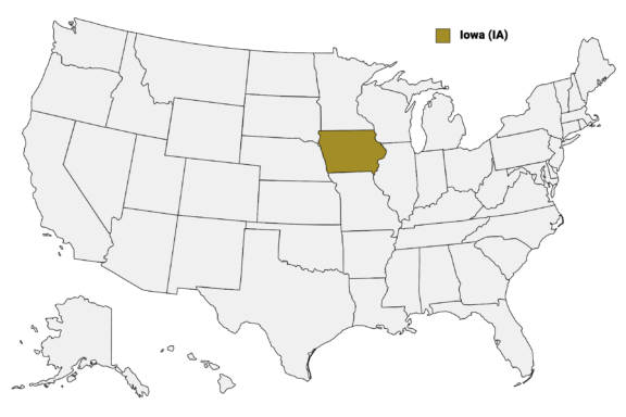
Iowa on the US Map
Beyond its political caucuses and rows of cornfields, the state is also recognized for its contributions to art, culture, and higher education, with the University of Iowa being a noted center for literary studies. The diversity of the state is perhaps best appreciated by examining its 99 counties, each with its own unique characteristics and attributes.
The County System in Iowa
Iowa’s 99 counties serve as administrative subdivisions for the state, providing various essential services to residents. These counties are the bedrock of local governance and community engagement in Iowa, and they range from heavily populated urban centers to sparsely inhabited rural landscapes.
In this post, we’ll look at some of Iowa’s most notable counties, starting with the most populous. Below is a detailed Iowa Counties Map that includes major cities.
Iowa Counties Map
Below is a map of the 99 counties of Iowa (you can click on the map to enlarge it and to see the major city in each county).

Interactive Map of Iowa Counties
Click on any of the counties on the map to see its population, economic data, time zone, and zip code (the data will appear below the map). Data is sourced from the US Census 2021.
List of the Counties of New Hampshire:
| County | Population | Per sq. km | Largest City |
|---|---|---|---|
| Adair County | 7,439 | 5.05 | Greenfield |
| Adams County | 3,697 | 3.37 | Corning |
| Allamakee County | 14,068 | 8.5 | Waukon |
| Appanoose County | 12,310 | 9.56 | Centerville |
| Audubon County | 5,657 | 4.93 | Audubon |
| Benton County | 25,654 | 13.83 | Vinton |
| Black Hawk County | 131,396 | 89.67 | Waterloo |
| Boone County | 26,721 | 18.08 | Boone |
| Bremer County | 24,863 | 22.04 | Waverly |
| Buchanan County | 20,598 | 13.93 | Independence |
| Buena Vista County | 20,723 | 13.92 | Storm Lake |
| Butler County | 14,421 | 9.6 | Parkersburg |
| Calhoun County | 9,962 | 6.75 | Rockwell City |
| Carroll County | 20,756 | 14.07 | Carroll |
| Cass County | 13,158 | 9 | Atlantic |
| Cedar County | 18,494 | 12.32 | Tipton |
| Cerro Gordo County | 43,185 | 29.34 | Mason City |
| Cherokee County | 11,606 | 7.77 | Cherokee |
| Chickasaw County | 12,021 | 9.2 | New Hampton |
| Clarke County | 9,736 | 8.72 | Osceola |
| Clay County | 16,410 | 11.17 | Spencer |
| Clayton County | 17,173 | 8.52 | Postville |
| Clinton County | 46,589 | 25.88 | Clinton |
| Crawford County | 16,555 | 8.95 | Denison |
| Dallas County | 96,604 | 63.4 | West Des Moines |
| Davis County | 9,066 | 6.97 | Bloomfield |
| Decatur County | 7,718 | 5.6 | Lamoni |
| Delaware County | 17,508 | 11.7 | Manchester |
| Des Moines County | 39,069 | 36.25 | Burlington |
| Dickinson County | 17,536 | 17.79 | Spirit Lake |
| Dubuque County | 98,687 | 62.64 | Dubuque |
| Emmet County | 9,433 | 9.2 | Estherville |
| Fayette County | 19,582 | 10.35 | Oelwein |
| Floyd County | 15,672 | 12.09 | Charles City |
| Franklin County | 10,056 | 6.67 | Hampton |
| Fremont County | 6,702 | 5.06 | Shenandoah |
| Greene County | 8,831 | 5.99 | Jefferson |
| Grundy County | 12,336 | 9.49 | Grundy Center |
| Guthrie County | 10,599 | 6.93 | Stuart |
| Hamilton County | 15,073 | 10.09 | Webster City |
| Hancock County | 10,837 | 7.33 | Forest City |
| Hardin County | 16,997 | 11.53 | Iowa Falls |
| Harrison County | 14,589 | 8.08 | Missouri Valley |
| Henry County | 20,488 | 18.21 | Mount Pleasant |
| Howard County | 9,456 | 7.71 | Cresco |
| Humboldt County | 9,622 | 8.55 | Humboldt |
| Ida County | 6,979 | 6.24 | Ida Grove |
| Iowa County | 16,596 | 10.93 | Williamsburg |
| Jackson County | 19,499 | 11.84 | Maquoketa |
| Jasper County | 37,686 | 19.92 | Newton |
| Jefferson County | 15,846 | 14.05 | Fairfield |
| Johnson County | 151,833 | 95.63 | Iowa City |
| Jones County | 20,680 | 13.87 | Anamosa |
| Keokuk County | 10,050 | 6.7 | Sigourney |
| Kossuth County | 14,823 | 5.88 | Algona |
| Lee County | 33,724 | 25.16 | Fort Madison |
| Linn County | 228,567 | 123.07 | Cedar Rapids |
| Louisa County | 10,891 | 10.47 | Columbus Junction |
| Lucas County | 8,650 | 7.75 | Chariton |
| Lyon County | 11,953 | 7.85 | Rock Rapids |
| Madison County | 16,414 | 11.3 | West Des Moines |
| Mahaska County | 22,132 | 14.97 | Oskaloosa |
| Marion County | 33,381 | 23.24 | Pella |
| Marshall County | 40,137 | 27.07 | Marshalltown |
| Mills County | 14,658 | 12.94 | Glenwood |
| Mitchell County | 10,526 | 8.66 | Osage |
| Monona County | 8,732 | 4.86 | Onawa |
| Monroe County | 7,589 | 6.76 | Albia |
| Montgomery County | 10,327 | 9.4 | Red Oak |
| Muscatine County | 43,145 | 38.08 | Muscatine |
| O’Brien County | 14,139 | 9.53 | Sheldon |
| Osceola County | 6,168 | 5.97 | Sibley |
| Page County | 15,250 | 11.01 | Clarinda |
| Palo Alto County | 8,996 | 6.16 | Emmetsburg |
| Plymouth County | 25,543 | 11.43 | Le Mars |
| Pocahontas County | 7,091 | 4.74 | Pocahontas |
| Polk County | 488,871 | 329.76 | Des Moines |
| Pottawattamie County | 93,571 | 37.98 | Council Bluffs |
| Poweshiek County | 18,628 | 12.3 | Grinnell |
| Ringgold County | 4,739 | 3.42 | Mount Ayr |
| Sac County | 9,829 | 6.6 | Sac City |
| Scott County | 174,170 | 146.8 | Davenport |
| Shelby County | 11,750 | 7.68 | Harlan |
| Sioux County | 35,647 | 17.92 | Sioux Center |
| Story County | 98,106 | 66.16 | Ames |
| Tama County | 17,079 | 9.15 | Tama |
| Taylor County | 5,932 | 4.31 | Lenox |
| Union County | 12,193 | 11.11 | Creston |
| Van Buren County | 7,196 | 5.73 | Keosauqua |
| Wapello County | 35,343 | 31.6 | Ottumwa |
| Warren County | 51,862 | 35.15 | Des Moines |
| Washington County | 22,525 | 15.29 | Washington |
| Wayne County | 6,504 | 4.78 | Corydon |
| Webster County | 37,114 | 20.02 | Fort Dodge |
| Winnebago County | 10,743 | 10.36 | Forest City |
| Winneshiek County | 20,100 | 11.25 | Decorah |
| Woodbury County | 105,102 | 46.49 | Sioux City |
| Worth County | 7,450 | 7.19 | Northwood |
| Wright County | 12,978 | 8.63 | Eagle Grove |
Biggest Counties in Iowa by Population
Polk County

Polk County is the most populous county in Iowa and serves as the political and economic hub of the state. It is located in the central region and is home to Des Moines, the state capital and the largest city in Iowa.
The county was established in 1846 and was named after James K. Polk, the 11th President of the United States. With a diverse population of nearly 490,000 residents, Polk County is a major center for business, healthcare, and education. Major employers in the county include Wells Fargo, Principal Financial Group, and UnityPoint Health.
Polk County offers an array of cultural and recreational opportunities, including the Des Moines Art Center, the Iowa State Fairgrounds, and numerous parks and trails. Some of the many outdoor activities available in Polk County include camping, hiking, horseback riding, fishing, and cross-country skiing.
Polk County is also home to educational institutions like Drake University and Des Moines University. The county is known for its strong public school system, and its residents have access to various public services such as libraries, healthcare facilities, and public transportation options.
Linn County

Linn County, situated in the eastern part of Iowa, has the distinction of being the second-most populous county in the state. Cedar Rapids, known as the “City of Five Seasons,” serves as the county seat and is a focal point for the arts, commerce, and industry. Unlike its more agrarian counterparts, Linn County is a hotbed for technology and is the largest manufacturing center in the state.
Culture thrives in Linn County, thanks in part to institutions like the Cedar Rapids Museum of Art and the Paramount Theatre, which offer residents and visitors a taste of fine art and performance. For those who prefer the outdoors, the county boasts an extensive trail system that links parks and communities, making it a haven for hikers and cyclists.
Educational needs are met by a variety of institutions, ranging from public schools to Coe College and Mount Mercy University. Linn County’s governance structure involves various departments and offices working in unison to provide comprehensive services, from public health to road maintenance.
Scott County

Scott County is located in the easternmost part of Iowa along the Mississippi River and is best known as the home of Davenport, the largest of the Quad Cities. The area has a rich history, with its founding dating back to 1837, and its name honors General Winfield Scott, a prominent figure in the Black Hawk War.
In terms of economy, the county has a diverse industrial base that includes manufacturing, healthcare, and technology. Major employers include Rock Island Arsenal, John Deere, and Genesis Health System.
Davenport itself is a cultural center, housing attractions like the Figge Art Museum and Putnam Museum, as well as hosting the famous Bix Beiderbecke Memorial Jazz Festival.
Scott County is more than just urban life and industry; it also offers an array of outdoor activities. With access to the Mississippi River, residents and visitors can enjoy boating, fishing, and riverside picnics. Scott County Park is the largest park in the area and offers picnic areas as well as a heated swimming pool.
There’s also a focus on education, with public and private schools, as well as higher education options such as St. Ambrose University and a campus of Eastern Iowa Community Colleges. The Scott County Government involves a board of supervisors, and various departments manage aspects like public safety, public health, and community services.
Johnson County

Situated in the southeastern part of Iowa, Johnson County is notable for being home to Iowa City, which is the county seat, a cultural hub, and hosts the University of Iowa. Johnson County distinguishes itself through its emphasis on education and healthcare, largely due to the presence of the university and its associated medical facilities, including the University of Iowa Hospitals and Clinics.
Culturally, Johnson County is rich and vibrant, offering a variety of venues for arts and entertainment. The university’s presence infuses the area with a youthful energy, seen in the array of coffee shops, bookstores, and cultural festivals like the Iowa City Book Festival and the Mission Creek Festival. The county also offers recreational opportunities at places like Coralville Lake and several parks, attracting those interested in hiking, boating, and camping.
Economically, Johnson County has a robust job market, thanks in part to the University of Iowa being one of the area’s largest employers. Another major employer is ACT, the standardized testing company, although it recently announced significant layoffs. The county also places an emphasis on the biotechnology sector.
Black Hawk County

Located in northeastern Iowa, Black Hawk County is perhaps most recognized for its county seat, Waterloo, a city known for its industrial heritage and vibrant cultural scene. Named after Black Hawk, a leader of the Sac tribe, the county was officially formed in 1853 and has a history that dates back to the early 19th century.
Today, Black Hawk County serves as an economic and educational hub for the region, housing several major employers such as John Deere, Tyson Foods, and Wheaton Franciscan Healthcare.
Cedar Falls is another significant city in the county and is home to the University of Northern Iowa (UNI). The presence of UNI brings cultural events, athletics, and academic diversity to the county. The historic and cultural elements of the county are on display at the Grout Museum District and the Waterloo Center for the Arts.
The outdoor attractions in Black Hawk County include sites like George Wyth State Park, offering a mix of hiking, fishing, and boating opportunities. The Cedar Valley Trails system is another attraction, providing opportunities for biking and walking.
Smallest Counties in Iowa by Population
Adams County

Adams County is the least populous county in Iowa. It’s located in the southwestern part of the state and is home to four different communities, of which Corning is the county seat. Adams County was founded in 1851, the same year the Indian Appropriations Act was passed, forcing the relocation of the Potawatomie, Oto, and Iowa Indian tribes that had lived in the area.
Despite its small size, Adams County has a strong sense of community and a rich agricultural heritage, primarily involving the cultivation of corn and soybeans. A regularly updated calendar of community events adds to the close-knit atmosphere.
Corning itself is home to the French Icarian Village, a historical landmark that commemorates a 19th-century utopian community, offering a glimpse into the county’s unique history. The area also provides numerous outdoor recreational opportunities, such as Lake Icaria, a popular spot for fishing, camping, and boating.
Although the county doesn’t have the bustling job market seen in some of Iowa’s larger counties, it does offer a peaceful, close-knit community environment. Adams County’s governance operates on a smaller scale, with local officials and a board of supervisors attending to the area’s needs, from road maintenance to public health services.
Ringgold County

Ringgold County is located along Iowa’s southernmost boundary, sharing a border with the neighboring state of Missouri. Named after Major Sam Ringgold, who fought in the Mexican-American War, the county was established in 1847. It currently has the second smallest population of any county in the state.
Mount Ayr is the county seat, a small town that serves as the commercial and administrative center for the county. The primary economic driver in the county is agriculture, thanks to its fertile soil conducive to growing corn, and soybeans. A highlight of community events in Mount Ayr is the annual Ayr Days.
For outdoor enthusiasts, the county is home to several parks and recreational areas that encompass over 800 acres. Poe Hollow Park and Sun Valley Lake are particularly popular for camping, fishing, and boating activities.
Education in Ringgold County is provided by a few public schools, which, although smaller in size, foster a sense of community involvement and focus on quality education. Governance in the county is overseen by a board of supervisors and a range of departments responsible for public health, road maintenance, and other community services.
Audubon County

Audubon County, located in west-central Iowa, is named after the famed ornithologist and naturalist John James Audubon. This county has a predominantly rural landscape and is characterized by its strong agricultural sector. Audubon, one of five incorporated towns and the county seat, is best known for the Albert the Bull statue, the world’s largest bull sculpture.
An interesting bit of local lore includes the tale of a giant Cottonwood tree that stands in the middle of a road intersection in the county. Known locally as the “Tree in the Road,” it is said to have been planted by a surveyor more than 150 years ago.
Apart from agriculture, Audubon County holds a particular appeal for nature lovers. The Littlefield Recreation Area offers fishing, camping, and hiking opportunities, making it a go-to spot for outdoor activities. Another unique aspect of the county is the Audubon County Freedom Rock, a painted boulder that serves as a tribute to veterans and adds a layer of community identity and pride.
Notable Iowa Counties
Story County

Story County, located in central Iowa, is perhaps most famous for being the home of Ames, its largest city, and Iowa State University. The presence of the university significantly shapes the county’s identity, serving as a hub for education, research, and innovation. Story County is also where the state’s geographical center is located.
With a student body that adds thousands to the local population during the academic year, Ames experiences a cyclical influx of youthful energy and diversity. This, in turn, influences local businesses, cultural events, and even the job market, with many roles tied to academia and research.
The city of Ames provides various cultural amenities, from art galleries to theaters, while the surrounding countryside is dotted with parks and nature reserves, such as McFarland Park, appealing to those interested in outdoor activities like hiking, fishing, and birdwatching.
Pottawattamie County

Pottawattamie County is situated in the southwestern part of Iowa and shares its western border with the state of Nebraska, separated by the Missouri River. The county was established in 1847 and named after the Pottawattamie Native American tribe.
Council Bluffs, the county seat, is a city with modern attractions that’s also known for its railroad history. The city is home to landmarks like the Union Pacific Railroad Museum, which chronicles the development of the railroad and its impact on the American West.
Beyond its historical roots, the city is also a center for gaming and entertainment, with several casinos drawing both local residents and tourists. Additionally, the area is rich in outdoor recreational opportunities, such as Lake Manawa State Park, one of the state’s premier boating and hiking locations.
The county’s economy is diverse, encompassing manufacturing, healthcare, and retail sectors. Major employers in the area include the Council Bluffs Community School District and CHI Health Mercy Council Bluffs.
More About Iowa Counties: FAQs
How many counties are in Iowa?
Iowa is divided into 99 counties.
What are some common agricultural products across Iowa counties?
Corn, eggs, soybeans, and pigs are some of the most common agricultural products in Iowa.
How do Iowa counties typically handle public transportation?
Public transportation varies by county and is often more prevalent in populous areas. Some counties have bus services, while others may have limited or no public transportation options.
Are there Indian reservations in any Iowa counties?
No, there are currently no federally recognized Indian reservations in Iowa. However, the Meskwaki Settlement in Iowa’s Tama County is owned by the Meskwaki Nation.

- Aerial View of Des Moines, Iowa Skyline at Sunset — © Jacob Boomsma/Shutterstock
- Winter Scene of Cedar Rapids City Hall with Bridge Over River — © wisit wongba/Shutterstock
- Riverboat Cruising Along the Mississippi River with Davenport, Iowa Skyline in the Background — © Sam Wagner/Shutterstock
- Autumn View of the Old Capitol Building in Johnson County, Downtown Iowa City — © Suzanne Tucker/Shutterstock
- Golden Hour Over a Riverside Town with Pedestrian Bridge and Passing School Bus — © Sam Wagner/Shutterstock
- Adams County Courthouse on a Sunny Day — © Scott Romine/Wikimedia Commons
- Quiet Afternoon on a Small Town Main Street in Mount Ayr, Iowa — © Jared Winkler/Wikimedia Commons
- Majestic Cottonwood Tree Standing at a Country Road Intersection — © Suzanne Tucker/Shutterstock
- Autumn Splendor at Iowa State University Campus with Clock Tower — © Harris Dzulkarnain/Shutterstock
- Union Pacific Railroad Museum in Council Bluffs, Iowa on a Sunny Day — © EQRoy/Shutterstock