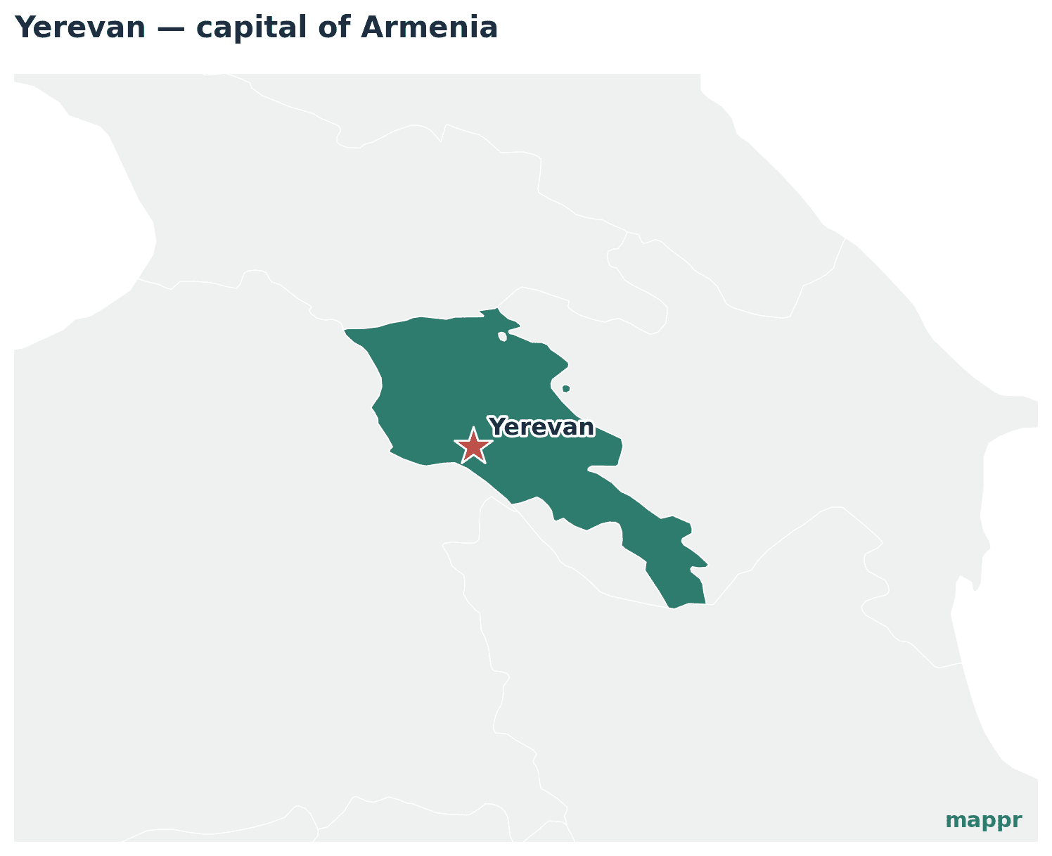
Yerevan is the largest city in Armenia. It has served as the capital since 1918, making it the twelfth city to hold this prestigious title.
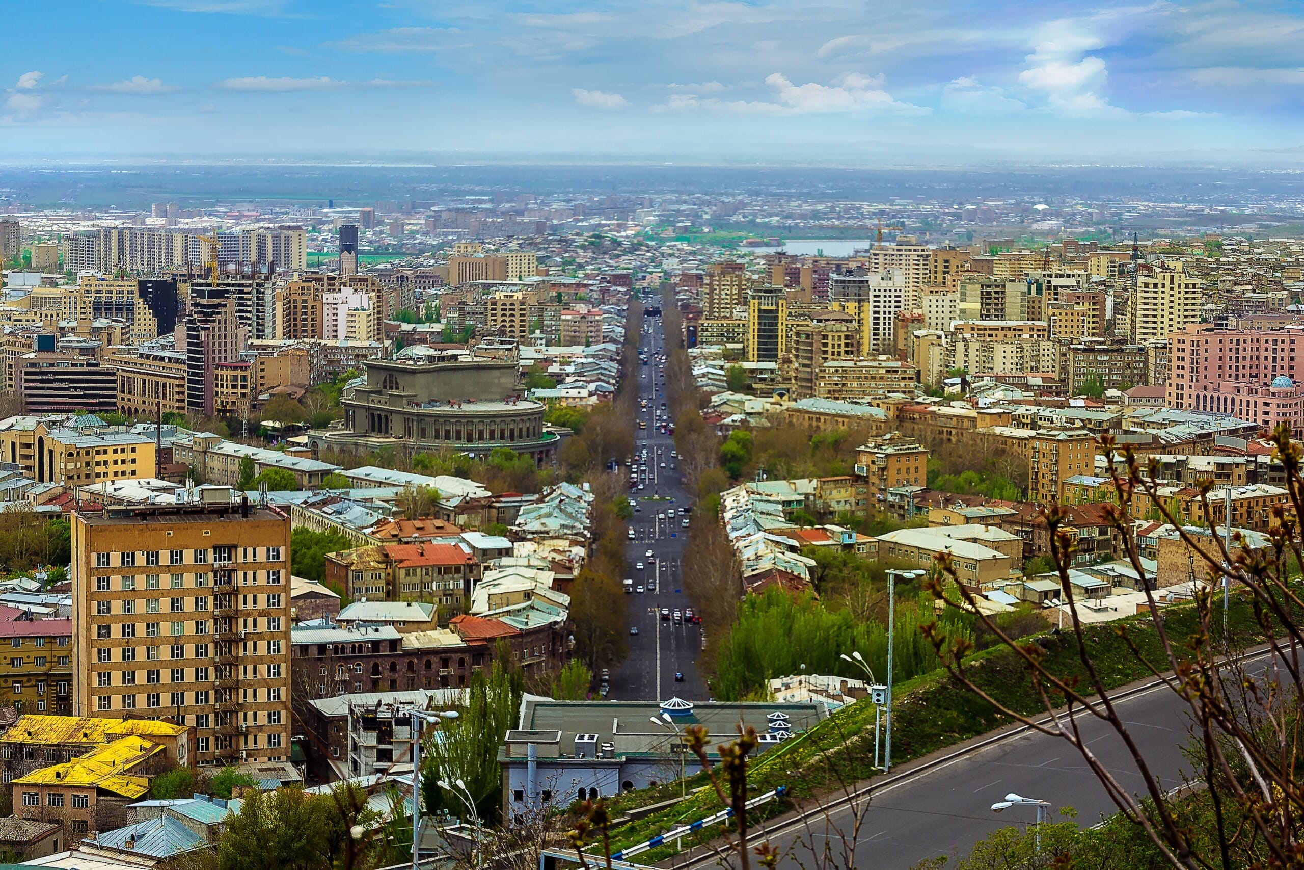
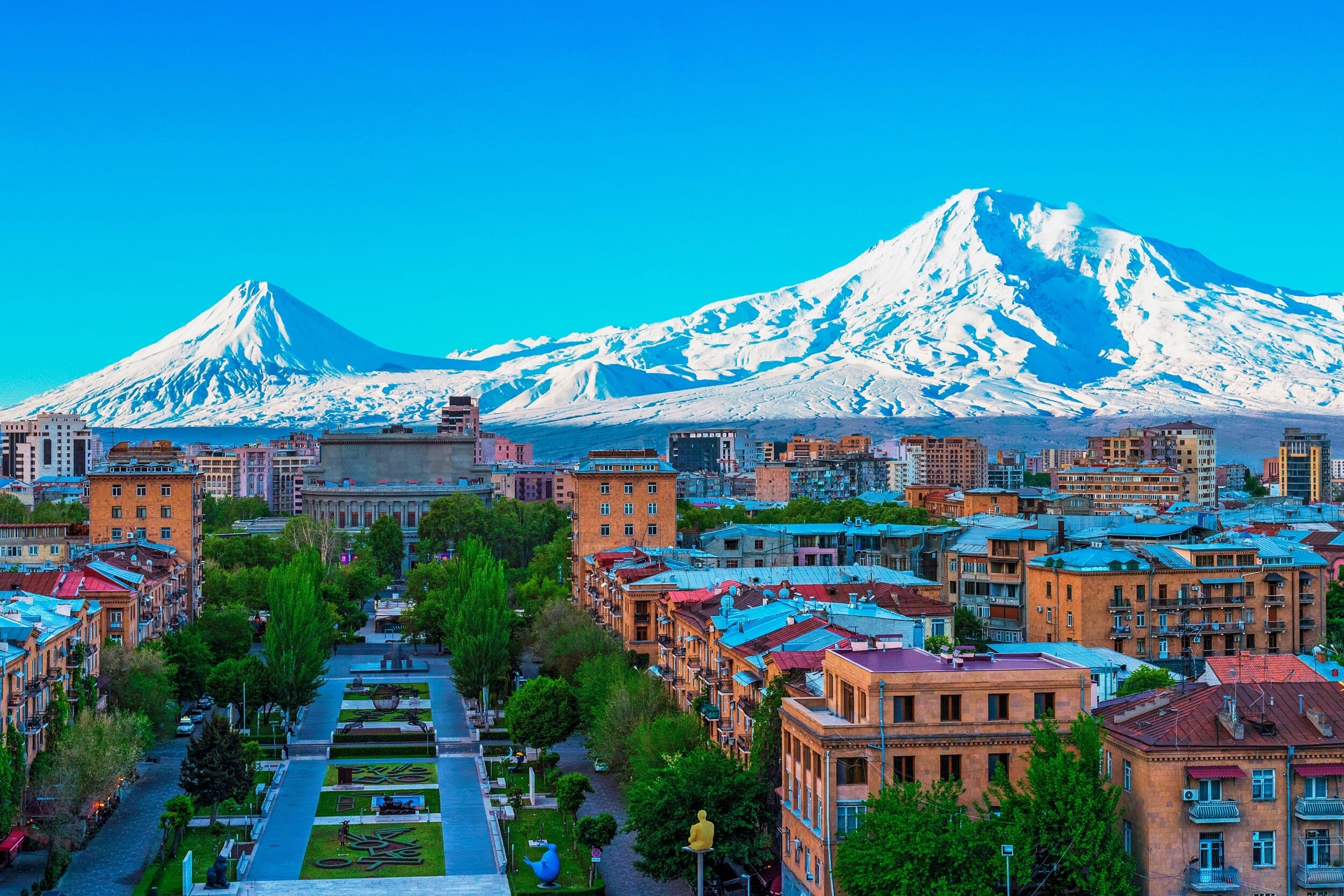
The city was originally founded back in 782 BC. Its location was strategically chosen on the western edge of Armenia. The easternmost reaches of the Mount Ararat plain provide the backdrop for the city. Yerevan overlooks the bustling passages of the Hrazdan River.
With a history spanning 2,500 years, Yerevan has endured numerous challenges. Its story is a dynamic saga of conflict, pillage, and infernos. The city has also survived numerous earthquakes. Each event has indelibly shaped the character and spirit of this remarkable city.
When did Yerevan Become the Capital?
he 16th and 17th centuries were challenging times for Yerevan; it became a warzone amidst conflicts between the Persians and the Turks. Moreover, it was subject to attacks from the Arabs and Mongols. The 1679 earthquake was a disastrous blow, almost entirely decimating the city, with only a few remnants of the original city standing today.
By the early 20th century, Yerevan, then a small town on the outskirts of the Russian Empire, had a modest population of around 30,000 inhabitants. It was designated as the capital of the nascent Democratic Republic of Armenia in 1918, serving as the hub of the newly independent Armenia until 1920.
Yerevan’s transformation is greatly attributed to Alexander Tamanian, the city’s chief architect. His plans ushered in a period of extensive urban development, enhancing the city’s stature and value. This period of urban growth substantially altered the city’s appearance, with new neighborhoods, road networks, bridges, and an international airport being established. The construction of the Yerevan metro system in the 1980s marked another significant milestone.
After the Sovietization of Armenia on November 29, 1920, Yerevan maintained its status as the capital of the republic. However, with the establishment of the Transcaucasian Socialist Federative Soviet Republic in 1922, the capital shifted to Tbilisi.
Yet, Yerevan regained its capital status in 1936 upon the dissolution of the Transcaucasian Federation and the creation of the Armenian Soviet Socialist Republic. Yerevan continues to be the capital of Armenia, retaining its status after the country gained independence from the Soviet Union in 1991.
History of Yerevan
Yerevan, Armenia’s capital, is among the oldest continuously inhabited cities globally. Its history begins in 782 BC with King Argishti I establishing the fortress of Erebuni during the Urartian period. The city’s strategic location ensured continued habitation even after the fall of Urartu.
Under the Armenian Orontid Dynasty and the subsequent Roman Empire rule, Yerevan integrated into larger political structures. It experienced fluctuating fortunes and various dominions, including the Byzantine, Seljuk, and Ottoman Empires, during the Middle Ages.
The early 16th century saw Yerevan transition to Persian rule before being incorporated into the Russian Empire in 1828. This period marked significant growth for the city.
Yerevan was officially designated as the capital of Armenia on May 28, 1918, during the establishment of the Democratic Republic of Armenia. Following this brief period, it retained its capital status under Soviet rule. Throughout this era, the city saw extensive industrial and architectural transformation, guided by the master plan of Alexander Tamanyan.
Post-independence from the Soviet Union in 1991, Yerevan continued as Armenia’s capital.
Features of Yerevan
Geography and Climate
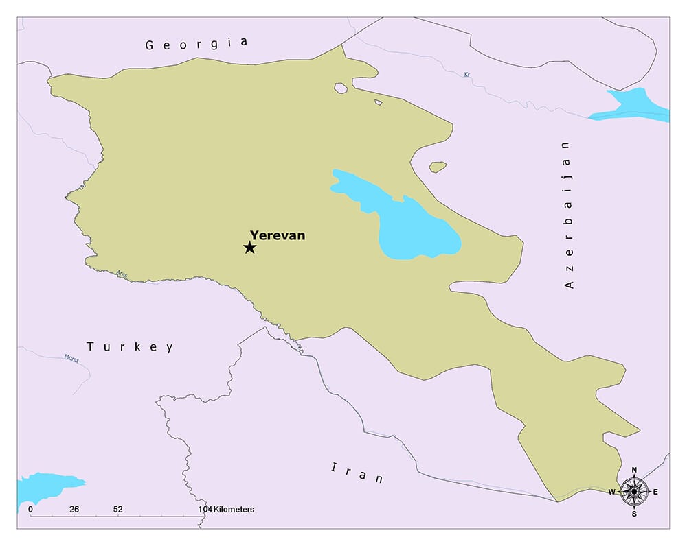
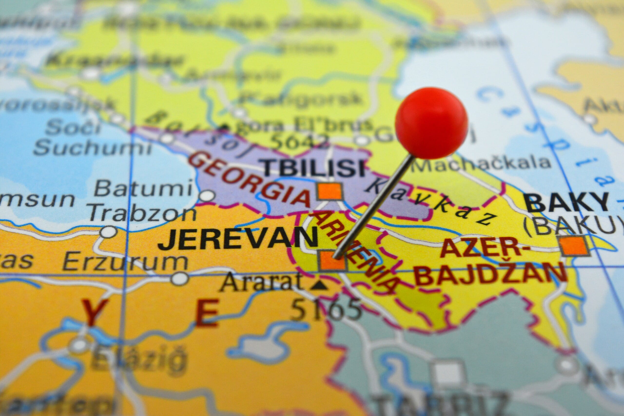
Yerevan, the capital and most populous city in Armenia, nestles in the western sector of the country, adjacent to the border with Turkey. It lies at the western edge of the Ararat Plain, along the banks of the Hrazdan River, embraced on three sides by mountains. Yerevan’s elevation varies between 900 and 1,300 meters (2,950 to 4,270 feet) above sea level.
This city experiences a highland continental climate, marked by sizzling summers and chilly winters. Summer temperatures often climb beyond 30°C (86°F), while winters can usher in below-freezing temperatures. Yerevan sees moderate annual precipitation, with the majority falling in spring and early summer. Winter snowfall is not uncommon, although it typically melts swiftly.
Population
Boasting a population exceeding 1 million residents, Yerevan is home to approximately one-third of Armenia’s total population. The populace predominantly identifies as Armenian, with the Armenian Apostolic Church being the prevalent religion.
The official language, Armenian, is ubiquitously spoken in Yerevan. Russian also maintains a firm presence, especially amongst the older demographic, and English is progressively gaining traction among the younger generation.
Yerevan’s demographic structure is relatively youthful, with a significant proportion of its population under the age of 30. Consistent with other urban areas, Yerevan has experienced a growth spurt, largely due to the influx of rural-to-urban migration.
Economy
As Armenia’s economic powerhouse, Yerevan contributes substantially to the nation’s GDP. This city houses the headquarters of major Armenian banks and numerous large corporations.
The service sector, encompassing retail, hospitality, and information technology, is integral to Yerevan’s economic fabric. The IT sector, in particular, has seen an accelerated growth trajectory in the past decade, with a proliferation of tech startups, software development firms, and innovation hubs dotting the cityscape.
In addition, Yerevan is a crucial industrial hub in Armenia, specializing in heavy industry sectors such as construction materials, chemicals, and textiles. The food processing industry and alcoholic beverage production, particularly brandy and wine, hold a prominent place in Yerevan’s industrial landscape.
The tourism sector in Yerevan is on an upward trajectory, drawing visitors worldwide with its historical richness, cultural heritage, and vibrant gastronomy and wine culture.
Things to Do and Places to See in Yerevan
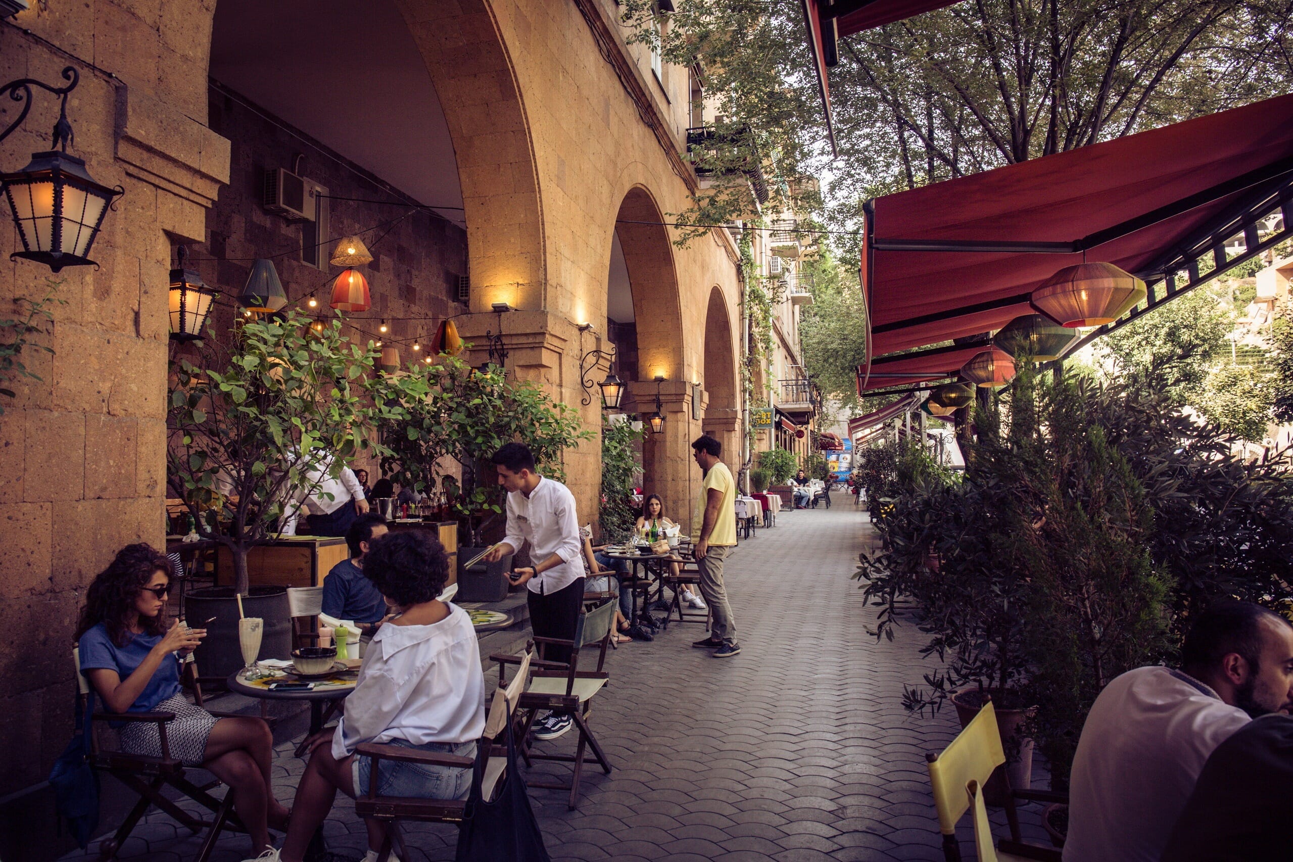
Yerevan, the capital of Armenia, offers a rich blend of history, culture, cuisine, and natural beauty. As one of the world’s oldest continuously inhabited cities, it’s a captivating destination for anyone interested in history and archaeology. Moreover, its vibrant arts scene, charming architecture, and friendly locals make it an inviting destination for all types of travelers.
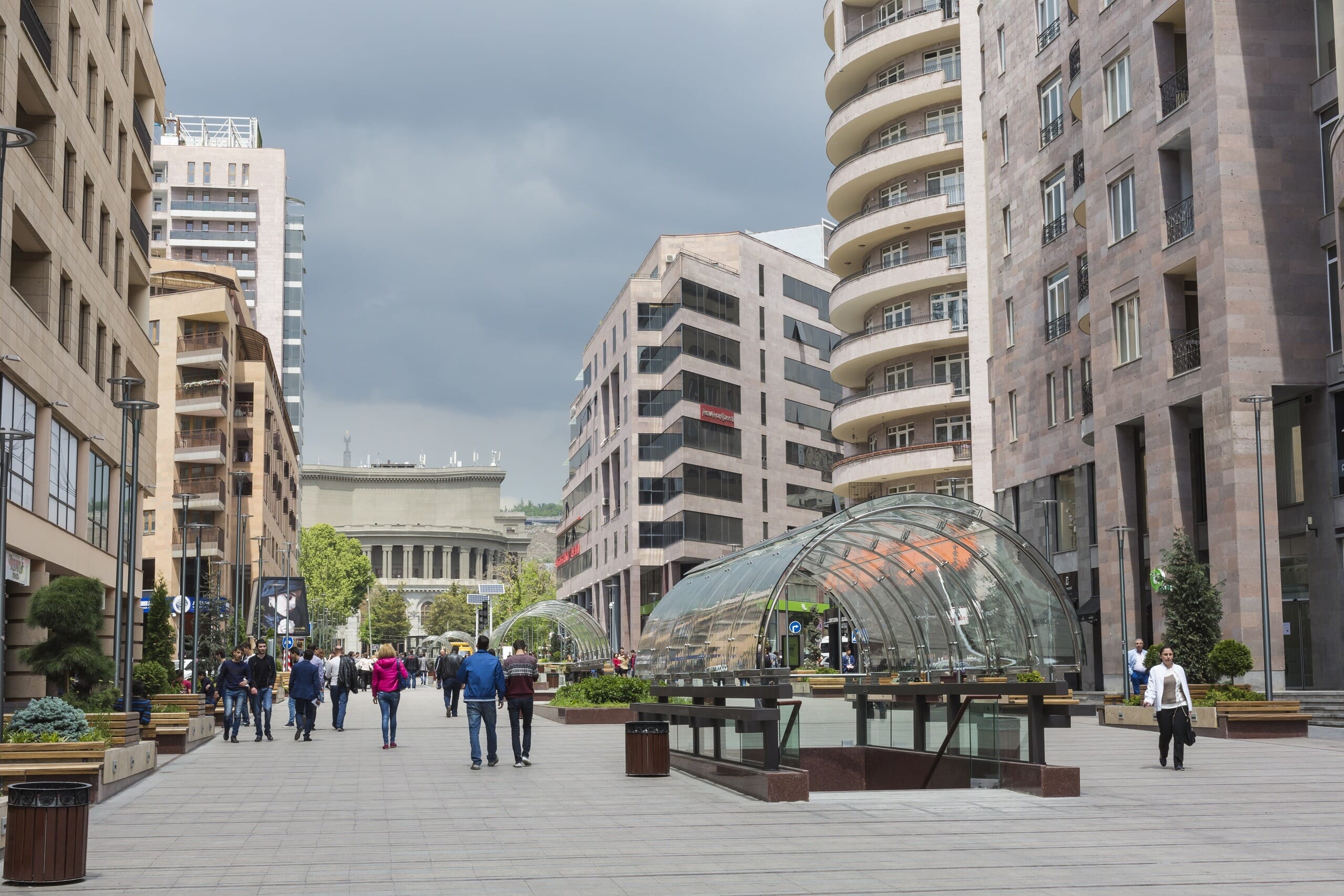
1. The Republic Square
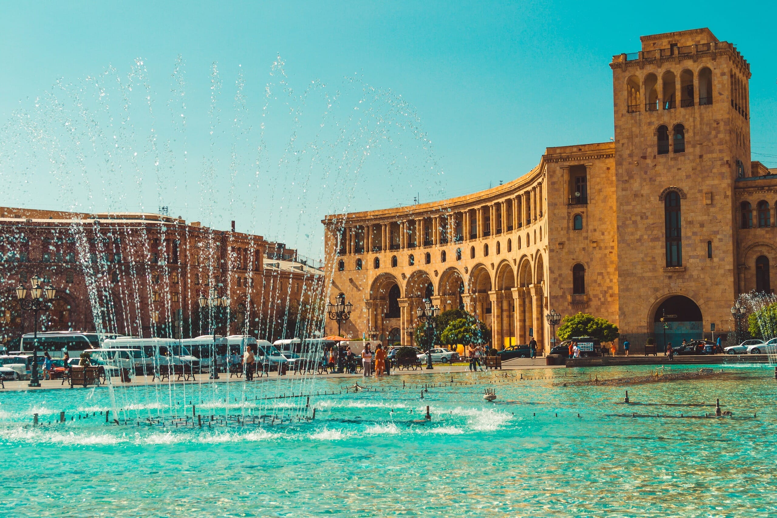
As the central town square of Yerevan, it’s surrounded by several notable buildings, including the National Gallery of Armenia and the Armenia Marriott Hotel. In the evenings, the square comes alive with a musical fountain show that draws both locals and tourists.
2. Armenian National Opera and Ballet Theatre
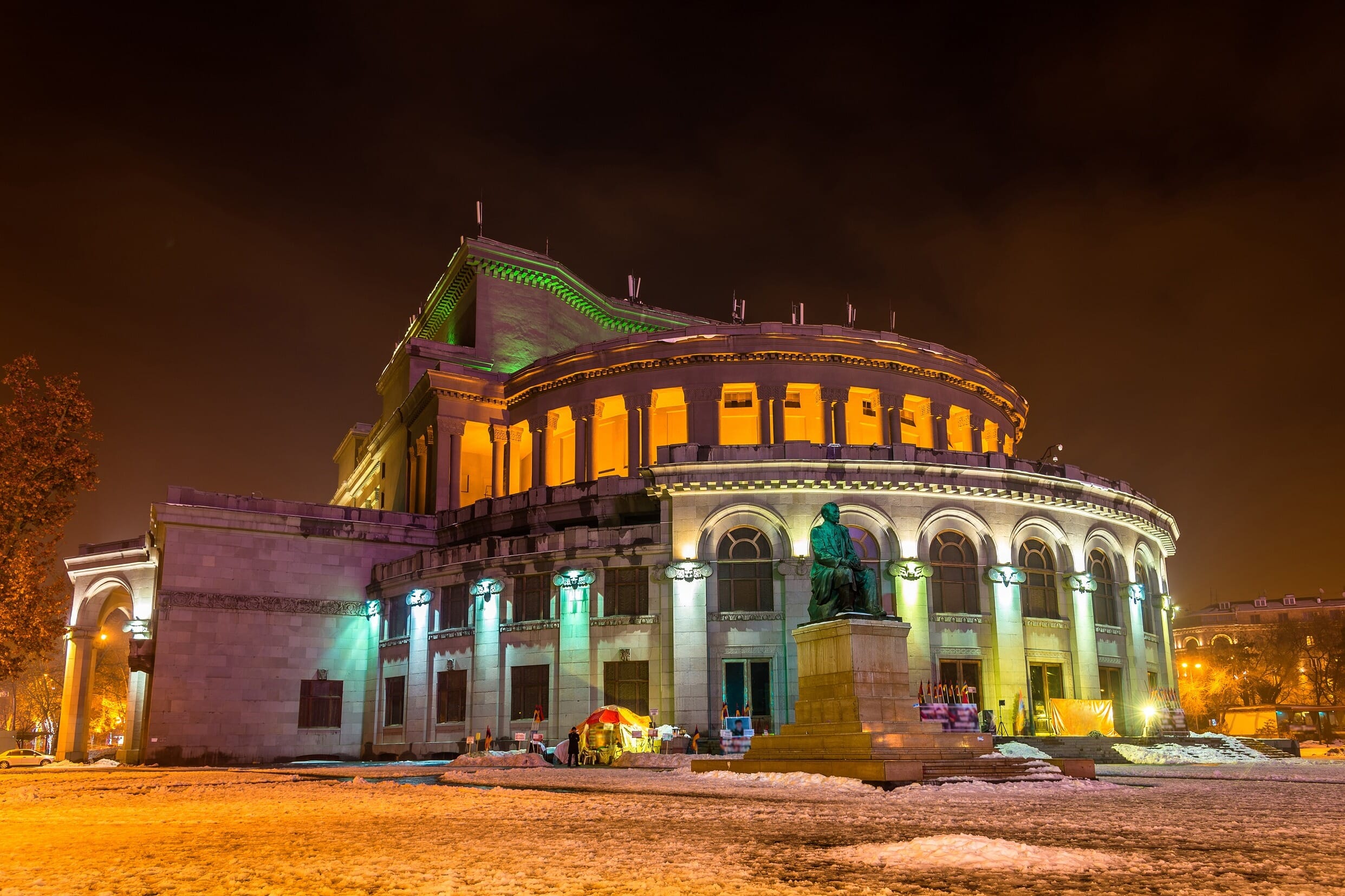
This cultural landmark in Yerevan is a must-visit. Founded in 1933, it’s home to the Spendiaryan Opera, Ballet National Theatre, and the Khachaturian Concert Hall. Whether attending a performance or just admiring the architecture, it’s a unique experience.
3. Saint Gregory The Illuminator Cathedral
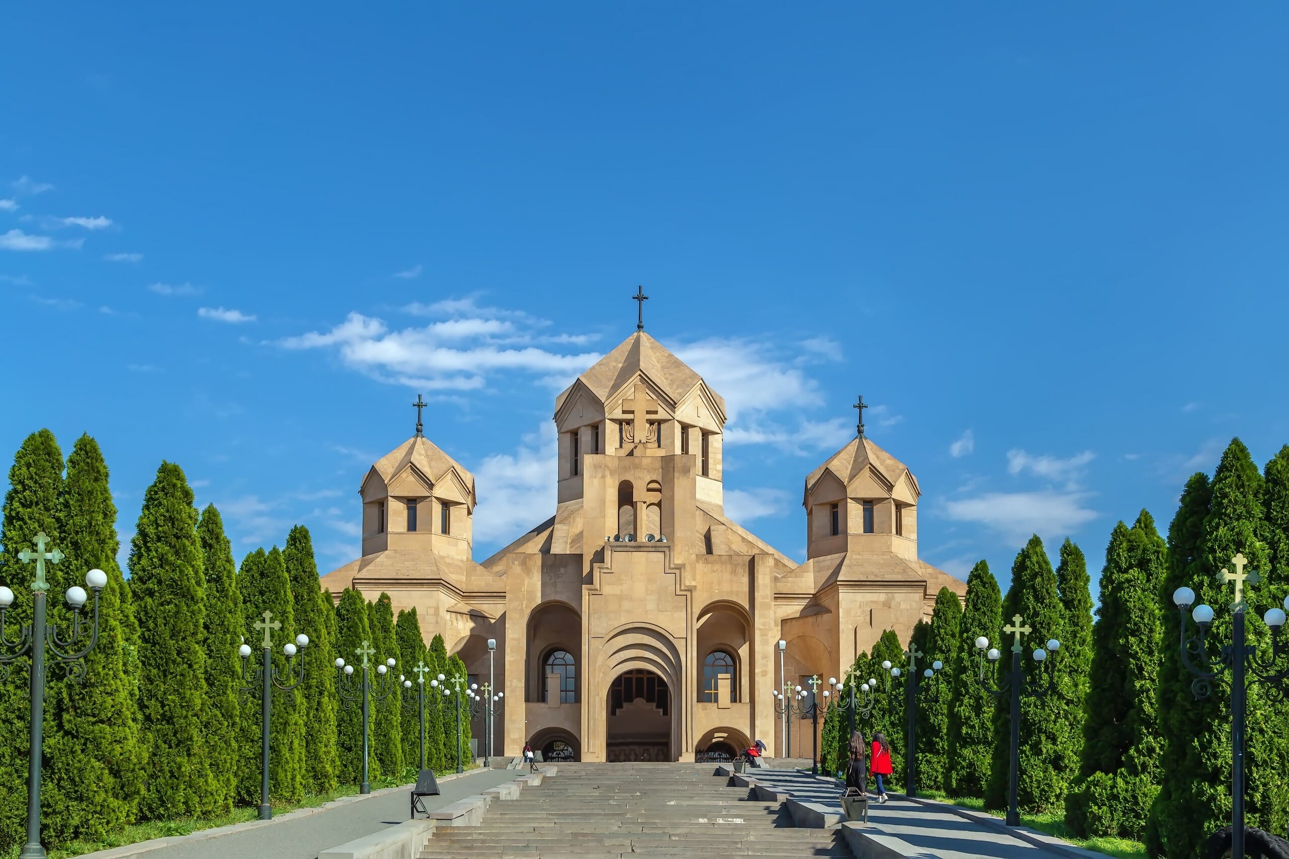
This is the largest cathedral of the Armenian Apostolic Church and one of the largest Orthodox churches in the world. It’s a stunning piece of architecture and a major center of religious life in Armenia.
4. Vernissage
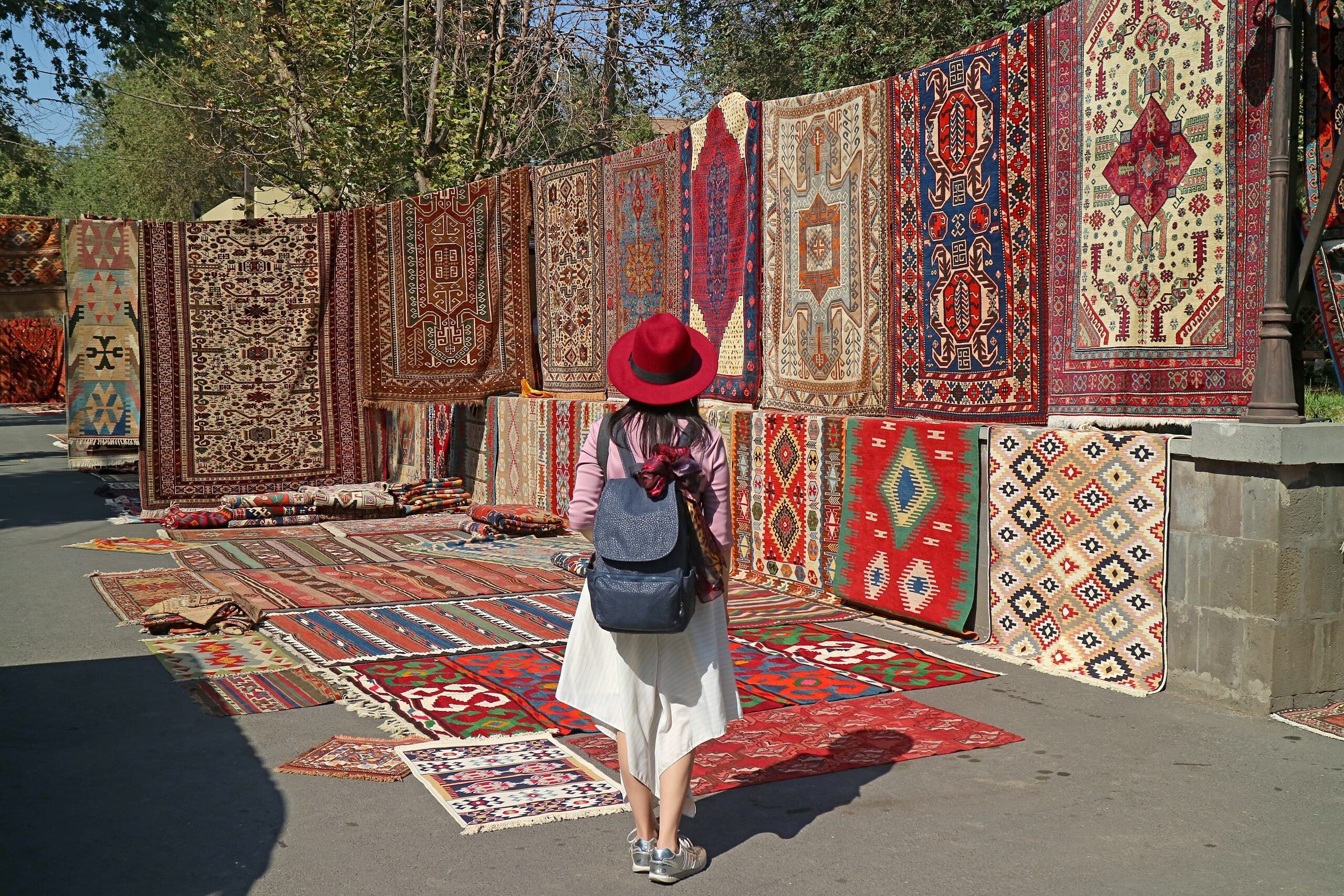
This large open-air market in Yerevan is the perfect place to pick up traditional Armenian arts and crafts, antiques, and souvenirs. From handmade jewelry to intricate carpets, it’s a great place to experience local artisan culture.
5. The Cascade Complex
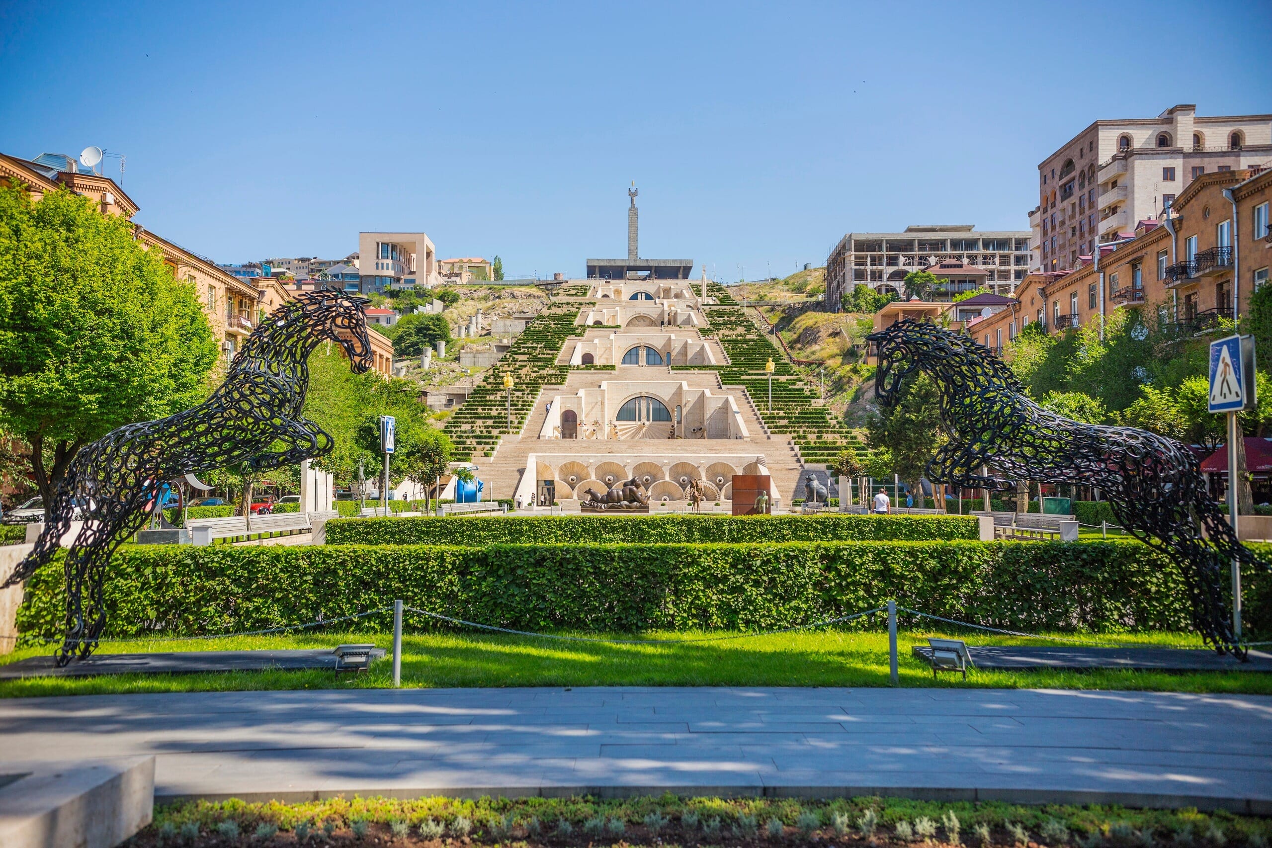
This is a massive Yerevan staircase with beautiful views of the city and Mount Ararat from the top. It’s home to the Cafesjian Center for the Arts, and the exterior has many beautiful sculptures and fountains. The Cascade is one of the city’s unique architectural features and is a hub of activity both day and night.


