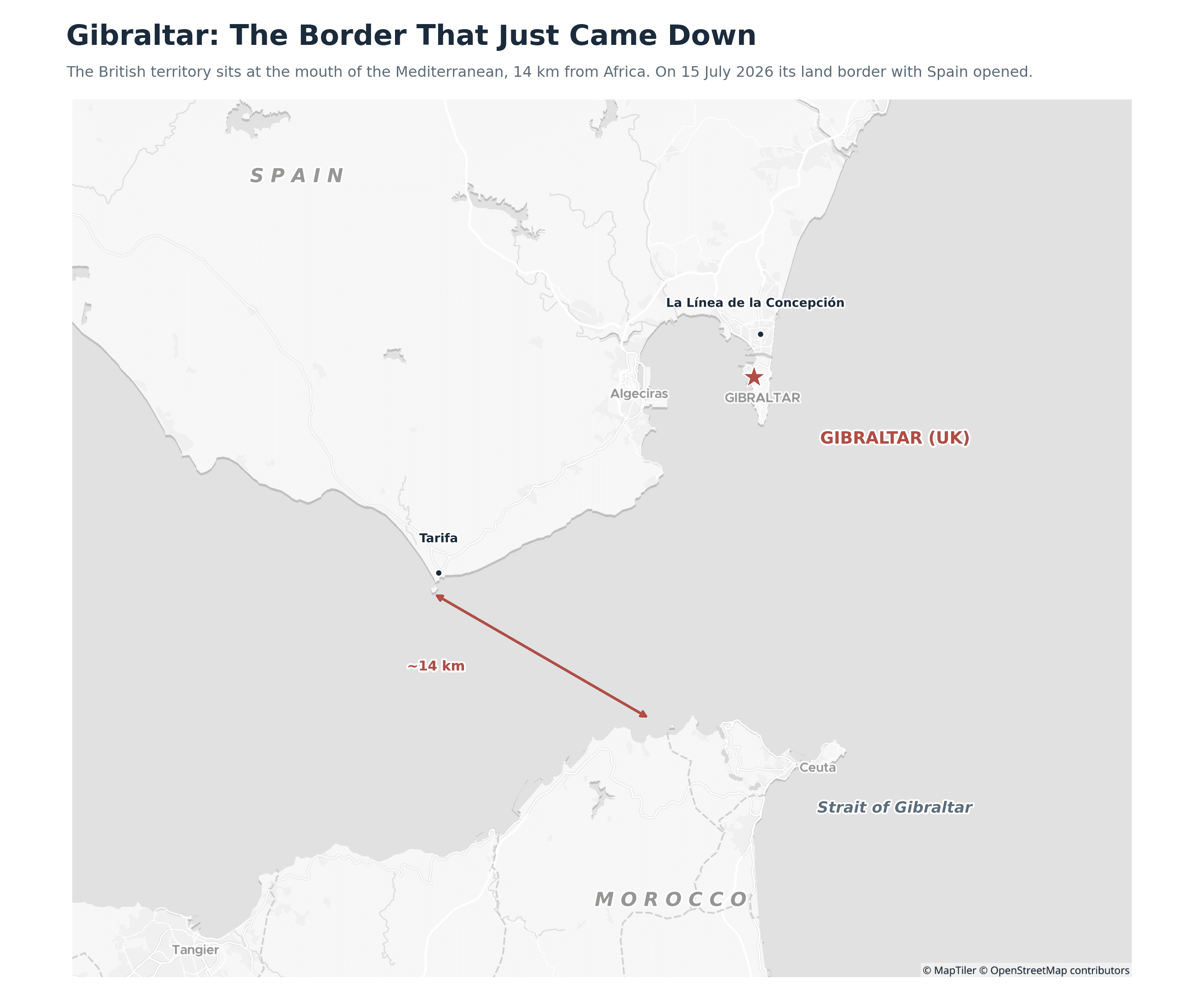
At the stroke of midnight on 15 July 2026, workers began dismantling a fence that had stood for 118 years. With it went the last routine land border on the European mainland. Under a landmark post-Brexit treaty between the United Kingdom and the European Union, the British territory of Gibraltar has joined the EU’s Schengen passport-free travel area, ending nearly a decade of post-Brexit limbo at one of Europe’s most unusual frontiers. To understand why a 6.7-square-kilometre outcrop matters so much, start with the map.
Key Takeaways
- A 118-year-old border came down. At midnight on 15 July 2026, the fence marking the Gibraltar-Spain frontier was removed, ending routine land-border checks between the British territory and Spain for the first time in over a century.
- Gibraltar joins the Schengen zone. A post-Brexit treaty between the UK and the EU places Gibraltar inside the Schengen passport-free travel area and the EU customs union, turning the crossing into an internal Schengen point.
- 15,000 daily commuters, no more queues. Around 15,000 Spanish workers commute into Gibraltar each day. They can now cross using only a national ID card, ending the rush-hour vehicle queues that could stretch for hours.
- The checks moved, they didn't vanish. External Schengen border controls have shifted to Gibraltar's airport and port, where UK and Spanish officers jointly check arrivals from outside the zone. Travellers from non-Schengen countries, including the rest of the UK, still pass the EU's biometric Entry-Exit System.
- A tiny place in a huge location. Gibraltar is just 6.7 km² but sits at the mouth of the Mediterranean, 14 km from Africa, guarding one of the world's most strategic shipping straits.
Where Gibraltar is, and why the border mattered
Gibraltar is a British Overseas Territory of about 6.7 km² and roughly 32,000 people, clinging to the southern tip of the Iberian Peninsula. It is dominated by the Rock of Gibraltar, a limestone monolith rising over 400 metres, and connected to Spain by a flat, sandy isthmus. That isthmus is where the border sits, next to the Spanish town of La Línea de la Concepción. Its position is the whole story: Gibraltar guards the Strait of Gibraltar, the 14-kilometre-wide chokepoint between the Atlantic and the Mediterranean, and between Europe and Africa. Britain has held it since 1713, and Spain has wanted it back ever since.
For the roughly 15,000 people who cross the border to work every day, most of them Spaniards commuting into Gibraltar, the frontier was a daily ordeal. After Brexit took the UK, and with it Gibraltar, out of the EU, checks tightened and queues at the crossing could stretch for hours. Solving that was the central purpose of the treaty.
What the treaty actually does
The agreement, signed in Brussels, folds Gibraltar into the Schengen area and the EU customs union. In practice, the land crossing with Spain becomes an internal Schengen point, with no routine checks. Residents and the daily commuters can now move between Gibraltar and Spain using only a national ID card. The physical fence is gone and the vehicle queues with it.
The checks have not disappeared, though. They have moved. External Schengen border control now happens at Gibraltar’s airport and its port, where UK and Spanish officers work side by side to check travellers arriving from outside the zone. There is a twist that matters for British visitors: anyone entering Gibraltar from a non-Schengen country, including the rest of the United Kingdom, must now pass through the EU’s biometric Entry-Exit System (EES) at the port or airport. The 250-plus page treaty is careful to protect British sovereignty and the UK’s military facilities on the Rock. It still requires ratification by the UK and EU parliaments.
The open border comes with a digital one
The chain-link fence has been replaced by something less visible. Gibraltar has rolled out live facial-recognition cameras, expanded CCTV and a larger police presence to manage security now that the physical barrier is gone. It is a pattern seen elsewhere in Europe: as hard borders soften, surveillance hardens. The frontier has not so much vanished as changed form, from a wall you queue at to a network you are scanned by.
The last wall comes down Gibraltar’s Chief Minister, Fabian Picardo, called the moment “a new dawn” and declared that “Europe is back” as the territory dissolved what he described as the last remaining land barrier within the European mainland. For a place that spent the post-Brexit years in limbo, the removal of the fence is as much symbolic as practical. |
The bottom line
Gibraltar is a reminder that the smallest dots on the map can carry the biggest histories. A 6.7-square-kilometre rock has been contested for three centuries, complicated by Brexit, and has now become the unlikely place where the UK and the EU found a way to reopen a border rather than close one. The fence is gone, the queues with it, and a strategic sliver of Europe has quietly changed how it connects to the continent it sits beside.