Whether you’re a geography enthusiast, a homeschooling parent, or someone who just loves poring over maps, a quality world atlas is one of those purchases that genuinely holds up over time. Digital maps are convenient, sure — but they can’t replicate the experience of spreading a large-format atlas across your desk and tracing coastlines, mountain ranges, and borders with your fingertip.
We’ve reviewed dozens of world atlases across every price range and format to find the ones actually worth buying in 2026. Our picks range from premium reference-grade volumes to affordable student editions, with options for adults, families, and kids.
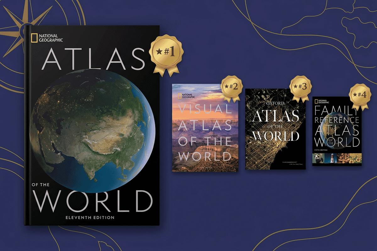
Below are our 9 top picks, ranked by overall quality, map detail, and value for the intended audience.
When you buy through links on this page, we may earn an affiliate commission. Commission payments do not affect the evaluations of the products.
Best World Atlas Books
1. National Geographic Atlas of the World, 11th Edition
- Best for: Serious geography buffs and collectors
- Publisher: National Geographic
- Dimensions: 12.6 × 18.9 inches (large-format)
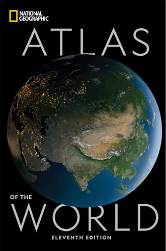
If you want the single best world atlas money can buy, this is it. National Geographic’s flagship atlas is a massive, coffee-table-worthy volume that measures nearly 19 inches tall and contains some of the most detailed cartography available in print. Every continent gets extensive coverage with physical, political, and thematic maps rendered at a level of detail that digital maps still struggle to match at a glance.

The 11th edition includes updated geopolitical boundaries, satellite imagery, and infographics on topics like climate change, urbanization, and ocean currents. It’s the kind of atlas that rewards slow, careful browsing — you’ll notice new details every time you open it.
At over $150, this isn’t an impulse purchase. But for anyone who considers maps a serious interest — or wants a reference atlas that doubles as a statement piece — the National Geographic Atlas of the World is the gold standard.
Pros
- Unmatched map detail and cartographic quality
- Stunning large format — perfect as a reference or display piece
- Includes satellite imagery and thematic infographics
- National Geographic’s editorial authority
Cons
- Premium price point
- Too large and heavy for casual use — not a desk reference
- Published in 2019, so some data may be slightly dated
2. Oxford Atlas of the World, 32nd Edition
- Best for: Anyone who wants the most up-to-date atlas available
- Publisher: Oxford University Press
- Dimensions: 11.4 × 14.8 inches
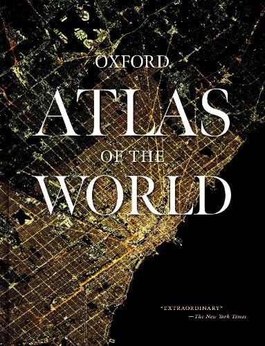
The Oxford Atlas of the World has a unique advantage: it’s the only major atlas revised and updated every single year. While other atlases publish new editions every 3–5 years, Oxford releases an updated volume annually, making it the most current printed atlas you can buy at any given time.

The 32nd edition (published October 2025) includes updated political boundaries, revised population statistics, and current environmental data. The cartography comes from Philip’s, one of the UK’s most respected mapmaking houses, and the maps are crisp, detailed, and beautifully produced.
At roughly 8 pounds and 14+ inches tall, this is a serious reference volume — not something you’d toss in a backpack. But if having the latest data matters to you (and it should, given how quickly geopolitics shift), the Oxford Atlas is the obvious choice.
Pros
- Updated annually — always the most current atlas in print
- Excellent Philip’s cartography
- Comprehensive coverage of all continents and oceans
- Strong reference sections with statistics and gazetteer
Cons
- Higher price than many competitors
- Heavy and large — not portable
- Newest edition has limited reviews so far
3. National Geographic Visual Atlas of the World, 2nd Edition
- Best for: Visual learners and photography lovers
- Publisher: National Geographic
- Dimensions: 12 × 17.2 inches (large-format)

If traditional atlases feel too dry, the Visual Atlas is National Geographic at its best: combining rigorous cartography with their legendary photography. Every region is illustrated not just with maps but with full-color photographs of landscapes, cities, wildlife, and cultural landmarks.

The 2nd edition weighs a hefty 9 pounds and covers every continent with physical and political maps supported by demographic data, environmental statistics, and geographic facts. It works brilliantly as both a reference tool and a coffee table book — the kind of volume guests actually pick up and browse.
The photography is what sets this apart from every other atlas on this list. If you want an atlas that makes the world feel alive rather than abstract, this is the one to get.
Pros
- Stunning photography alongside detailed maps
- Engages visual learners far better than text-heavy atlases
- Excellent conversation piece and coffee table book
- 4.8-star rating across 420+ reviews
Cons
- Published in 2017 — data is getting dated
- Very heavy at 9 lbs
- Photography takes space away from map detail in some sections
4. National Geographic Family Reference Atlas, 5th Edition
- Best for: Families and homeschooling
- Publisher: National Geographic
- Dimensions: 10.8 × 13.8 inches
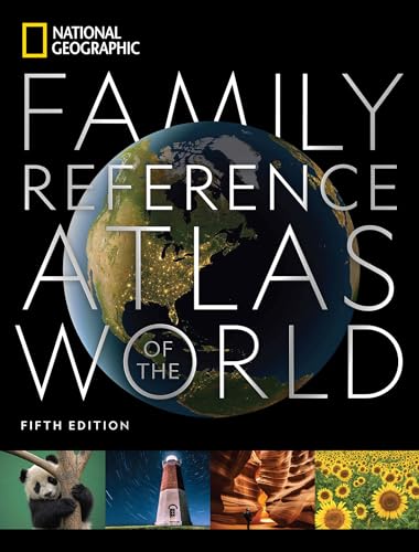
The Family Reference Atlas hits a sweet spot that most atlases miss: it’s detailed enough to satisfy adults but organized and written in a way that older children and teens can use independently. Each country gets a dedicated profile with key facts, and the maps strike a good balance between detail and readability.

The 5th edition (2020) includes updated geopolitical data, population statistics, and thematic sections on topics like world religions, languages, and environmental challenges. At 4 pounds and roughly 14 inches tall, it’s large enough to provide serious map detail without being unwieldy.
If you’re buying one atlas that needs to serve the whole household — from homework help to trip planning to casual browsing — the Family Reference Atlas is probably your best bet. The price-to-quality ratio is excellent.
Pros
- Perfect balance of detail and accessibility
- Country profiles are great for quick reference
- Thematic sections add educational depth
- Strong value at the ~$50 price point
Cons
- Not as cartographically detailed as the flagship Nat Geo atlas
- Some reviewers note the binding could be sturdier
- Last updated in 2020
5. Collins World Atlas: Complete Edition
- Best for: Readers who want a non-American perspective
- Publisher: Collins (HarperCollins UK)
- Dimensions: 10.8 × 14.5 inches

Most world atlases on this list come from American publishers, which means maps tend to center on the Americas and give heavier coverage to North American geography. The Collins Complete Edition offers a welcome counterpoint — it’s published by HarperCollins UK and provides more balanced global coverage, with particularly strong maps of Europe, Africa, and Asia.

Published in April 2025, this is one of the most recently updated atlases available. It includes detailed physical and political maps, thematic spreads on world issues, and a comprehensive index of over 100,000 place names. The cartography is clean and modern, with good use of color and shading.
If you’ve been raised on National Geographic and Oxford atlases, the Collins perspective is refreshing. It’s also competitively priced at around $42 for a full-size, hardcover atlas.
Pros
- Published 2025 — very current data
- Balanced international coverage (not US-centric)
- Over 100,000 indexed place names
- Good value for a complete-format atlas
Cons
- Fewer reviews than Nat Geo equivalents (still relatively new)
- Less supplementary photography than visual-focused atlases
- May be harder to find in US bookstores
6. National Geographic Concise Atlas of the World, 5th Edition
- Best for: Budget-conscious buyers who still want quality
- Publisher: National Geographic
- Dimensions: 10.3 × 13.5 inches

You don’t need to spend $80+ to get a genuinely good atlas. The Concise Atlas packs National Geographic’s cartographic quality into a more manageable (and affordable) format. At around $16, it’s one of the best values on this list — and it doesn’t feel like a compromise.

The 5th edition (2022) includes over 200 maps and illustrations, country fact files, and thematic content on population, climate, and economies. The maps aren’t as large or detailed as the flagship atlas, but they’re clear, accurate, and well-designed. Most casual users won’t miss the extra detail.
With over 900 reviews and a 4.5-star average, this is one of the most popular atlases on Amazon — and for good reason. If you want Nat Geo quality without the Nat Geo flagship price, start here.
Pros
- Excellent value — under $20 for Nat Geo quality
- Updated 2022 edition with current data
- 200+ maps and illustrations
- Manageable size — not too heavy for a desk
Cons
- Less detail than full-size atlases
- Softcover — less durable than hardcover editions
- Some thematic content feels surface-level
7. Collins World Atlas: Essential Edition
- Best for: Everyday desk reference
- Publisher: Collins (HarperCollins UK)
- Dimensions: 8.9 × 12.3 inches
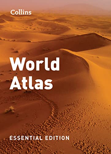
While the Collins Complete Edition is their flagship, the Essential Edition is the one you’ll actually keep on your desk. At roughly 9 × 12 inches and 2.3 pounds, it’s compact enough to pull out whenever you need to quickly locate a country, check a border, or settle a geography debate.

The maps are clear and well-labeled despite the smaller format, and the atlas includes useful statistical data and country information alongside the cartography. The 2023 edition ensures reasonably current boundaries and data.
This is the atlas equivalent of a good dictionary — not the most comprehensive resource in the room, but the one you reach for most often because it’s accessible, reliable, and doesn’t require clearing a whole table to open it.
Pros
- Compact and lightweight — ideal desk reference
- Clean, readable maps despite smaller format
- Very affordable at under $20
- Good international coverage from UK publisher
Cons
- Smaller maps mean less detail
- Not a showpiece — purely functional
- Limited thematic content compared to larger atlases
8. DK Where on Earth? Atlas
- Best for: Visual learners and older kids (ages 8+)
- Publisher: DK Children
- Dimensions: 10.2 × 12.1 inches

This isn’t a traditional atlas — and that’s exactly the point. DK’s “Where on Earth?” takes a data-visualization approach to geography, presenting information through infographics, 3D-rendered maps, cross-sections, and comparative diagrams. It answers questions like “Where are the world’s tallest buildings?” and “Which countries have the most UNESCO sites?” in visual, immediately graspable ways.

Officially marketed for kids ages 8 and up, but don’t let that fool you — adults love this book too. With nearly 2,000 reviews and a 4.8-star average, it’s one of the best-rated atlases on Amazon. The visual approach makes it genuinely addictive to browse, and you’ll learn things that traditional atlases don’t cover.
If you have a kid who’s mildly interested in geography, this is the book that could turn that into a genuine passion. And at around $10, it’s practically a no-brainer.
Pros
- Unique infographic and data-visualization approach to geography
- Engaging for both kids and adults
- Nearly 2,000 reviews with 4.8-star average
- Incredible value at ~$10
Cons
- Not a traditional reference atlas — won’t help you find specific cities
- Published 2017 — some data is outdated
- More of a geography book than a map atlas
9. DK Children’s Illustrated Atlas
- Best for: Young kids (ages 5–10)
- Publisher: DK Children
- Dimensions: 10.2 × 12.1 inches

For kids who aren’t quite ready for a traditional atlas, DK’s Children’s Illustrated Atlas is the perfect starting point. Instead of the detailed political and physical maps you’d find in adult atlases, this one uses colorful illustrated maps packed with icons showing local wildlife, landmarks, cultural traditions, and notable geographic features.

The revised and updated edition (2023) covers every continent with a mix of illustrated maps, photographs, and bite-sized facts that keep young readers engaged. It’s organized by continent and then by region, making it easy for kids to explore areas that interest them.
This is the atlas that gets kids excited about the world. It won’t teach them to read a topographic map, but it will spark curiosity about different countries, cultures, and landscapes — and that’s the whole point at this age.
Pros
- Age-appropriate — designed specifically for young kids
- Colorful illustrated maps are visually engaging
- Updated 2023 edition
- Good balance of fun and educational content
Cons
- Not a “real” atlas — kids will outgrow it
- Illustrated maps sacrifice geographic accuracy for appeal
- Limited depth — more of an introduction than a reference
How to Choose the Best World Atlas
With so many atlases available, finding the right one depends on how you plan to use it. Here are the key factors to consider:
Publication Date
Geopolitics change constantly — borders shift, countries rename cities, and population data evolves. An atlas from 2015 won’t reflect these changes. For the most current data, look for editions published within the last 2–3 years. The Oxford Atlas of the World is unique in being updated annually.
Format and Size
Large-format atlases (14+ inches) offer the best map detail and are ideal for browsing and display. But they’re heavy and awkward to use at a desk. Compact atlases (9–12 inches) sacrifice some detail for practicality. Think about where and how you’ll actually use it — on a coffee table, at a desk, or in a classroom.
Map Quality
Look for clear cartography with distinct color coding, legible labels, and good use of terrain shading. The best atlases (National Geographic, Oxford, Collins) use professional cartographic teams. Budget atlases sometimes use simpler, less detailed maps — fine for casual use, but noticeable if you compare them side-by-side with premium editions.
Supplementary Content
Beyond maps, many atlases include thematic sections on climate, demographics, economics, and environmental issues. Some include satellite imagery, photography, or infographics. If you want an atlas that teaches as well as shows, look for editions with rich supplementary content — National Geographic excels here.
Audience
Be honest about who will use this atlas. A 9-pound reference volume is wasted on a 7-year-old. Similarly, a children’s illustrated atlas won’t satisfy someone studying geopolitics. Our list includes options specifically designed for adults, families, students, and young children — pick the one that matches your actual use case.
Publisher Reputation
In cartography, the publisher matters more than in most book categories. National Geographic, Oxford University Press, Collins, and DK are all established names with professional cartographic teams. Lesser-known publishers may offer cheaper alternatives, but the map quality is often noticeably lower.
Conclusion
The best world atlas for you depends entirely on how you plan to use it. For serious reference and collection, the National Geographic Atlas of the World, 11th Edition remains the gold standard — nothing else matches its cartographic depth and production quality. If you prioritize having the most current data, the annually updated Oxford Atlas of the World is the smarter choice.
For most households, the National Geographic Family Reference Atlas or the Concise Atlas offer the best balance of quality, coverage, and price. And if you’re buying for kids, the DK Where on Earth? Atlas (for ages 8+) and DK Children’s Illustrated Atlas (for younger kids) are both excellent — engaging, educational, and affordable.
One practical tip: don’t overthink it. Even a “basic” atlas from a reputable publisher is a great resource. The important thing is having a quality printed atlas on your shelf — once you start browsing, you’ll wonder why you ever relied solely on Google Maps.