Tucked away in the Northeastern United States, Rhode Island is the smallest state in the country. Though compact, the state boasts no small measure of historical significance, cultural depth, or natural beauty.
Rhode Island was one of the original 13 colonies, playing a pivotal role in the American Revolution, and is known for its seafood, mansions, and scenic coastline.
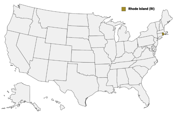
Rhode Island (RI) on the US Map
There are only five counties in Rhode Island, which ties the state with Hawaii for having the second-fewest counties. The county system in Rhode Island also stands out for the lack of local government at the county level. Administration is handled by the state and municipal governments, leaving counties to be relevant for court administrative and sheriff corrections boundaries.
This post will explore the distinctive character of Rhode Island’s counties, diving into their historical landmarks, cultural offerings, and picturesque landscapes. Despite the absence of local government at the county level, these counties showcase the diversity and heritage of Rhode Island, inviting exploration of its colonial past, maritime tradition, and vibrant community life.
We’ll start with a Rhode Island Counties Map that details the boundaries of each county and the major city in each.
Map of Rhode Island Counties
Below is a map of the 5 counties of Rhode Island (you can click on the map to enlarge it and to see the major city in each county).
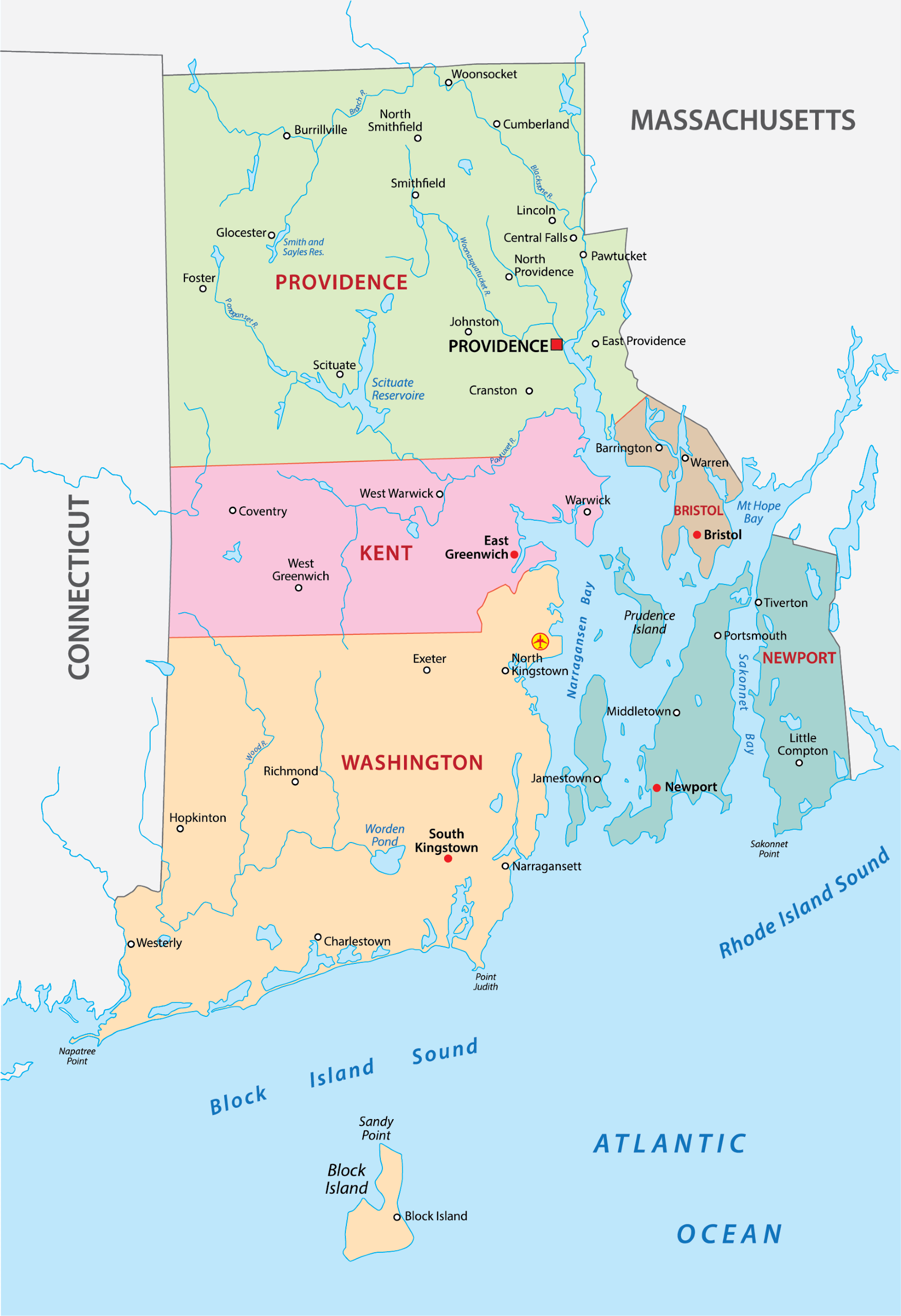
Interactive Map of Rhode Island Counties
Click on any of the counties on the map to see its population, economic data, time zone, and zip code (the data will appear below the map). Data is sourced from the US Census 2021.
List of the Counties of Rhode Island:
| County | Population | Per sq. km | Largest City |
|---|---|---|---|
| Bristol County | 50,672 | 810.74 | Bristol |
| Kent County | 169,345 | 387.88 | Warwick |
| Newport County | 85,525 | 322.38 | Newport |
| Providence County | 656,672 | 619.18 | Providence |
| Washington County | 129,735 | 152.12 | South Kingstown |
Bristol County

Bristol County, Rhode Island’s smallest county by land area, was established in 1747. It is renowned for its deep historical roots and vibrant maritime culture, with Bristol as its county seat.
This coastal county is distinguished by its significant role in America’s early history, notably through the preservation of landmarks such as the Blithewold Mansion, Gardens & Arboretum, and the Herreshoff Marine Museum, which celebrates the county’s shipbuilding heritage and America’s Cup yachting.
Bristol proudly hosts the oldest continuous Fourth of July celebration in the United States, a tradition that dates back to 1785 and reflects the community’s strong sense of American pride and patriotism. The parade draws visitors from across the nation to experience this historic event firsthand.
The county’s picturesque landscape is enhanced by Colt State Park, offering panoramic views of Narragansett Bay, and the East Bay Bike Path, providing miles of scenic cycling and walking trails along the waterfront.
These natural and cultural attractions, alongside Bristol’s historic downtown with its unique shops and restaurants, contribute to the county’s charm and appeal.
Kent County

Kent County, established in 1750, is centrally located in Rhode Island, with Warwick serving as its county seat. Warwick is not only the second-largest city in the state but also a site of significant historical interest, having been founded in 1642. The city’s Goddard Memorial State Park offers expansive green space, with miles of trails and a beach that overlooks Greenwich Bay, ideal for outdoor activities ranging from hiking to horseback riding.
The Warwick Center for the Arts and the Clouds Hill Victorian House Museum showcase the county’s cultural and historical dimensions, providing insights into the local arts scene and Victorian-era Rhode Island. The county’s position along Narragansett Bay enhances its appeal, with waterfront dining, marinas, and public beaches that are popular among residents and visitors alike.
Kent County is also a hub of transportation and commerce, home to the state’s main airport, T.F. Green Airport in Warwick, which connects Rhode Island to destinations across the country and internationally. The presence of the New England Institute of Technology contributes to the area’s educational landscape, offering a range of technical and professional programs.
Newport County

Newport County, established in 1703, encapsulates Rhode Island’s maritime heritage and Gilded Age splendor. Newport, the county seat, is famed for its historic seaside mansions like The Breakers and Rosecliff, built by America’s wealthiest families in the late 19th and early 20th centuries. These opulent homes, now open to the public, offer a glimpse into the luxurious lifestyle of that era.
The county’s rich sailing tradition is embodied by the America’s Cup, with Newport hosting many of the prestigious yacht races over the years. The International Tennis Hall of Fame, located in Newport, celebrates the history of the sport and its champions, housed in the Newport Casino, a National Historic Landmark.
Newport County’s coastal landscape features scenic beaches such as Second Beach in Middletown and the rugged coastline of Jamestown, providing ample opportunities for water sports, relaxation, and exploration.
The Cliff Walk, a 3.5-mile public access walkway bordering the shore, offers breathtaking views of the Atlantic Ocean and the mansions’ backyards, symbolizing the unique blend of natural beauty and architectural heritage that defines Newport County.
Providence County

Providence County, established in 1703, is the most populous county in Rhode Island, with the city of Providence serving as both the county seat and the state capital. This county is a focal point of academic, cultural, and economic activity in the state, housing renowned institutions like Brown University, Rhode Island School of Design (RISD), and Providence College.
The city of Providence is celebrated for its vibrant arts scene, including WaterFire, an award-winning fire sculpture installation on the three rivers of downtown Providence that has become a must-see event. The county’s rich industrial history is preserved in the Slater Mill in Pawtucket, recognized as the birthplace of the American Industrial Revolution.
Providence County’s culinary scene is notable, with a diverse array of dining options that reflect the county’s multicultural population. The county also boasts extensive park systems, such as Roger Williams Park, offering a zoo, botanical gardens, and natural green spaces.
Pawtucket, another significant city in Providence County, contributes to the area’s cultural fabric with the Slater Mill Historic Site and the McCoy Stadium, underscoring the county’s blend of historical significance and contemporary dynamism.
Washington County

Washington County, often referred to by locals as South County, was established in 1729. It’s celebrated for its pristine beaches, rural countryside, and vibrant arts community. The University of Rhode Island, located in Kingston, is a major educational and cultural center within the county, contributing significantly to the community with a wide range of academic programs and cultural events.
The county’s coastline includes popular destinations like Narragansett Beach, known for its surfing and family-friendly atmosphere, and the historic Point Judith Lighthouse. Inland, the rural charm of Washington County is evident in its numerous farms, farmers’ markets, and vineyards, such as the Tomaquag Museum, which preserves and shares the culture and traditions of the region’s Indigenous peoples.
Charlestown’s annual Seafood Festival showcases Washington County’s rich seafood heritage, drawing visitors from across New England. The area’s commitment to conservation is evident in protected areas like the Ninigret National Wildlife Refuge, offering habitats for a variety of species and opportunities for nature observation and photography.
More About Rhode Island Counties: FAQs
How many counties are in Rhode Island?
Rhode Island has five counties.
Which Rhode Island county has the highest population?
Providence County has the highest population with 657,288 residents.
What is the oldest county in Rhode Island?
Providence County and Newport County are the oldest counties in Rhode Island, each established in 1703.
Which Rhode Island county is known for its beaches?
Washington County, often referred to as South County, is famous for Narragansett Beach.
Which Rhode Island county has the smallest population?
Bristol County has the smallest population with just 50,360 residents.

- Grand Historic Mansion with Lush Green Lawn in Bristol County, Rhode Island — © Yingna Cai/Shutterstock
- Aerial View of a Coastal Peninsula with Lighthouse — © Wangkun Jia/Shutterstock
- Aerial View of a Grand Mansion by the Sea with Cliffside Walkway — © Felix Lipov/Shutterstock
- Downtown Providence, Rhode Island Skyline at Twilight — © Sean Pavone/Shutterstock
- Students Walking Towards the Entrance of a Modern University Building on a Sunny Day — © Ken Wolter/Shutterstock